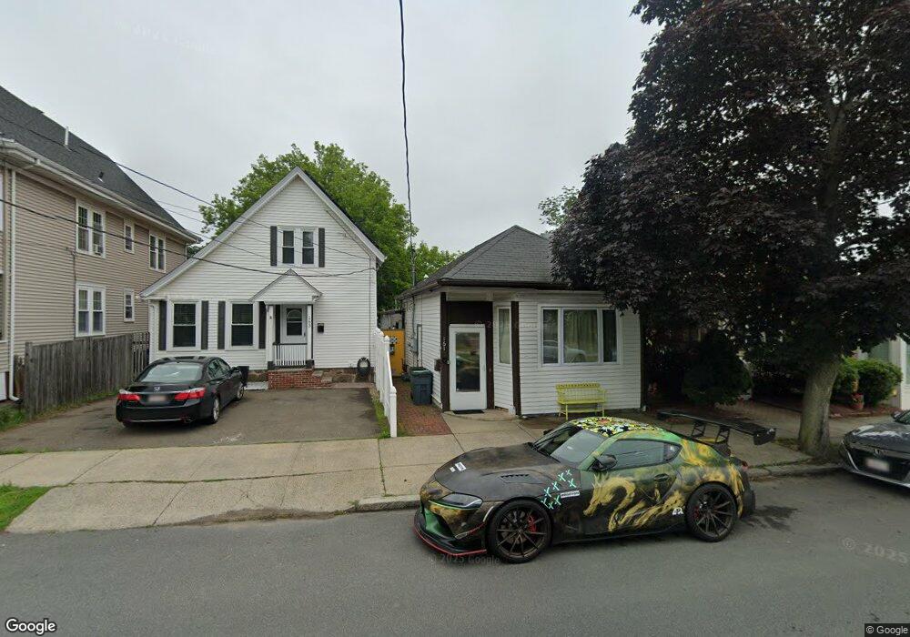
161 Burrill St Unit A Swampscott, MA 01907
Estimated Value: $451,203
2
Beds
2
Baths
1,364
Sq Ft
$331/Sq Ft
Est. Value
About This Home
This home is located at 161 Burrill St Unit A, Swampscott, MA 01907 and is currently estimated at $451,203, approximately $330 per square foot. 161 Burrill St Unit A is a home located in Essex County with nearby schools including Swampscott Middle School and Swampscott High School.
Ownership History
Date
Name
Owned For
Owner Type
Purchase Details
Closed on
Jun 7, 2023
Sold by
Lima-Figueroa Dalila and Vega Elizabeth C
Bought by
Rodriguez Ada M and Stengel Liliana A
Current Estimated Value
Home Financials for this Owner
Home Financials are based on the most recent Mortgage that was taken out on this home.
Original Mortgage
$354,598
Outstanding Balance
$344,651
Interest Rate
6.75%
Mortgage Type
FHA
Estimated Equity
$106,552
Purchase Details
Closed on
Jun 6, 2018
Sold by
3 Cavendish Circle Nt and Mark
Bought by
Lima-Figueroa Dalila and Locke-Deacon Karen
Home Financials for this Owner
Home Financials are based on the most recent Mortgage that was taken out on this home.
Original Mortgage
$245,471
Interest Rate
4.37%
Mortgage Type
FHA
Purchase Details
Closed on
Jun 13, 2013
Sold by
Mark Roseann S
Bought by
3 Cavendish Circle Nt and Mark
Purchase Details
Closed on
Nov 6, 2003
Sold by
Ulery Billie Jo
Bought by
Mark William R
Create a Home Valuation Report for This Property
The Home Valuation Report is an in-depth analysis detailing your home's value as well as a comparison with similar homes in the area
Home Values in the Area
Average Home Value in this Area
Purchase History
| Date | Buyer | Sale Price | Title Company |
|---|---|---|---|
| Rodriguez Ada M | $410,000 | None Available | |
| Rodriguez Ada M | $410,000 | None Available | |
| Rodriguez Ada M | $410,000 | None Available | |
| Rodriguez Ada M | $410,000 | None Available | |
| Lima-Figueroa Dalila | $250,000 | -- | |
| Lima-Figueroa Dalila | $250,000 | -- | |
| Lima-Figueroa Dalila | $250,000 | -- | |
| Lima-Figueroa Dalila | $250,000 | -- | |
| 3 Cavendish Circle Nt | -- | -- | |
| Mark William R | -- | -- | |
| Mark William R | -- | -- | |
| Mark William R | $155,000 | -- | |
| Mark William R | $155,000 | -- |
Source: Public Records
Mortgage History
| Date | Status | Borrower | Loan Amount |
|---|---|---|---|
| Open | Rodriguez Ada M | $354,598 | |
| Closed | Rodriguez Ada M | $354,598 | |
| Previous Owner | Lima-Figueroa Dalila | $245,471 |
Source: Public Records
Tax History Compared to Growth
Tax History
| Year | Tax Paid | Tax Assessment Tax Assessment Total Assessment is a certain percentage of the fair market value that is determined by local assessors to be the total taxable value of land and additions on the property. | Land | Improvement |
|---|---|---|---|---|
| 2025 | $4,721 | $411,600 | $205,200 | $206,400 |
| 2024 | $4,540 | $395,100 | $195,400 | $199,700 |
| 2023 | $0 | $369,700 | $180,900 | $188,800 |
| 2022 | $0 | $320,200 | $159,200 | $161,000 |
| 2021 | $0 | $273,200 | $123,000 | $150,200 |
| 2020 | $4,528 | $251,600 | $115,800 | $135,800 |
| 2019 | $0 | $237,100 | $101,300 | $135,800 |
| 2018 | $0 | $237,100 | $101,300 | $135,800 |
| 2017 | $0 | $212,500 | $86,800 | $125,700 |
| 2016 | $3,510 | $184,200 | $68,700 | $115,500 |
| 2015 | $3,510 | $184,200 | $68,700 | $115,500 |
| 2014 | $3,510 | $158,200 | $49,200 | $109,000 |
Source: Public Records
Map
Nearby Homes
- 146 Burrill St
- 189 Burrill St Unit 2
- 11 Boynton St Unit 104
- 11 Boynton St Unit 102
- 11 Boynton St Unit 204
- 80 Norfolk Ave Unit 1
- 40 Andrew Rd
- 51 New Ocean St Unit 2
- 29-31 Essex Ave Unit 2
- 106 Norfolk Ave
- 7-9 Rock Ave
- 28 Claremont Terrace Unit 6
- 97 Seymour Ave
- 64 Stetson Ave
- 59 Essex St Unit 59B
- 40 Buena Vista St
- 79 Brookline St
- 26 Groveland St
- 106 Williams Ave
- 11 Seymour Ave Unit 3
- 161 Burrill St
- 163 Burrill St
- 159 Burrill St
- 159 Burrill St Unit 1
- 159 Burrill St Unit 2
- 157 Burrill St
- 157 Burrill St Unit 1
- 165 Burrill St Unit 167
- 155 Burrill St
- 1 Ellis Terrace
- 169 Burrill St
- 151 Burrill St
- 9 Huron St Unit 11
- 5 Huron St
- 3 Huron St
- 1 Huron St
- 3 Ellis Terrace
- 147 Burrill St
- 149 Burrill St
- 22 Norfolk Ave