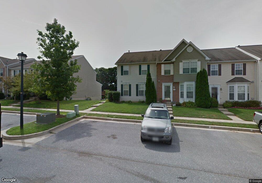
161 Carolstowne Rd Reisterstown, MD 21136
Estimated Value: $293,000 - $357,000
--
Bed
3
Baths
1,320
Sq Ft
$256/Sq Ft
Est. Value
About This Home
This home is located at 161 Carolstowne Rd, Reisterstown, MD 21136 and is currently estimated at $337,766, approximately $255 per square foot. 161 Carolstowne Rd is a home located in Baltimore County with nearby schools including Franklin Elementary School, Franklin Middle, and Franklin High.
Ownership History
Date
Name
Owned For
Owner Type
Purchase Details
Closed on
Aug 19, 2003
Sold by
Paperman Diane J
Bought by
Murry Charles Edwin and Mury Diane J
Current Estimated Value
Purchase Details
Closed on
Jan 8, 2003
Sold by
Rivera Laura Lee
Bought by
Paperman Diane J
Purchase Details
Closed on
Apr 25, 2000
Sold by
Bender Charles B
Bought by
Rivera Laura Lee and Bennett Jason Michael
Purchase Details
Closed on
Jun 24, 1999
Sold by
Powers Homes At Stone Mill Inc
Bought by
Bender Charles B
Purchase Details
Closed on
Jan 27, 1999
Sold by
Glyndon Development Llc
Bought by
Powers Homes At Stone Mill Inc
Create a Home Valuation Report for This Property
The Home Valuation Report is an in-depth analysis detailing your home's value as well as a comparison with similar homes in the area
Home Values in the Area
Average Home Value in this Area
Purchase History
| Date | Buyer | Sale Price | Title Company |
|---|---|---|---|
| Murry Charles Edwin | -- | -- | |
| Paperman Diane J | $175,000 | -- | |
| Rivera Laura Lee | $129,900 | -- | |
| Bender Charles B | $125,430 | -- | |
| Powers Homes At Stone Mill Inc | $248,000 | -- |
Source: Public Records
Tax History Compared to Growth
Tax History
| Year | Tax Paid | Tax Assessment Tax Assessment Total Assessment is a certain percentage of the fair market value that is determined by local assessors to be the total taxable value of land and additions on the property. | Land | Improvement |
|---|---|---|---|---|
| 2025 | $3,543 | $244,500 | -- | -- |
| 2024 | $3,543 | $221,000 | $63,000 | $158,000 |
| 2023 | $1,741 | $215,800 | $0 | $0 |
| 2022 | $3,349 | $210,600 | $0 | $0 |
| 2021 | $3,193 | $205,400 | $63,000 | $142,400 |
| 2020 | $3,193 | $202,733 | $0 | $0 |
| 2019 | $3,278 | $200,067 | $0 | $0 |
| 2018 | $3,206 | $197,400 | $63,000 | $134,400 |
| 2017 | $3,120 | $191,900 | $0 | $0 |
| 2016 | $2,699 | $186,400 | $0 | $0 |
| 2015 | $2,699 | $180,900 | $0 | $0 |
| 2014 | $2,699 | $180,900 | $0 | $0 |
Source: Public Records
Map
Nearby Homes
- 4 Wolf Ave
- 100 1st Ave
- 131 Westminster Rd
- 223 New Ave
- 123 Glyndon Trace Dr
- 10 Pennyborough Ct
- 65A Bond Ave
- 7 Butler Rd
- 259 E Chatsworth Ave
- 3 Meadow Mist Ct
- 120 Lamport Rd
- 13943 B Old Hanover Rd
- 13943 D Old Hanover Rd
- 13943 C Old Hanover Rd
- 225 Highmeadow Rd
- 15 Gloucester Ct
- 9 Norris Run Ct
- 926 Nicodemus Rd
- 1015 Nicodemus Rd
- 701 Cockeys Mill Rd
- 163 Carolstowne Rd
- 159 Carolstowne Rd
- 165 Carolstowne Rd
- 157 Carolstowne Rd
- 167 Carolstowne Rd
- 155 Carolstowne Rd
- 169 Carolstowne Rd
- 153 Carolstowne Rd
- 171 Carolstowne Rd
- 151 Carolstowne Rd
- 173 Carolstowne Rd
- 149 Carolstowne Rd
- 175 Carolstowne Rd
- 150 Carolstowne Rd
- 152 Carolstowne Rd
- 147 Carolstowne Rd
- 148 Carolstowne Rd
- 154 Carolstowne Rd
- 146 Carolstowne Rd
- 156 Carolstowne Rd