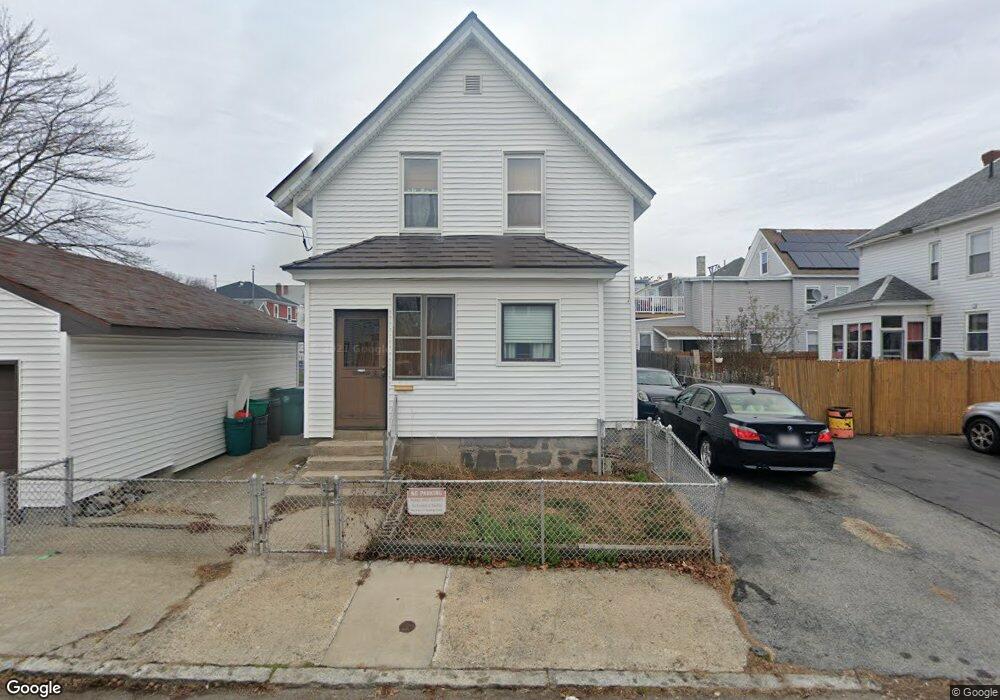
161 Cumberland Rd Lowell, MA 01850
Centralville NeighborhoodEstimated Value: $409,000 - $488,000
3
Beds
2
Baths
1,683
Sq Ft
$274/Sq Ft
Est. Value
About This Home
This home is located at 161 Cumberland Rd, Lowell, MA 01850 and is currently estimated at $460,509, approximately $273 per square foot. 161 Cumberland Rd is a home located in Middlesex County with nearby schools including Greenhalge Elementary School, S. Christa McAuliffe Elementary School, and Moody Elementary School.
Ownership History
Date
Name
Owned For
Owner Type
Purchase Details
Closed on
Mar 3, 2000
Sold by
Laurin Gertrude M
Bought by
Renaud Donald and Renaud Denise
Current Estimated Value
Home Financials for this Owner
Home Financials are based on the most recent Mortgage that was taken out on this home.
Original Mortgage
$96,000
Interest Rate
8.21%
Mortgage Type
Purchase Money Mortgage
Create a Home Valuation Report for This Property
The Home Valuation Report is an in-depth analysis detailing your home's value as well as a comparison with similar homes in the area
Home Values in the Area
Average Home Value in this Area
Purchase History
| Date | Buyer | Sale Price | Title Company |
|---|---|---|---|
| Renaud Donald | $120,000 | -- | |
| Renaud Donald | $120,000 | -- |
Source: Public Records
Mortgage History
| Date | Status | Borrower | Loan Amount |
|---|---|---|---|
| Open | Renaud Donald | $127,000 | |
| Closed | Renaud Donald | $35,000 | |
| Closed | Renaud Donald | $96,000 |
Source: Public Records
Tax History Compared to Growth
Tax History
| Year | Tax Paid | Tax Assessment Tax Assessment Total Assessment is a certain percentage of the fair market value that is determined by local assessors to be the total taxable value of land and additions on the property. | Land | Improvement |
|---|---|---|---|---|
| 2025 | $4,983 | $434,100 | $128,900 | $305,200 |
| 2024 | $4,957 | $416,200 | $128,000 | $288,200 |
| 2023 | $4,684 | $377,100 | $111,400 | $265,700 |
| 2022 | $4,411 | $347,600 | $101,200 | $246,400 |
| 2021 | $4,128 | $306,700 | $88,000 | $218,700 |
| 2020 | $3,747 | $280,500 | $72,400 | $208,100 |
| 2019 | $3,391 | $241,500 | $58,100 | $183,400 |
| 2018 | $3,328 | $231,300 | $55,300 | $176,000 |
| 2017 | $3,106 | $208,200 | $43,300 | $164,900 |
| 2016 | $3,005 | $198,200 | $46,600 | $151,600 |
| 2015 | $2,903 | $187,500 | $46,600 | $140,900 |
| 2013 | $2,801 | $186,600 | $62,300 | $124,300 |
Source: Public Records
Map
Nearby Homes
- 88 Lilley Ave
- 84 Lilley Ave
- 194 Ludlam St
- 94 Lilley Ave
- 94 Lilley Ave Unit 2
- 94 Lilley Ave Unit R
- 162 Cumberland Rd
- 168 Cumberland Rd
- 184 Ludlam St
- 184 Ludlam St Unit 2
- 184 Ludlam St Unit 1
- 76 Lilley Ave
- 166 Cumberland Rd
- 176 Ludlam St
- 72 Lilley Ave
- 100 Lilley Ave
- 102 Lilley Ave Unit 2
- 102 Lilley Ave Unit B
- 102 Lilley Ave
- 68 Lilley Ave