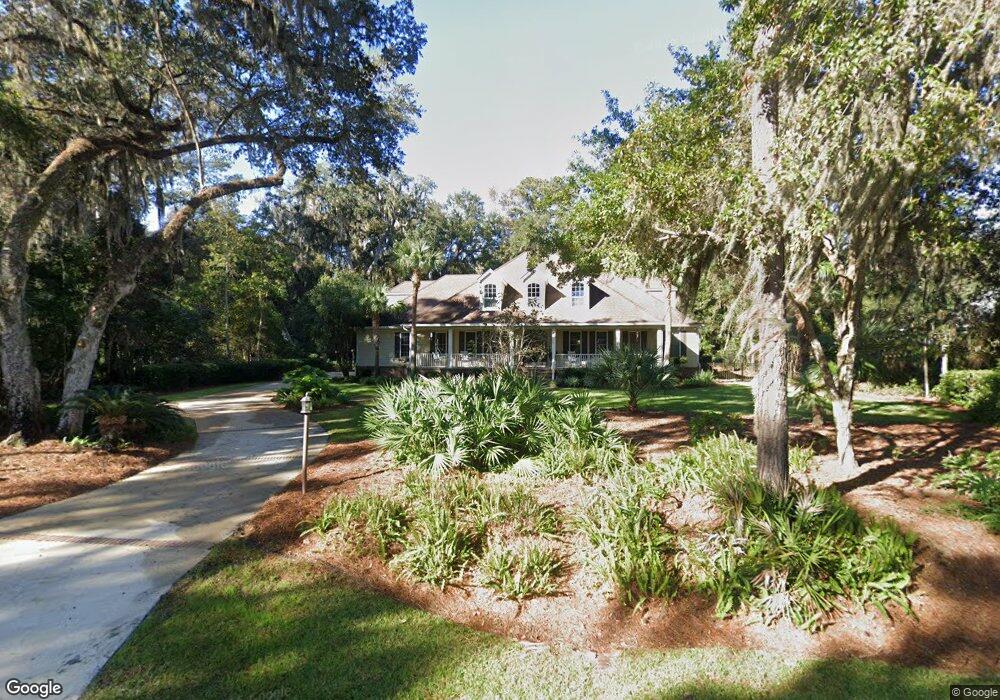
161 Hampton Point Dr Saint Simons Island, GA 31522
Hampton Point NeighborhoodEstimated Value: $1,024,999 - $1,708,000
4
Beds
5
Baths
3,574
Sq Ft
$373/Sq Ft
Est. Value
About This Home
This home is located at 161 Hampton Point Dr, Saint Simons Island, GA 31522 and is currently estimated at $1,332,750, approximately $372 per square foot. 161 Hampton Point Dr is a home located in Glynn County with nearby schools including Oglethorpe Point Elementary School, Glynn Middle School, and Glynn Academy.
Ownership History
Date
Name
Owned For
Owner Type
Purchase Details
Closed on
Mar 28, 2005
Sold by
Parker Alexandria Palmer
Bought by
Driggers Robert E and Driggers Dana C
Current Estimated Value
Home Financials for this Owner
Home Financials are based on the most recent Mortgage that was taken out on this home.
Original Mortgage
$117,000
Interest Rate
5.62%
Mortgage Type
New Conventional
Create a Home Valuation Report for This Property
The Home Valuation Report is an in-depth analysis detailing your home's value as well as a comparison with similar homes in the area
Home Values in the Area
Average Home Value in this Area
Purchase History
| Date | Buyer | Sale Price | Title Company |
|---|---|---|---|
| Driggers Robert E | $168,500 | -- |
Source: Public Records
Mortgage History
| Date | Status | Borrower | Loan Amount |
|---|---|---|---|
| Closed | Driggers Robert E | $117,000 |
Source: Public Records
Tax History
| Year | Tax Paid | Tax Assessment Tax Assessment Total Assessment is a certain percentage of the fair market value that is determined by local assessors to be the total taxable value of land and additions on the property. | Land | Improvement |
|---|---|---|---|---|
| 2025 | $8,626 | $343,960 | $45,320 | $298,640 |
| 2024 | $8,477 | $338,000 | $45,320 | $292,680 |
| 2023 | $5,669 | $338,000 | $45,320 | $292,680 |
| 2022 | $6,174 | $255,680 | $45,320 | $210,360 |
| 2021 | $6,272 | $242,720 | $36,240 | $206,480 |
| 2020 | $6,061 | $232,400 | $25,920 | $206,480 |
| 2019 | $5,592 | $214,440 | $25,920 | $188,520 |
| 2018 | $4,563 | $216,160 | $27,640 | $188,520 |
| 2017 | $4,563 | $175,040 | $40,400 | $134,640 |
| 2016 | $4,215 | $175,040 | $40,400 | $134,640 |
| 2015 | $4,233 | $175,040 | $40,400 | $134,640 |
| 2014 | $4,233 | $175,040 | $40,400 | $134,640 |
Source: Public Records
Map
Nearby Homes
- 160 Hampton Point Dr
- 160 Butler Lake Dr
- 144 Butler Lake Dr
- 174 Pierce Butler Dr
- 145 Butler Lake Dr
- 133 Hampton Point Dr
- 814 Kings Grant
- 805 Kings Grant
- 819 Kings Grant
- 150 Rice Mill
- 119 Kiln Trail
- 22 Kiln Cir
- 186 Pierce Butler Dr
- 181 Rice Mill
- 403 Indigo
- 912 Champney
- 155 Limeburn Trail
- 189 Rice Mill
- 930 Champney
- 121 Rice Mill
- 165 Hampton Point Dr
- 157 Hampton Point Dr
- 154 Pierce Butler Dr
- 152 Pierce Butler Dr
- 164 Hampton Point Dr
- 167 Hampton Point Dr
- 162 Hampton Point Dr
- 168 Hampton Point Dr (Blk G Lot 2)
- 158 Hampton Point Dr
- 156 Hampton Point Dr
- 169 Hampton Point Dr
- 154 Hampton Point
- 154 Hampton Point Dr
- 158 Pierce Butler Dr
- 153 Pierce Butler Dr
- 151 Pierce Butler Dr
- 149 Hampton Point Dr
- 172 Hampton Point Dr
- 152 Hampton Point Dr
- 155 Pierce Butler Dr
Your Personal Tour Guide
Ask me questions while you tour the home.