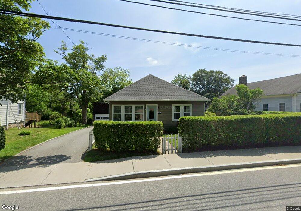
161 High St Wakefield, RI 02879
Estimated Value: $496,726 - $618,000
2
Beds
2
Baths
1,322
Sq Ft
$408/Sq Ft
Est. Value
About This Home
This home is located at 161 High St, Wakefield, RI 02879 and is currently estimated at $539,432, approximately $408 per square foot. 161 High St is a home located in Washington County with nearby schools including South Kingstown High School, Monsignor Matthew Clarke Catholic Regional School, and Bradley School-South.
Ownership History
Date
Name
Owned For
Owner Type
Purchase Details
Closed on
Jun 14, 2019
Sold by
Allan Simon and Allan Jessica
Bought by
Allan Simon
Current Estimated Value
Purchase Details
Closed on
Jun 1, 2017
Sold by
Allan M Christine
Bought by
Allan Simon T and Allan Jessica S
Home Financials for this Owner
Home Financials are based on the most recent Mortgage that was taken out on this home.
Original Mortgage
$248,484
Interest Rate
3.97%
Mortgage Type
Purchase Money Mortgage
Purchase Details
Closed on
Sep 14, 1990
Sold by
Phelps Bristol R
Bought by
Allan Christine
Home Financials for this Owner
Home Financials are based on the most recent Mortgage that was taken out on this home.
Original Mortgage
$105,000
Interest Rate
9.76%
Create a Home Valuation Report for This Property
The Home Valuation Report is an in-depth analysis detailing your home's value as well as a comparison with similar homes in the area
Home Values in the Area
Average Home Value in this Area
Purchase History
| Date | Buyer | Sale Price | Title Company |
|---|---|---|---|
| Allan Simon | -- | -- | |
| Allan Simon T | $246,000 | -- | |
| Allan Christine | $110,000 | -- |
Source: Public Records
Mortgage History
| Date | Status | Borrower | Loan Amount |
|---|---|---|---|
| Previous Owner | Allan Christine | $248,484 | |
| Previous Owner | Allan Christine | $105,000 |
Source: Public Records
Tax History
| Year | Tax Paid | Tax Assessment Tax Assessment Total Assessment is a certain percentage of the fair market value that is determined by local assessors to be the total taxable value of land and additions on the property. | Land | Improvement |
|---|---|---|---|---|
| 2025 | $3,597 | $402,300 | $148,900 | $253,400 |
| 2024 | $3,459 | $313,000 | $114,500 | $198,500 |
| 2023 | $3,459 | $313,000 | $114,500 | $198,500 |
| 2022 | $3,427 | $313,000 | $114,500 | $198,500 |
| 2021 | $3,371 | $233,300 | $94,300 | $139,000 |
| 2020 | $3,371 | $233,300 | $94,300 | $139,000 |
| 2019 | $3,371 | $233,300 | $94,300 | $139,000 |
| 2018 | $2,725 | $173,800 | $62,900 | $110,900 |
| 2017 | $2,661 | $173,800 | $62,900 | $110,900 |
| 2016 | $2,623 | $173,800 | $62,900 | $110,900 |
| 2015 | $2,752 | $177,300 | $66,700 | $110,600 |
| 2014 | $2,745 | $177,300 | $66,700 | $110,600 |
Source: Public Records
Map
Nearby Homes
- 23 Rockland Dr
- 48 Stone Bridge Dr
- 39 Hazard Ave
- 35 Whittier Dr
- 37 Whittier Dr
- 45 Cherry Ln Unit C
- 128 Rodman St
- 66 Christopher St
- 3 Larkin St
- 39 Secluded Dr
- 22 Beech Tree Place
- 260 Sweet Allen Farm Rd Unit 3
- 100 Spartina Cove Way
- 53 Rocky Brook Way
- 44 Vespia Ln
- 534 Curtis Corner Rd
- 56 Vespia Ln
- 918 Saugatucket Rd
- 507 Curtis Corner Rd
- 1808 Kingstown Rd
- 169 High St
- 12 Northup St
- 18 Northup St
- 177 High St
- 148 High St
- 28 Northup St
- 183 High St
- 137 High St
- 15 Northup St
- 189 High St
- 9 School Ln
- 131 High St
- 193 High St
- 27 Northup St
- 33 Northup St Unit A
- 5 School Ln Unit A
- 5 School Ln
- 0 Confidential St Unit 71361167
- 0 Confidential St Unit 71361166
- 0 Confidential St Unit 647890
Your Personal Tour Guide
Ask me questions while you tour the home.