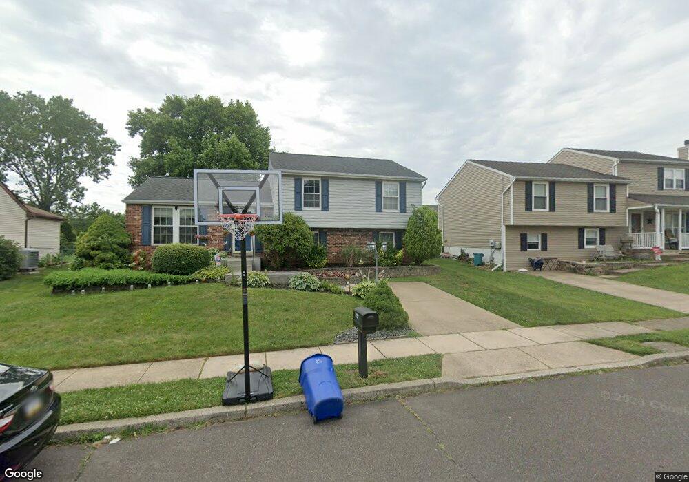
161 Independence Dr Morrisville, PA 19067
Estimated Value: $453,610 - $530,000
3
Beds
2
Baths
1,152
Sq Ft
$430/Sq Ft
Est. Value
About This Home
This home is located at 161 Independence Dr, Morrisville, PA 19067 and is currently estimated at $495,653, approximately $430 per square foot. 161 Independence Dr is a home located in Bucks County with nearby schools including Eleanor Roosevelt Elementary School, Pennwood Middle School, and Pennsbury High School.
Ownership History
Date
Name
Owned For
Owner Type
Purchase Details
Closed on
Jan 8, 2015
Sold by
Russomanno Thomas E and Russomanno Natalie Ll
Bought by
Russomanno Natalie L
Current Estimated Value
Home Financials for this Owner
Home Financials are based on the most recent Mortgage that was taken out on this home.
Original Mortgage
$235,900
Outstanding Balance
$181,221
Interest Rate
3.92%
Mortgage Type
New Conventional
Estimated Equity
$314,432
Purchase Details
Closed on
Jun 30, 1999
Sold by
Becker James E and Becker Jennie
Bought by
Russomanno Thomas E and Russomanno Natalie L
Home Financials for this Owner
Home Financials are based on the most recent Mortgage that was taken out on this home.
Original Mortgage
$164,220
Interest Rate
7.39%
Mortgage Type
VA
Create a Home Valuation Report for This Property
The Home Valuation Report is an in-depth analysis detailing your home's value as well as a comparison with similar homes in the area
Home Values in the Area
Average Home Value in this Area
Purchase History
| Date | Buyer | Sale Price | Title Company |
|---|---|---|---|
| Russomanno Natalie L | -- | None Available | |
| Russomanno Thomas E | $162,000 | T A Title Insurance Company |
Source: Public Records
Mortgage History
| Date | Status | Borrower | Loan Amount |
|---|---|---|---|
| Open | Russomanno Natalie L | $235,900 | |
| Closed | Russomanno Thomas E | $164,220 |
Source: Public Records
Tax History Compared to Growth
Tax History
| Year | Tax Paid | Tax Assessment Tax Assessment Total Assessment is a certain percentage of the fair market value that is determined by local assessors to be the total taxable value of land and additions on the property. | Land | Improvement |
|---|---|---|---|---|
| 2025 | $6,414 | $28,800 | $7,240 | $21,560 |
| 2024 | $6,414 | $28,800 | $7,240 | $21,560 |
| 2023 | $6,145 | $28,800 | $7,240 | $21,560 |
| 2022 | $5,954 | $28,800 | $7,240 | $21,560 |
| 2021 | $5,839 | $28,800 | $7,240 | $21,560 |
| 2020 | $5,839 | $28,800 | $7,240 | $21,560 |
| 2019 | $5,737 | $28,800 | $7,240 | $21,560 |
| 2018 | $5,666 | $28,800 | $7,240 | $21,560 |
| 2017 | $5,523 | $28,800 | $7,240 | $21,560 |
| 2016 | $5,523 | $28,800 | $7,240 | $21,560 |
| 2015 | $5,062 | $28,800 | $7,240 | $21,560 |
| 2014 | $5,062 | $28,800 | $7,240 | $21,560 |
Source: Public Records
Map
Nearby Homes
- 113 Juliet Rd
- 10 Makefield Rd
- 115 Winding Way
- 413 Alden Ave
- 404 Alden Ave
- 5 Patrick Ln
- 494 Keating Dr
- 229 Walton Dr
- 199 Share Dr
- 670 Lincoln Hwy
- LOT 021-003 W M Y Ln
- 167 Gilbert Dr
- 120 Vermont Ln
- 320 Melvin Ave N
- 581 Nottingham Dr
- 329 Sherwood Dr
- 554 Doloro Dr
- 184 Crestview Way
- 46 Moon Dr
- 505 Carmela Way
- 163 Independence Dr
- 159 Independence Dr
- 165 Independence Dr
- 157 Independence Dr
- 146 Independence Dr
- 125 Nicoles Way
- 123 Nicole's Way Unit 37
- 123 Nicole's Way
- 121 Nicole's Way
- 121 Nicole's Way Unit 38
- 148 Independence Dr
- 155 Independence Dr
- 119 Nicole's Way Unit 39
- 119 Nicole's Way
- 167 Independence Dr
- 117 Nicole's Way Unit 40
- 144 Independence Dr
- 129 Nicole's Way Unit 34
- 115 Nicole's Way Unit 20
- 133 Nicole's Way