--
Bed
--
Bath
3,470
Sq Ft
0.55
Acres
About This Home
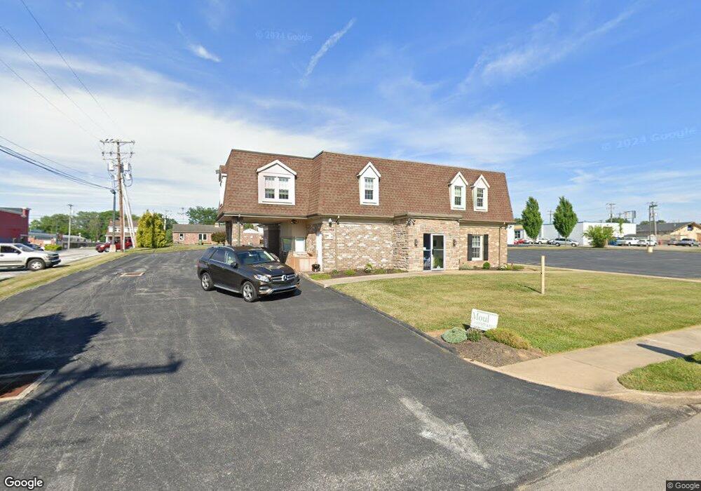
This home is located at 161 Kent Rd, York, PA 17402. 161 Kent Rd is a home located in York County with nearby schools including York Suburban Middle School, York Suburban Senior High School, and St Joseph School.
Ownership History
Date
Name
Owned For
Owner Type
Purchase Details
Closed on
Oct 29, 2020
Sold by
Rodas Katherine K and Rodas Thomas S
Bought by
Rodas Katherine K and Rodas Thomas S
Purchase Details
Closed on
Dec 22, 2016
Sold by
First Capital Federal Credit Union
Bought by
Rodas Thomas S and Rodas Katherine K
Home Financials for this Owner
Home Financials are based on the most recent Mortgage that was taken out on this home.
Original Mortgage
$325,000
Outstanding Balance
$262,594
Interest Rate
3.54%
Mortgage Type
Commercial
Purchase Details
Closed on
Dec 19, 2016
Sold by
First Capital Fcu
Bought by
Rodas Thomas A and Rodas Katherine K
Home Financials for this Owner
Home Financials are based on the most recent Mortgage that was taken out on this home.
Original Mortgage
$325,000
Outstanding Balance
$262,594
Interest Rate
3.54%
Mortgage Type
Commercial
Purchase Details
Closed on
Apr 1, 1985
Sold by
York Tracktown Employees
Bought by
York Tracktown Employees Credit Union
Create a Home Valuation Report for This Property
The Home Valuation Report is an in-depth analysis detailing your home's value as well as a comparison with similar homes in the area
Home Values in the Area
Average Home Value in this Area
Purchase History
| Date | Buyer | Sale Price | Title Company |
|---|---|---|---|
| Rodas Katherine K | -- | None Available | |
| Rodas Thomas S | $310,000 | None Available | |
| Rodas Thomas A | $310,000 | None Available | |
| York Tracktown Employees Credit Union | $57,000 | -- |
Source: Public Records
Mortgage History
| Date | Status | Borrower | Loan Amount |
|---|---|---|---|
| Open | Rodas Thomas A | $325,000 |
Source: Public Records
Tax History Compared to Growth
Tax History
| Year | Tax Paid | Tax Assessment Tax Assessment Total Assessment is a certain percentage of the fair market value that is determined by local assessors to be the total taxable value of land and additions on the property. | Land | Improvement |
|---|---|---|---|---|
| 2025 | $13,023 | $372,260 | $79,010 | $293,250 |
| 2024 | $10,941 | $372,260 | $79,010 | $293,250 |
| 2023 | $12,375 | $372,260 | $79,010 | $293,250 |
| 2022 | $12,375 | $372,260 | $79,010 | $293,250 |
| 2021 | $11,844 | $372,260 | $79,010 | $293,250 |
| 2020 | $11,844 | $372,260 | $79,010 | $293,250 |
| 2019 | $11,422 | $372,260 | $79,010 | $293,250 |
| 2018 | $11,261 | $372,260 | $79,010 | $293,250 |
| 2017 | $10,912 | $372,260 | $79,010 | $293,250 |
| 2016 | $0 | $372,260 | $79,010 | $293,250 |
| 2015 | -- | $372,260 | $79,010 | $293,250 |
| 2014 | -- | $372,260 | $79,010 | $293,250 |
Source: Public Records
Map
Nearby Homes
- 15 N Harlan St
- 2224 Eastern Blvd Unit B
- 29 N Rockburn St
- 31 N Manheim St
- 500 S Kershaw St
- 741 S Russell St
- 1777 San Gabriel Dr
- 1552 Wayne Ave
- 1508 E Market St
- 117 Wynwood Rd
- 445 Quaker Dr
- 3200 E Market St
- 1501 3rd Ave
- 1000 Sundale Dr
- 1447 4th Ave
- 42 N East St
- 19 Lady Harrington Dr
- 1401 2nd Ave
- 3101 Rex Dr
- 116 Lady Morgan Dr