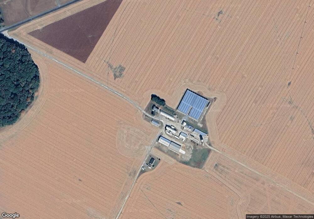
161 Kimstead Farm Ln Centreville, MD 21617
Estimated Value: $823,000 - $1,550,909
--
Bed
2
Baths
3,492
Sq Ft
$305/Sq Ft
Est. Value
About This Home
This home is located at 161 Kimstead Farm Ln, Centreville, MD 21617 and is currently estimated at $1,065,727, approximately $305 per square foot. 161 Kimstead Farm Ln is a home located in Queen Anne's County with nearby schools including Centreville Elementary School, Kennard Elementary School, and Centreville Middle School.
Ownership History
Date
Name
Owned For
Owner Type
Purchase Details
Closed on
Jan 19, 2011
Sold by
Kimbles William V
Bought by
Kimbles V William James V and Kimbles Tracy A
Current Estimated Value
Purchase Details
Closed on
Jul 18, 1997
Sold by
Kimbles John Bowen
Bought by
Kimbles William J V V and Kimbles William J Tracy A
Purchase Details
Closed on
Feb 28, 1996
Sold by
Hill Patricia K
Bought by
Kimbles John Bowen and Kimbles, V William V
Purchase Details
Closed on
Jun 29, 1995
Sold by
Kimbles Virginia I
Bought by
Hill Patricia K
Create a Home Valuation Report for This Property
The Home Valuation Report is an in-depth analysis detailing your home's value as well as a comparison with similar homes in the area
Home Values in the Area
Average Home Value in this Area
Purchase History
| Date | Buyer | Sale Price | Title Company |
|---|---|---|---|
| Kimbles V William James V | -- | -- | |
| Kimbles William J V V | -- | -- | |
| Kimbles John Bowen | $259,500 | -- | |
| Hill Patricia K | $30,000 | -- | |
| Hill Patricia K | -- | -- |
Source: Public Records
Tax History Compared to Growth
Tax History
| Year | Tax Paid | Tax Assessment Tax Assessment Total Assessment is a certain percentage of the fair market value that is determined by local assessors to be the total taxable value of land and additions on the property. | Land | Improvement |
|---|---|---|---|---|
| 2025 | $8,365 | $906,300 | $139,900 | $766,400 |
| 2024 | $8,373 | $867,600 | $0 | $0 |
| 2023 | $8,009 | $828,900 | $0 | $0 |
| 2022 | $7,259 | $790,200 | $139,900 | $650,300 |
| 2021 | $4,024 | $790,200 | $139,900 | $650,300 |
| 2020 | $7,386 | $790,200 | $139,900 | $650,300 |
| 2019 | $8,008 | $815,300 | $139,900 | $675,400 |
| 2018 | $7,880 | $815,300 | $139,900 | $675,400 |
| 2017 | $7,499 | $815,300 | $0 | $0 |
| 2016 | -- | $818,800 | $0 | $0 |
| 2015 | $8,542 | $818,800 | $0 | $0 |
| 2014 | $8,542 | $818,800 | $0 | $0 |
Source: Public Records
Map
Nearby Homes
- 104 Gadd Dr
- 112 Echo Ln
- 129 Thicket Ct
- 107 Thicket Ct
- 219 Songbird Ln
- 217 Austin Ct
- 408 Laurens Way
- 0 Trunk Line Rd Unit MDCM2005918
- 231 Ingleside Rd
- 0 5 281 Acres Schulyer Rd
- 113 Paulowina Rd
- 272 Granny Branch Rd
- 252 Granny Branch Rd
- 0 Eagle Manor Lot 20 Dr
- Merion Plan at Meadow Creek
- Windermere Plan at Meadow Creek
- Doral Plan at Meadow Creek
- Sawgrass Plan at Meadow Creek
- Pinehurst Plan at Meadow Creek
- Congressional Plan at Meadow Creek
- 161 Kimstead Farm Ln
- 333 Roe Ingleside Rd
- 323 Roe Ingleside Rd Unit 1
- 323 Roe Ingleside Rd
- 319 Roe Ingleside Rd
- 325 Roe Ingleside Rd
- 337 Roe Ingleside Rd
- 417 Roe Ingleside Rd
- 805 Cox Sawmill Rd
- 809 Cox Sawmill Rd
- 717 Cox Sawmill Rd
- 305 Roe Ingleside Rd
- 813 Cox Sawmill Rd
- 501 Roe Ingleside Rd
- 713 Cox Sawmill Rd
- 341 Roe Ingleside Rd
- 709 Cox Sawmill Rd
- 509 Roe Ingleside Rd
- 513 Roe Ingleside Rd
- 606 Cox Sawmill Rd
