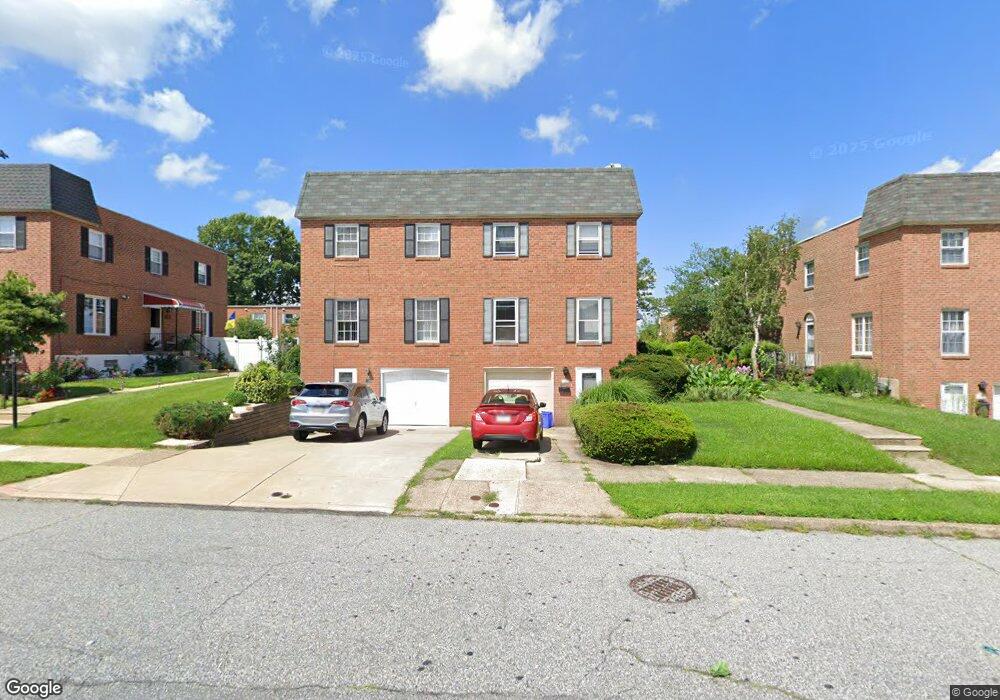
161 Larkspur St Philadelphia, PA 19116
Somerton NeighborhoodEstimated Value: $401,177 - $473,000
3
Beds
3
Baths
1,732
Sq Ft
$254/Sq Ft
Est. Value
About This Home
This home is located at 161 Larkspur St, Philadelphia, PA 19116 and is currently estimated at $440,294, approximately $254 per square foot. 161 Larkspur St is a home located in Philadelphia County with nearby schools including Loesche William H School, CCA Baldi Middle School, and George Washington High School.
Ownership History
Date
Name
Owned For
Owner Type
Purchase Details
Closed on
Jul 2, 2001
Sold by
Frog Shunya
Bought by
Frog Shunya and Frog Aleksandra
Current Estimated Value
Home Financials for this Owner
Home Financials are based on the most recent Mortgage that was taken out on this home.
Original Mortgage
$108,000
Interest Rate
7.2%
Purchase Details
Closed on
Jun 15, 1999
Sold by
Boleslavsky Leon and Boleslavsky Sara
Bought by
Frog Shunya
Create a Home Valuation Report for This Property
The Home Valuation Report is an in-depth analysis detailing your home's value as well as a comparison with similar homes in the area
Home Values in the Area
Average Home Value in this Area
Purchase History
| Date | Buyer | Sale Price | Title Company |
|---|---|---|---|
| Frog Shunya | -- | -- | |
| Frog Shunya | $113,000 | -- |
Source: Public Records
Mortgage History
| Date | Status | Borrower | Loan Amount |
|---|---|---|---|
| Closed | Frog Shunya | $108,000 |
Source: Public Records
Tax History Compared to Growth
Tax History
| Year | Tax Paid | Tax Assessment Tax Assessment Total Assessment is a certain percentage of the fair market value that is determined by local assessors to be the total taxable value of land and additions on the property. | Land | Improvement |
|---|---|---|---|---|
| 2026 | $4,226 | $379,400 | $75,880 | $303,520 |
| 2025 | $4,226 | $379,400 | $75,880 | $303,520 |
| 2024 | $4,226 | $379,400 | $75,880 | $303,520 |
| 2023 | $4,226 | $301,900 | $60,380 | $241,520 |
| 2022 | $3,596 | $256,900 | $60,380 | $196,520 |
| 2021 | $3,500 | $0 | $0 | $0 |
| 2020 | $3,500 | $0 | $0 | $0 |
| 2019 | $3,295 | $0 | $0 | $0 |
| 2018 | $3,049 | $0 | $0 | $0 |
| 2017 | $3,049 | $0 | $0 | $0 |
| 2016 | -- | $0 | $0 | $0 |
| 2015 | -- | $0 | $0 | $0 |
| 2014 | -- | $217,800 | $86,292 | $131,508 |
| 2012 | -- | $30,240 | $3,569 | $26,671 |
Source: Public Records
Map
Nearby Homes
- 166 Rennard St
- 370 Selma St
- 11169 Hendrix St
- 11722 Audubon Ave
- 118 Rennard Place
- 11990 Rennard St
- 133 Gardner St
- 11243 Jeanes Place
- 10922 Lockart Rd
- 11715 Jeanes St
- 11012 Audubon Ave
- 11022 Ferndale St
- 509 Larkspur St
- 375 Avon St
- 441 Tomlinson Rd Unit F6
- 412 Avon Place
- 10665 Halstead St
- 120 Woodland Rd
- 0 Tomlinson Rd Unit E1
- 110 30 Byberry Rd Unit M1
- 159 Larkspur St
- 163 Larkspur St
- 157 Larkspur St
- 165 Larkspur St
- 155 Larkspur St
- 162 Rennard St
- 164 Rennard St
- 160 Rennard St
- 158 Rennard St
- 167 Larkspur St
- 169 Larkspur St
- 156 Rennard St
- 156 Larkspur St
- 154 Larkspur St
- 153 Larkspur St
- 152 Larkspur St
- 151 Larkspur St
- 178 Larkspur St
- 150 Larkspur St
- 171 Larkspur St