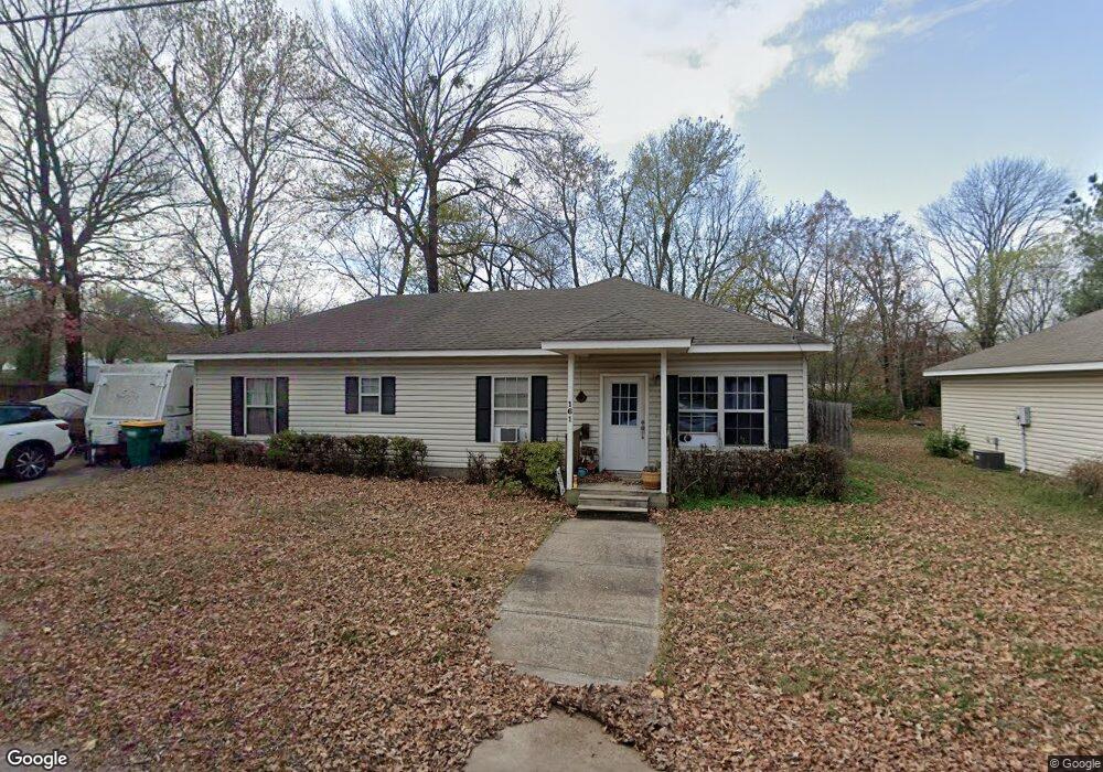
161 Maple Ave West Fork, AR 72774
Estimated Value: $206,000 - $296,000
3
Beds
2
Baths
1,440
Sq Ft
$166/Sq Ft
Est. Value
About This Home
This home is located at 161 Maple Ave, West Fork, AR 72774 and is currently estimated at $239,576, approximately $166 per square foot. 161 Maple Ave is a home located in Washington County with nearby schools including West Fork Elementary School, West Fork Middle School, and West Fork High School.
Ownership History
Date
Name
Owned For
Owner Type
Purchase Details
Closed on
May 22, 2008
Sold by
Mab Builders Inc
Bought by
Erwin Heather
Current Estimated Value
Home Financials for this Owner
Home Financials are based on the most recent Mortgage that was taken out on this home.
Original Mortgage
$132,914
Outstanding Balance
$83,711
Interest Rate
5.86%
Mortgage Type
FHA
Estimated Equity
$155,865
Create a Home Valuation Report for This Property
The Home Valuation Report is an in-depth analysis detailing your home's value as well as a comparison with similar homes in the area
Home Values in the Area
Average Home Value in this Area
Purchase History
| Date | Buyer | Sale Price | Title Company |
|---|---|---|---|
| Erwin Heather | $135,000 | Heritage Land Title Of Ar |
Source: Public Records
Mortgage History
| Date | Status | Borrower | Loan Amount |
|---|---|---|---|
| Open | Erwin Heather | $132,914 |
Source: Public Records
Tax History Compared to Growth
Tax History
| Year | Tax Paid | Tax Assessment Tax Assessment Total Assessment is a certain percentage of the fair market value that is determined by local assessors to be the total taxable value of land and additions on the property. | Land | Improvement |
|---|---|---|---|---|
| 2025 | $921 | $38,310 | $6,000 | $32,310 |
| 2024 | $952 | $38,310 | $6,000 | $32,310 |
| 2023 | $969 | $38,310 | $6,000 | $32,310 |
| 2022 | $952 | $26,810 | $3,000 | $23,810 |
| 2021 | $897 | $26,810 | $3,000 | $23,810 |
| 2020 | $842 | $26,810 | $3,000 | $23,810 |
| 2019 | $725 | $20,720 | $3,000 | $17,720 |
| 2018 | $747 | $20,720 | $3,000 | $17,720 |
| 2017 | $671 | $20,720 | $3,000 | $17,720 |
| 2016 | $627 | $20,720 | $3,000 | $17,720 |
| 2015 | $582 | $20,720 | $3,000 | $17,720 |
| 2014 | $538 | $17,210 | $3,000 | $14,210 |
Source: Public Records
Map
Nearby Homes
- 0000 Highway 170
- 185 Wheeler St
- 121 & 129 Main St
- 302 Mcknight Ave
- 321 Cedar Springs Place
- 106 Pleasant St
- 340 W Smith St
- Springs 1445 Plan at Rolling Plains
- Eureka 1536 Plan at Rolling Plains
- Oak 1463 Plan at Rolling Plains
- Magnolia 1556 Plan at Rolling Plains
- Ashton 1496 Plan at Rolling Plains
- Ouachita 1669 Plan at Rolling Plains
- Osage 1567 Plan at Rolling Plains
- Maple 1659 Plan at Rolling Plains
- 327 W Smith St
- 385 W Smith St
- 393 W Smith St
- 365 W Smith St
- 359 W Smith St
- 153 Maple Ave
- 162 Maple Ave
- 154 Maple Ave
- 147 Maple Ave
- 192 Maple Ave
- 189 S Campbell Ave
- 121 Maple Ave
- 120 Maple Ave
- 232 Webber St
- 227 Webber St
- 242 White St
- 290 Phillips St
- 230 White St
- 296 Phillips St
- . Campbell Community
- 105 Maple Ave
- 159 Williams Ave
- 212 White St
- 312 Phillips St
- 000 Mcknight Ave Unit 10662 Union Star Chu