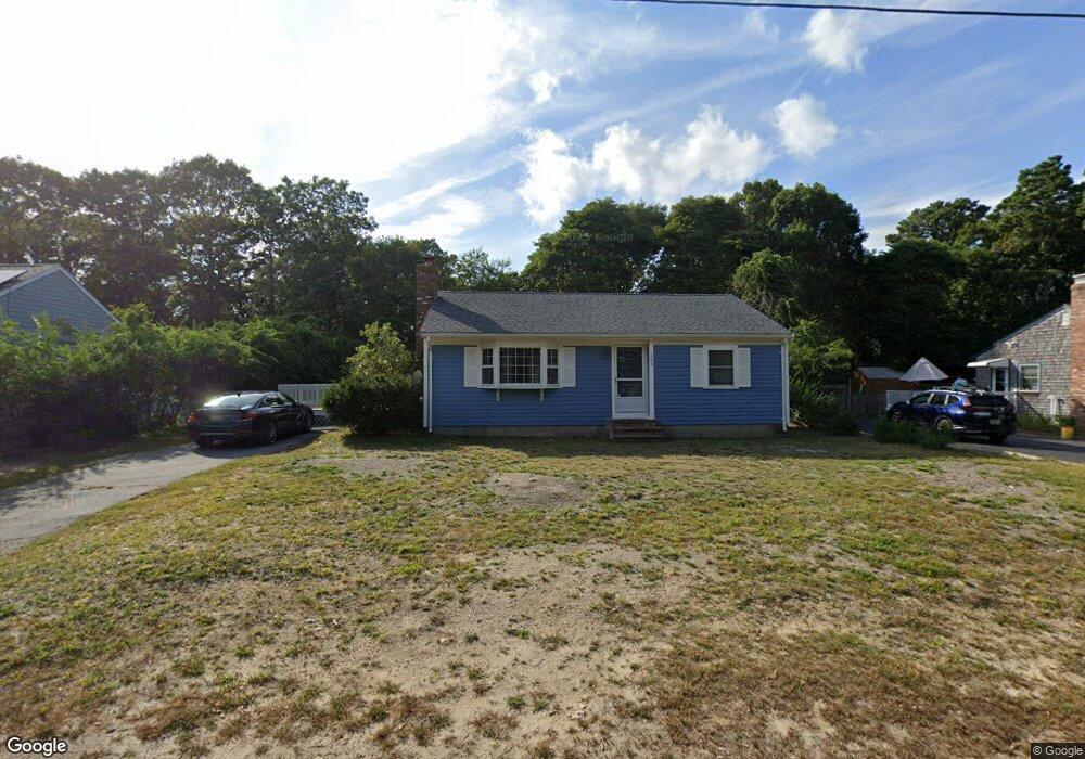
161 Megan Rd Hyannis, MA 02601
Estimated Value: $428,000 - $507,000
2
Beds
1
Bath
986
Sq Ft
$483/Sq Ft
Est. Value
About This Home
This home is located at 161 Megan Rd, Hyannis, MA 02601 and is currently estimated at $476,459, approximately $483 per square foot. 161 Megan Rd is a home located in Barnstable County with nearby schools including Hyannis West Elementary School, Barnstable United Elementary School, and Barnstable Intermediate School.
Ownership History
Date
Name
Owned For
Owner Type
Purchase Details
Closed on
Dec 28, 2006
Sold by
Bullock Andrew E
Bought by
Costa Lynda C
Current Estimated Value
Home Financials for this Owner
Home Financials are based on the most recent Mortgage that was taken out on this home.
Original Mortgage
$219,450
Outstanding Balance
$131,725
Interest Rate
6.29%
Mortgage Type
Purchase Money Mortgage
Estimated Equity
$344,734
Purchase Details
Closed on
Mar 12, 1999
Sold by
Gagne David M and Gagne Shirley A
Bought by
Bullock Andrew E
Home Financials for this Owner
Home Financials are based on the most recent Mortgage that was taken out on this home.
Original Mortgage
$74,920
Interest Rate
6.73%
Mortgage Type
Purchase Money Mortgage
Create a Home Valuation Report for This Property
The Home Valuation Report is an in-depth analysis detailing your home's value as well as a comparison with similar homes in the area
Home Values in the Area
Average Home Value in this Area
Purchase History
| Date | Buyer | Sale Price | Title Company |
|---|---|---|---|
| Costa Lynda C | $231,000 | -- | |
| Bullock Andrew E | $99,900 | -- |
Source: Public Records
Mortgage History
| Date | Status | Borrower | Loan Amount |
|---|---|---|---|
| Open | Costa Lynda C | $219,450 | |
| Previous Owner | Bullock Andrew E | $74,920 | |
| Closed | Bullock Andrew E | $19,980 |
Source: Public Records
Tax History Compared to Growth
Tax History
| Year | Tax Paid | Tax Assessment Tax Assessment Total Assessment is a certain percentage of the fair market value that is determined by local assessors to be the total taxable value of land and additions on the property. | Land | Improvement |
|---|---|---|---|---|
| 2025 | $3,715 | $400,800 | $138,500 | $262,300 |
| 2024 | $3,606 | $398,400 | $138,500 | $259,900 |
| 2023 | $3,406 | $355,900 | $132,900 | $223,000 |
| 2022 | $3,385 | $292,600 | $98,400 | $194,200 |
| 2021 | $2,980 | $250,200 | $93,300 | $156,900 |
| 2020 | $3,055 | $247,800 | $93,300 | $154,500 |
| 2019 | $2,810 | $223,400 | $88,100 | $135,300 |
| 2018 | $2,537 | $206,300 | $92,700 | $113,600 |
| 2017 | $2,149 | $179,200 | $70,900 | $108,300 |
| 2016 | $2,109 | $179,800 | $71,500 | $108,300 |
| 2015 | $2,010 | $173,700 | $69,600 | $104,100 |
Source: Public Records
Map
Nearby Homes
- 52 Maryalice Ln
- 57 Suffolk Ave
- 292 Megan Rd
- 7 Delta St
- 720 Pitchers Way Unit 52
- 199 Hamden Cir
- 28 Bumpus Rd
- 179 Sudbury Ln
- 86 Arrowhead Dr
- 69 Pine Grove Ave
- 296 Lincoln Rd
- 295 Sudbury Ln
- 15 Goldie Way
- 370 Compass Cir
- 112 W Main St Unit 4
- 112 W Main St Unit 1
- 112 W Main St Unit 2
- 112 W Main St Unit 7
- 112 W Main St Unit 5
- 112 W Main St Unit 8