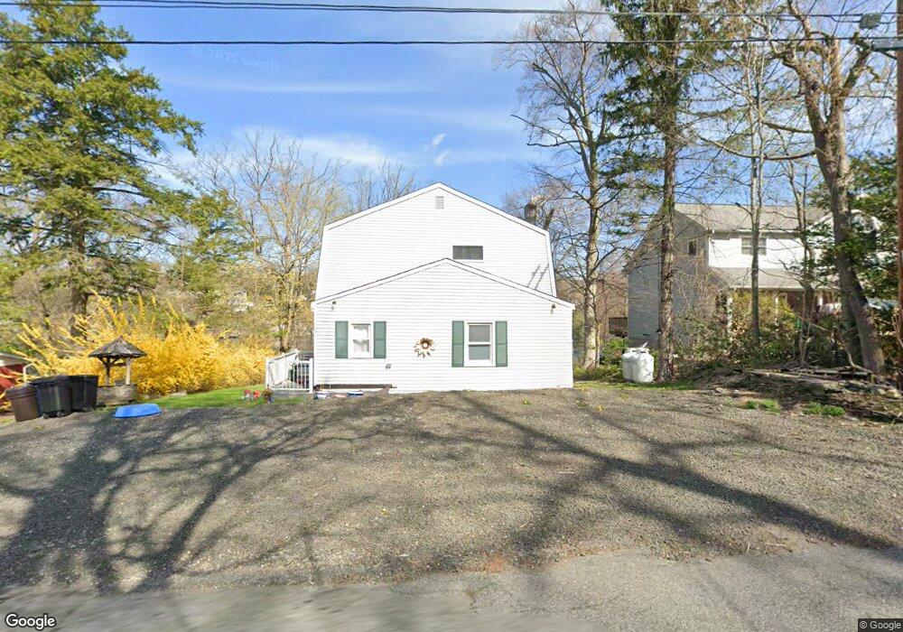
161 Point Breeze Dr Hewitt, NJ 07421
Estimated Value: $448,158 - $563,000
--
Bed
--
Bath
1,456
Sq Ft
$333/Sq Ft
Est. Value
About This Home
This home is located at 161 Point Breeze Dr, Hewitt, NJ 07421 and is currently estimated at $485,040, approximately $333 per square foot. 161 Point Breeze Dr is a home located in Passaic County with nearby schools including Macopin Middle School and West Milford High School.
Ownership History
Date
Name
Owned For
Owner Type
Purchase Details
Closed on
Dec 4, 2020
Sold by
Leswing Michael B
Bought by
Goldstein Rebecca and Turkel Avram Solomon
Current Estimated Value
Home Financials for this Owner
Home Financials are based on the most recent Mortgage that was taken out on this home.
Original Mortgage
$270,000
Outstanding Balance
$240,381
Interest Rate
2.7%
Mortgage Type
New Conventional
Estimated Equity
$244,659
Purchase Details
Closed on
Jan 8, 2010
Sold by
Leswing Michael B and Leswing Deana M
Bought by
Leswing Michael B
Purchase Details
Closed on
May 31, 2001
Sold by
Marzinke Matthew
Bought by
Leswing Michael and Pantiliano Deana
Home Financials for this Owner
Home Financials are based on the most recent Mortgage that was taken out on this home.
Original Mortgage
$156,000
Interest Rate
7.08%
Create a Home Valuation Report for This Property
The Home Valuation Report is an in-depth analysis detailing your home's value as well as a comparison with similar homes in the area
Home Values in the Area
Average Home Value in this Area
Purchase History
| Date | Buyer | Sale Price | Title Company |
|---|---|---|---|
| Goldstein Rebecca | $300,000 | Key Settlements Inc | |
| Leswing Michael B | -- | -- | |
| Leswing Michael | $195,000 | -- | |
| Leswing Michael | $195,000 | -- |
Source: Public Records
Mortgage History
| Date | Status | Borrower | Loan Amount |
|---|---|---|---|
| Open | Goldstein Rebecca | $270,000 | |
| Previous Owner | Leswing Michael | $156,000 |
Source: Public Records
Tax History Compared to Growth
Tax History
| Year | Tax Paid | Tax Assessment Tax Assessment Total Assessment is a certain percentage of the fair market value that is determined by local assessors to be the total taxable value of land and additions on the property. | Land | Improvement |
|---|---|---|---|---|
| 2025 | $10,593 | $261,300 | $185,500 | $75,800 |
| 2024 | $11,870 | $261,300 | $185,500 | $75,800 |
| 2022 | $11,267 | $291,300 | $185,500 | $105,800 |
| 2021 | $11,026 | $291,300 | $185,500 | $105,800 |
| 2020 | $10,909 | $291,300 | $185,500 | $105,800 |
| 2019 | $10,764 | $291,300 | $185,500 | $105,800 |
| 2018 | $10,737 | $291,300 | $185,500 | $105,800 |
| 2017 | $10,787 | $291,300 | $185,500 | $105,800 |
| 2016 | $10,804 | $291,300 | $185,500 | $105,800 |
| 2015 | $10,679 | $289,000 | $185,500 | $103,500 |
| 2014 | $10,338 | $289,000 | $185,500 | $103,500 |
Source: Public Records
Map
Nearby Homes
- 230 Point Breeze Dr
- 530 Lake Shore Dr
- 0 Kresson Rd
- 116 Point Breeze Dr
- 40 Upper Greenwood Rd
- 40 Upper Greenwood Lake Rd
- 10 Paterson Rd
- 486 Lake Shore Dr
- 54 Race Track Dr
- 1 Norwood Rd
- 10 Emerson Rd
- 3 Riverside Rd
- 6 Passaic Dr
- 00 Fairlawn Dr
- 12 Riverside Rd
- 25 Longhouse Dr
- 00 Jenkins Rd
- 5 Fanwood Ct
- 6 Dunham Rd
- 159 Point Breeze Dr
- 165 Point Breeze Dr
- 157 Point Breeze Dr
- 162 Point Breeze Dr
- 166 Point Breeze Dr
- 155 Point Breeze Dr
- 160 157 Point Breeze Dr
- 160 Point Breeze Dr
- 168 Point Breeze Dr
- 171 Point Breeze Dr
- 170 Point Breeze Dr
- 153 Point Breeze Dr
- 4 Belford Dr
- 2 Belford Dr
- 208 Point Breeze Dr
- 174 Point Breeze Dr
- 173 Point Breeze Dr
- 177 Breeze Dr
- 206 Point Breeze Dr
- 178 Point Breeze Dr