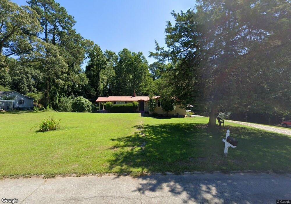
161 Poplar Cir Lagrange, GA 30241
Estimated Value: $131,000 - $153,000
3
Beds
1
Bath
1,168
Sq Ft
$122/Sq Ft
Est. Value
About This Home
This home is located at 161 Poplar Cir, Lagrange, GA 30241 and is currently estimated at $142,151, approximately $121 per square foot. 161 Poplar Cir is a home located in Troup County with nearby schools including Callaway Elementary School, Hogansville Elementary School, and Callaway Middle School.
Ownership History
Date
Name
Owned For
Owner Type
Purchase Details
Closed on
Aug 31, 2004
Sold by
Sandra Cornwell
Bought by
Hernandez Christina
Current Estimated Value
Purchase Details
Closed on
Sep 9, 2003
Sold by
Cornwell Sandra
Bought by
Sandra Cornwell
Purchase Details
Closed on
Jun 12, 1996
Sold by
Doyal Smith
Bought by
Cornwell Sandra
Purchase Details
Closed on
Feb 1, 1987
Bought by
Doyal Smith
Purchase Details
Closed on
Sep 8, 1978
Sold by
Henry Williams
Purchase Details
Closed on
May 31, 1977
Sold by
Frances D Benson
Bought by
Henry Williams
Purchase Details
Closed on
Sep 3, 1976
Sold by
Kyle R Benson
Bought by
Frances D Benson
Purchase Details
Closed on
Nov 27, 1974
Sold by
Teague
Bought by
Kyle R Benson
Purchase Details
Closed on
Jan 1, 1964
Sold by
Franklin Grizzard
Bought by
Teague
Create a Home Valuation Report for This Property
The Home Valuation Report is an in-depth analysis detailing your home's value as well as a comparison with similar homes in the area
Purchase History
| Date | Buyer | Sale Price | Title Company |
|---|---|---|---|
| Hernandez Christina | $65,500 | -- | |
| Sandra Cornwell | -- | -- | |
| Cornwell Sandra | -- | -- | |
| Doyal Smith | -- | -- | |
| -- | -- | -- | |
| Henry Williams | -- | -- | |
| Frances D Benson | -- | -- | |
| Kyle R Benson | -- | -- | |
| Teague | -- | -- |
Source: Public Records
Tax History
| Year | Tax Paid | Tax Assessment Tax Assessment Total Assessment is a certain percentage of the fair market value that is determined by local assessors to be the total taxable value of land and additions on the property. | Land | Improvement |
|---|---|---|---|---|
| 2025 | $1,020 | $44,072 | $10,000 | $34,072 |
| 2024 | $788 | $30,872 | $10,000 | $20,872 |
| 2023 | $301 | $30,912 | $10,000 | $20,912 |
| 2022 | $710 | $27,432 | $8,000 | $19,432 |
| 2021 | $574 | $21,008 | $6,000 | $15,008 |
| 2020 | $574 | $21,008 | $6,000 | $15,008 |
| 2019 | $570 | $20,900 | $6,000 | $14,900 |
| 2018 | $533 | $19,660 | $6,800 | $12,860 |
| 2017 | $533 | $19,660 | $6,800 | $12,860 |
| 2016 | $539 | $19,867 | $6,780 | $13,087 |
| 2015 | $541 | $19,867 | $6,780 | $13,087 |
| 2014 | $520 | $19,178 | $6,780 | $12,398 |
| 2013 | -- | $24,858 | $6,780 | $18,078 |
Source: Public Records
Map
Nearby Homes
- 129 Mallory Dr
- 113 Pine Cir
- 2 Louise St
- 15 Fulton St
- 0 E Render St
- 311 Mourning Ct Unit LOT 33
- 507 Headwater Ct Unit 6
- 459 Merrywood Dr
- 503 Headwater Ct Unit 4D
- 502 Headwater Ct Unit 8D
- 302 Glenhaven Dr Unit 2D
- 4 1/2 Barnard Ave
- 428 Macon St
- 111 Shenandoah Ln
- 109 Shenandoah Ln
- 117 Shenandoah Ln Unit 22D
- 200 River Meadow Dr
- 106 Shenandoah Ln Unit 26E
- 106 Shenandoah Ln
- 100 Dove Creek Ct
Your Personal Tour Guide
Ask me questions while you tour the home.