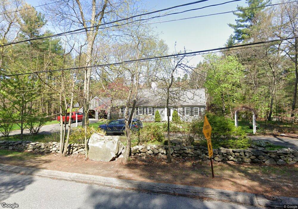
161 Powers Rd Sudbury, MA 01776
Estimated Value: $1,075,000 - $1,272,000
4
Beds
2
Baths
3,182
Sq Ft
$361/Sq Ft
Est. Value
About This Home
This home is located at 161 Powers Rd, Sudbury, MA 01776 and is currently estimated at $1,147,256, approximately $360 per square foot. 161 Powers Rd is a home located in Middlesex County with nearby schools including Josiah Haynes Elementary School, Ephraim Curtis Middle School, and Lincoln-Sudbury Regional High School.
Ownership History
Date
Name
Owned For
Owner Type
Purchase Details
Closed on
Jun 21, 2005
Sold by
Leslie Ann W and Leslie Annabel
Bought by
Lizotte Craig and Sampson-Lizotte Luess
Current Estimated Value
Home Financials for this Owner
Home Financials are based on the most recent Mortgage that was taken out on this home.
Original Mortgage
$265,000
Outstanding Balance
$138,524
Interest Rate
5.78%
Mortgage Type
Purchase Money Mortgage
Estimated Equity
$1,008,732
Create a Home Valuation Report for This Property
The Home Valuation Report is an in-depth analysis detailing your home's value as well as a comparison with similar homes in the area
Home Values in the Area
Average Home Value in this Area
Purchase History
| Date | Buyer | Sale Price | Title Company |
|---|---|---|---|
| Lizotte Craig | $619,000 | -- |
Source: Public Records
Mortgage History
| Date | Status | Borrower | Loan Amount |
|---|---|---|---|
| Open | Lizotte Craig | $265,000 |
Source: Public Records
Tax History Compared to Growth
Tax History
| Year | Tax Paid | Tax Assessment Tax Assessment Total Assessment is a certain percentage of the fair market value that is determined by local assessors to be the total taxable value of land and additions on the property. | Land | Improvement |
|---|---|---|---|---|
| 2025 | $14,226 | $971,700 | $442,200 | $529,500 |
| 2024 | $13,684 | $936,600 | $429,400 | $507,200 |
| 2023 | $14,027 | $889,500 | $397,800 | $491,700 |
| 2022 | $13,489 | $747,300 | $365,400 | $381,900 |
| 2021 | $12,859 | $682,900 | $365,400 | $317,500 |
| 2020 | $12,600 | $682,900 | $365,400 | $317,500 |
| 2019 | $12,231 | $682,900 | $365,400 | $317,500 |
| 2018 | $12,307 | $686,400 | $389,400 | $297,000 |
| 2017 | $11,531 | $650,000 | $370,600 | $279,400 |
| 2016 | $11,113 | $624,300 | $356,600 | $267,700 |
| 2015 | $10,697 | $607,800 | $343,000 | $264,800 |
| 2014 | $10,672 | $591,900 | $333,000 | $258,900 |
Source: Public Records
Map
Nearby Homes
- 16 Blacksmith Dr
- 369 Border Rd
- 42 Dakin Rd
- 67 Powder Mill Rd
- 29 Black Birch Ln Unit 29
- 57 Longfellow Rd
- 9 Black Birch Ln Unit 9
- 96 Forest Ridge Rd Unit 96
- 589 North Rd
- 5 Oak Ridge Dr Unit 7
- 10 Oak Ridge Dr Unit 5
- 40 Rookery Ln Unit 5
- 72 Rookery Ln Unit 3
- 80 N Branch Rd
- 401 Emery Ln Unit 104
- 24 Rookery Ln Unit 6
- 56 Rookery Ln Unit 4
- 1844 Main St Unit 1844
- 1 Maillet Dr
- 2 & 6 Powder Mill Rd
- 169 Powers Rd
- 153 Powers Rd
- 158 Powers Rd
- 126 Willard Grant Rd
- 147 Powers Rd
- 175 Powers Rd
- 150 Powers Rd
- 111 Willard Grant Rd
- 118 Willard Grant Rd
- 139 Powers Rd
- 142 Powers Rd
- 10 Barnet Rd
- 11 Barnet Rd
- Lot 2 & 3 Nolan Cir
- 112 Willard Grant Rd
- 105 Willard Grant Rd
- 105 Willard Grant Rd Unit 105
- 106 Willard Grant Rd
- 19 Barnet Rd
- 130 Powers Rd