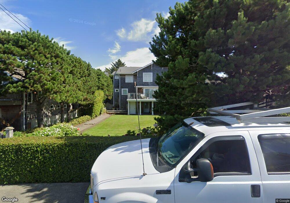
161 S Ocean Ave Seaside, OR 97138
Estimated Value: $1,316,000 - $1,871,000
5
Beds
2
Baths
1,524
Sq Ft
$1,043/Sq Ft
Est. Value
About This Home
This home is located at 161 S Ocean Ave, Seaside, OR 97138 and is currently estimated at $1,589,569, approximately $1,043 per square foot. 161 S Ocean Ave is a home with nearby schools including Seaside High School.
Ownership History
Date
Name
Owned For
Owner Type
Purchase Details
Closed on
Jan 17, 2020
Sold by
Miller Andrew W and The Andrew W Miller Trust
Bought by
Meigs Sarah M and The Miller Family Trust
Current Estimated Value
Purchase Details
Closed on
Oct 16, 2019
Sold by
Miller Andrew W
Bought by
Miller Andrew W and The Andrew W Miller Trust
Purchase Details
Closed on
Jul 14, 2017
Sold by
Miller Andrew W and Meigs Sarah M
Bought by
Miller Andrew W and Meigs Sarah M
Purchase Details
Closed on
Dec 28, 2016
Sold by
Miller Catherine M
Bought by
Miller Prudence M and Miller Andrew W
Create a Home Valuation Report for This Property
The Home Valuation Report is an in-depth analysis detailing your home's value as well as a comparison with similar homes in the area
Purchase History
| Date | Buyer | Sale Price | Title Company |
|---|---|---|---|
| Meigs Sarah M | -- | None Available | |
| Miller Andrew W | -- | None Available | |
| Miller Andrew W | -- | None Available | |
| Miller Prudence M | -- | None Available |
Source: Public Records
Tax History
| Year | Tax Paid | Tax Assessment Tax Assessment Total Assessment is a certain percentage of the fair market value that is determined by local assessors to be the total taxable value of land and additions on the property. | Land | Improvement |
|---|---|---|---|---|
| 2025 | $9,348 | $855,795 | -- | -- |
| 2024 | $9,503 | $830,870 | -- | -- |
| 2023 | $9,237 | $806,671 | $0 | $0 |
| 2022 | $8,960 | $783,176 | $0 | $0 |
| 2021 | $9,146 | $760,366 | $0 | $0 |
| 2020 | $8,822 | $738,220 | $0 | $0 |
| 2019 | $8,595 | $716,719 | $0 | $0 |
Source: Public Records
Map
Nearby Homes
- 1396 N Ocean Ave
- 735 3rd St
- 1255 A St
- 641 6th St
- 750 5th St
- 934 H St
- 856 Neacoxie Blvd
- 856 Neacoxie Blvd Unit 311
- 101 13th St Unit 209
- 782 Woodland Ct
- 1146 N Marion Ave Unit 1-606
- 1065 Picture Place
- 1238 N Marion Ave Unit 467
- 3387-3389 U S 101
- 3389 U S 101
- 1238 N Marion Pacific View Condo Ave Unit 467
- 1398 N Ocean Ave
- 1400 N Ocean Ave
- 645 Meadow Ln
- 2674 U S 101
- 124 S Marion
- 124 N Marion Ave
- 172 S Marion Ave
- 183 S Ocean Ave
- 123 S Ocean Ave
- 104 S Marion Ave
- 201 S Ocean Ave
- 52 S Marion Ave
- 235 S Ocean Ave
- 235 S Ocean Ave
- 61 S Ocean Ave
- 233 S Ocean Ave
- 223 Pacific Way
- 194 S Ocean Ave
- 251 S Ocean Ave
- 08100 Nita
- 220 Nita Ave
- 8100 Nita Adj To 400 A Unit 35-36
- 321 Pacific Way
- 293 S Ocean Ave
Your Personal Tour Guide
Ask me questions while you tour the home.