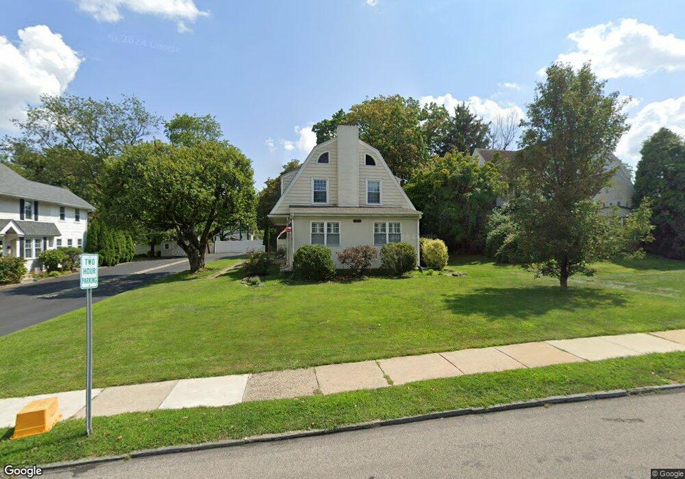
161 S Rolling Rd Springfield, PA 19064
Estimated Value: $546,417 - $685,000
4
Beds
2
Baths
2,520
Sq Ft
$241/Sq Ft
Est. Value
About This Home
This home is located at 161 S Rolling Rd, Springfield, PA 19064 and is currently estimated at $606,354, approximately $240 per square foot. 161 S Rolling Rd is a home located in Delaware County with nearby schools including Springfield High School, St Francis Of Assisi School, and Holy Cross School.
Ownership History
Date
Name
Owned For
Owner Type
Purchase Details
Closed on
Jul 22, 2005
Sold by
Thomas Mark J and Thomas Joanne F
Bought by
Henry Andrew and Schneider Sara Jane
Current Estimated Value
Home Financials for this Owner
Home Financials are based on the most recent Mortgage that was taken out on this home.
Original Mortgage
$251,920
Interest Rate
5.84%
Mortgage Type
Fannie Mae Freddie Mac
Purchase Details
Closed on
Aug 21, 2003
Sold by
Forrester Bette K and Thomas Mark J
Bought by
Thomas Mark J and Thomas Joanne F
Purchase Details
Closed on
Dec 29, 1997
Sold by
Forrester Bette K
Bought by
Thomas Mark J and Thomas Joanne F
Purchase Details
Closed on
Dec 27, 1996
Sold by
Forrester Robert Lester and Forrester Bette K
Bought by
Forrester Bette K
Create a Home Valuation Report for This Property
The Home Valuation Report is an in-depth analysis detailing your home's value as well as a comparison with similar homes in the area
Home Values in the Area
Average Home Value in this Area
Purchase History
| Date | Buyer | Sale Price | Title Company |
|---|---|---|---|
| Henry Andrew | $314,900 | None Available | |
| Thomas Mark J | -- | -- | |
| Thomas Mark J | -- | -- | |
| Forrester Bette K | -- | -- |
Source: Public Records
Mortgage History
| Date | Status | Borrower | Loan Amount |
|---|---|---|---|
| Previous Owner | Henry Andrew | $251,920 |
Source: Public Records
Tax History
| Year | Tax Paid | Tax Assessment Tax Assessment Total Assessment is a certain percentage of the fair market value that is determined by local assessors to be the total taxable value of land and additions on the property. | Land | Improvement |
|---|---|---|---|---|
| 2025 | $8,298 | $295,230 | $119,230 | $176,000 |
| 2024 | $8,298 | $295,230 | $119,230 | $176,000 |
| 2023 | $7,990 | $295,230 | $119,230 | $176,000 |
| 2022 | $7,817 | $295,230 | $119,230 | $176,000 |
| 2021 | $12,106 | $295,230 | $119,230 | $176,000 |
| 2020 | $7,860 | $173,460 | $54,670 | $118,790 |
| 2019 | $7,676 | $173,460 | $54,670 | $118,790 |
| 2018 | $7,566 | $173,460 | $0 | $0 |
| 2017 | $7,391 | $173,460 | $0 | $0 |
| 2016 | $952 | $173,460 | $0 | $0 |
| 2015 | $952 | $173,460 | $0 | $0 |
| 2014 | $952 | $173,460 | $0 | $0 |
Source: Public Records
Map
Nearby Homes
- 226 Lynbrooke Rd
- 120 W Springfield Rd
- 227 E Leamy Ave
- 111 Forest Rd
- 31 Wayfield Rd
- 332 Franklin Ave
- 29 School Ln
- 364 S Rolling Rd
- 173 Rambling Way
- 147 Snyder Ln
- 493 Wheatsheaf Rd
- 220 N Rolling Rd
- 606 W Springfield Rd
- 501 Flora Cir
- 514 Springview Ln
- 472 Larchwood Rd
- 838 West Ave
- 641 W Sproul Rd
- 933 Greenbriar Ln
- 978 Westfield Rd
- 155 S Rolling Rd
- 165 S Rolling Rd
- 153 S Rolling Rd
- 0 0000 S Rolling Rd
- 149 S Rolling Rd
- 162 Hart Ln
- 158 Hart Ln
- 111 Saxer Ave
- 154 Hart Ln
- 145 Saxer Ave
- 145 S Rolling Rd
- 152 Hart Ln
- 136 Saxer Ave
- 146 S Rolling Rd
- 99 Lownes Ln
- 141 S Rolling Rd
- 142 S Rolling Rd
- 159 Hart Ln
- 144 Saxer Ave
- 137 S Rolling Rd
Your Personal Tour Guide
Ask me questions while you tour the home.