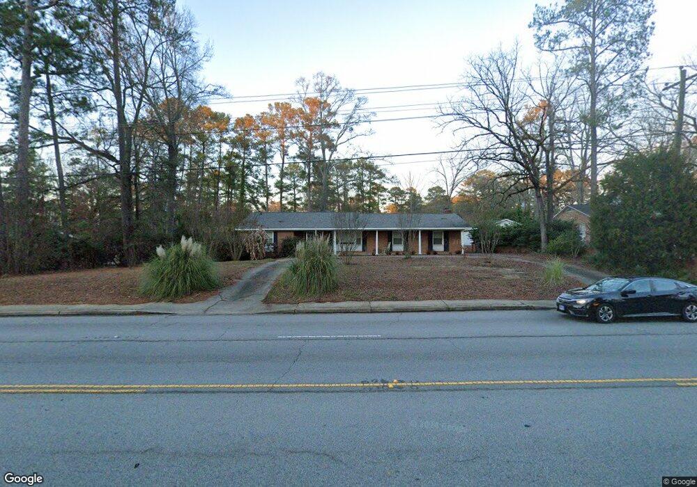
161 Saint Andrews Rd Columbia, SC 29210
Seven Oaks NeighborhoodEstimated Value: $259,000 - $288,000
3
Beds
2
Baths
2,177
Sq Ft
$125/Sq Ft
Est. Value
About This Home
This home is located at 161 Saint Andrews Rd, Columbia, SC 29210 and is currently estimated at $271,256, approximately $124 per square foot. 161 Saint Andrews Rd is a home located in Lexington County with nearby schools including Leaphart Elementary School, Irmo Middle, and Irmo High.
Ownership History
Date
Name
Owned For
Owner Type
Purchase Details
Closed on
Jun 11, 2007
Sold by
Smith Gwendolyn and Smith Gary
Bought by
Johnson Donald
Current Estimated Value
Home Financials for this Owner
Home Financials are based on the most recent Mortgage that was taken out on this home.
Original Mortgage
$159,125
Outstanding Balance
$97,209
Interest Rate
6.16%
Mortgage Type
Purchase Money Mortgage
Estimated Equity
$174,047
Purchase Details
Closed on
Oct 31, 2005
Sold by
Collins Pamela S
Bought by
Smith Gwendolyn and Smith Gary
Purchase Details
Closed on
Nov 10, 2003
Sold by
Palm Tradit Homes Llc
Bought by
Leaphart Nathan G
Create a Home Valuation Report for This Property
The Home Valuation Report is an in-depth analysis detailing your home's value as well as a comparison with similar homes in the area
Home Values in the Area
Average Home Value in this Area
Purchase History
| Date | Buyer | Sale Price | Title Company |
|---|---|---|---|
| Johnson Donald | $167,500 | None Available | |
| Smith Gwendolyn | $159,900 | -- | |
| Leaphart Nathan G | $119,387 | -- |
Source: Public Records
Mortgage History
| Date | Status | Borrower | Loan Amount |
|---|---|---|---|
| Open | Johnson Donald | $159,125 |
Source: Public Records
Tax History Compared to Growth
Tax History
| Year | Tax Paid | Tax Assessment Tax Assessment Total Assessment is a certain percentage of the fair market value that is determined by local assessors to be the total taxable value of land and additions on the property. | Land | Improvement |
|---|---|---|---|---|
| 2024 | $526 | $5,987 | $1,283 | $4,704 |
| 2023 | $526 | $5,987 | $1,283 | $4,704 |
| 2022 | $552 | $5,987 | $1,283 | $4,704 |
| 2020 | $976 | $5,987 | $1,283 | $4,704 |
| 2019 | $866 | $5,207 | $1,200 | $4,007 |
| 2018 | $760 | $5,207 | $1,200 | $4,007 |
| 2017 | $740 | $5,207 | $1,200 | $4,007 |
| 2016 | $761 | $5,206 | $1,200 | $4,006 |
| 2014 | $985 | $6,698 | $1,200 | $5,498 |
| 2013 | -- | $6,700 | $1,200 | $5,500 |
Source: Public Records
Map
Nearby Homes
- 163 Cheshire Dr
- 3725 Harrogate Rd
- 139 Cheshire Dr
- 320 Brookshire Dr
- 1115 Gardendale Dr
- 326 Townes Rd
- 224 Linsbury Cir
- 107 Southwell Rd
- 875 Gardendale Dr
- 411 Willow Winds Dr
- 119 Wilkshire Dr
- 412 Winstaire Dr
- 440 Leton Dr
- 531 Sulgrave Dr
- 2046 Shallow Bluff Ct
- 2034 Shallow Bluff Ct
- 2028 Shallow Bluff Ct
- 2022 Shallow Bluff Ct
- 2358 High Bluff Loop
- 203 Broken Hill Rd
- 165 Saint Andrews Rd
- 146 Banbury Rd
- 158 Dorset Dr
- 150 Dorset Dr
- 162 Saint Andrews Rd
- 169 Saint Andrews Rd
- 168 Dorset Dr
- 158 Saint Andrews Rd
- 173 Saint Andrews Rd
- 153 Banbury Rd
- 109 Saint Andrews Ct
- 109 Saint Andrews Ct
- 163 Dorset Dr
- 172 Dorset Dr
- 159 Banbury Rd
- 135 Tram Rd
- 170 Banbury Rd
- 176 Dorset Dr
- 177 Saint Andrews Rd
- 113 Saint Andrews Ct