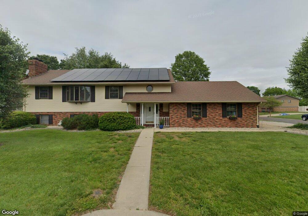
161 Stahl Dr Smithton, IL 62285
Estimated Value: $246,000 - $302,000
About This Home
This home is located at 161 Stahl Dr, Smithton, IL 62285 and is currently estimated at $264,236, approximately $209 per square foot. 161 Stahl Dr is a home located in St. Clair County with nearby schools including Smithton Elementary, Freeburg Community High School, and St John the Baptist Catholic School.
Ownership History
We collect this data history from publicly available records. To have your information removed, we recommend requesting removal directly through your county’s website.
Purchase Details
Home Financials for this Owner
Home Financials are based on the most recent Mortgage that was taken out on this home.Purchase Details
Purchase Details
Home Financials for this Owner
Home Financials are based on the most recent Mortgage that was taken out on this home.Home Values in the Area
Average Home Value in this Area
Purchase History
We collect this data history from publicly available records. To have your information removed, we recommend requesting removal directly through your county’s website.
| Date | Buyer | Sale Price | Title Company |
|---|---|---|---|
| $155,000 | First County Title | ||
| -- | -- | ||
| $161,500 | Chicago Title |
Mortgage History
We collect this data history from publicly available records. To have your information removed, we recommend requesting removal directly through your county’s website.
| Date | Status | Borrower | Loan Amount |
|---|---|---|---|
| Closed | $17,500 | ||
| Open | $122,000 | ||
| Previous Owner | $128,400 |
Tax History
We collect this data history from publicly available records. To have your information removed, we recommend requesting removal directly through your county’s website.
| Year | Tax Paid | Tax Assessment Tax Assessment Total Assessment is a certain percentage of the fair market value that is determined by local assessors to be the total taxable value of land and additions on the property. | Land | Improvement |
|---|---|---|---|---|
| 2024 | -- | $81,332 | $10,826 | $70,506 |
| 2023 | -- | $75,594 | $10,062 | $65,532 |
| 2022 | $6,023 | $69,378 | $9,235 | $60,143 |
| 2021 | $0 | $65,328 | $8,696 | $56,632 |
| 2020 | $0 | $61,661 | $8,390 | $53,271 |
| 2019 | $0 | $61,661 | $8,390 | $53,271 |
| 2018 | $0 | $59,501 | $8,096 | $51,405 |
| 2017 | $0 | $56,744 | $7,721 | $49,023 |
| 2016 | $0 | $55,748 | $7,856 | $47,892 |
| 2014 | $3,685 | $54,860 | $7,731 | $47,129 |
| 2013 | $4,081 | $56,054 | $7,899 | $48,155 |
Map
- 808 Fieldview Dr
- 603 N Hickory St
- 21 N Saint Johns Dr
- 14 N High St
- 5729 Abilene Ln
- 4805 Lone Rock Ln
- 4818 River Rock Ln
- 4525 Boardwalk
- 4517 Boardwalk
- 4916 Wilderness Point
- 6906 Holcomb School Rd
- 0 Unknown Unit 22065045
- 4192 Laurel Oak Ln
- 4213 Water Oak Ln
- 211 Alamosa Dr
- 359 Sleeping Indian Dr
- 363 Sleeping Indian Dr
- 5483 White Oak Dr
- 4132 Summer Oak Dr
- 4122 Knab Rd
Ask me questions while you tour the home.