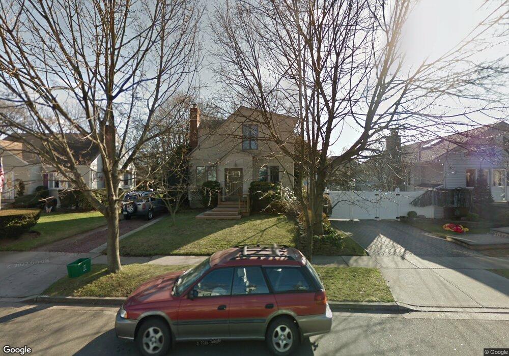
161 Stuyvesant Ave Merrick, NY 11566
Estimated Value: $692,917 - $774,000
--
Bed
2
Baths
1,521
Sq Ft
$482/Sq Ft
Est. Value
About This Home
This home is located at 161 Stuyvesant Ave, Merrick, NY 11566 and is currently estimated at $733,459, approximately $482 per square foot. 161 Stuyvesant Ave is a home located in Nassau County with nearby schools including Merrick Avenue Middle School, Sanford H Calhoun High School, and Grace Christian Academy.
Ownership History
Date
Name
Owned For
Owner Type
Purchase Details
Closed on
Jun 10, 2016
Sold by
Casserly Gerard
Bought by
Casserly Gerard
Current Estimated Value
Purchase Details
Closed on
Apr 30, 1996
Sold by
Collins John and Payne Katrina
Bought by
Hentze Walter and Trinchitella Lisa
Home Financials for this Owner
Home Financials are based on the most recent Mortgage that was taken out on this home.
Original Mortgage
$147,250
Outstanding Balance
$8,214
Interest Rate
7.77%
Estimated Equity
$725,245
Create a Home Valuation Report for This Property
The Home Valuation Report is an in-depth analysis detailing your home's value as well as a comparison with similar homes in the area
Home Values in the Area
Average Home Value in this Area
Purchase History
| Date | Buyer | Sale Price | Title Company |
|---|---|---|---|
| Casserly Gerard | -- | Judicial Title Insurance Age | |
| Hentze Walter | $155,000 | -- |
Source: Public Records
Mortgage History
| Date | Status | Borrower | Loan Amount |
|---|---|---|---|
| Open | Hentze Walter | $147,250 |
Source: Public Records
Tax History Compared to Growth
Tax History
| Year | Tax Paid | Tax Assessment Tax Assessment Total Assessment is a certain percentage of the fair market value that is determined by local assessors to be the total taxable value of land and additions on the property. | Land | Improvement |
|---|---|---|---|---|
| 2025 | $15,160 | $532 | $230 | $302 |
| 2024 | $3,542 | $532 | $230 | $302 |
| 2023 | $14,105 | $532 | $230 | $302 |
| 2022 | $14,105 | $532 | $219 | $313 |
| 2021 | $19,341 | $512 | $211 | $301 |
| 2020 | $13,660 | $748 | $432 | $316 |
| 2019 | $13,442 | $748 | $432 | $316 |
| 2018 | $12,766 | $748 | $0 | $0 |
| 2017 | $6,836 | $748 | $432 | $316 |
| 2016 | $9,846 | $748 | $432 | $316 |
| 2015 | $2,780 | $748 | $432 | $316 |
| 2014 | $2,780 | $748 | $432 | $316 |
| 2013 | $2,632 | $748 | $432 | $316 |
Source: Public Records
Map
Nearby Homes
- 25 Babylon Turnpike
- 179 Commonwealth Ave
- 2291 Girard Place
- 2991 Girard Place
- 1690 Argyle Rd
- 10 Central Pkwy
- 131 Gregory Ave
- 1674 Birch Dr
- 49 Princeton Place
- 1931 Miller Place
- 96 Thelma Ave
- 1818 Gormley Ave
- 1729 Gormley Ave
- 45 Lakeview Ave
- 78 Jesse St
- 174 Babylon Turnpike
- 1707 Carroll Ave
- 1938 Meadowbrook Rd
- 33 Willow Ave
- 54 Beverly Rd
- 1780 Stuyvesant Ave
- 165 Stuyvesant Ave
- 2202 Madison St
- 181 Stuyvesant Ave
- 1790 Stuyvesant Ave
- 160 Bedford Ave
- 1779 Bedford Ave
- 185 Stuyvesant Ave
- 166 Bedford Ave
- 168 Stuyvesant Ave
- 1781 Stuyvesant Ave
- 1 Madison St
- 1775 Stuyvesant Ave
- 2207 Babylon Turnpike
- 1789 Stuyvesant Ave
- 170 Bedford Ave
- 28 Babylon Turnpike
- 1800 Stuyvesant Ave
- 195 Stuyvesant Ave
- 1761 Stuyvesant Ave