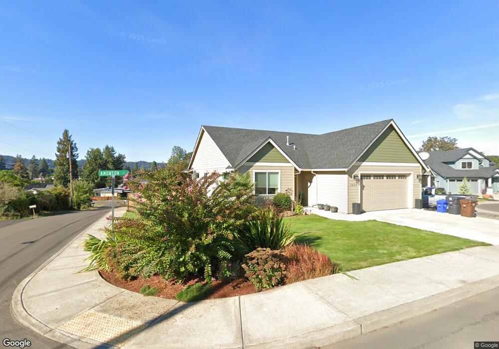
1610 Amonson Ct Gladstone, OR 97027
Estimated Value: $565,121 - $592,000
3
Beds
2
Baths
1,814
Sq Ft
$319/Sq Ft
Est. Value
About This Home
This home is located at 1610 Amonson Ct, Gladstone, OR 97027 and is currently estimated at $579,280, approximately $319 per square foot. 1610 Amonson Ct is a home with nearby schools including John Wetten Elementary School, Walter L Kraxberger Middle School, and Gladstone High School.
Ownership History
Date
Name
Owned For
Owner Type
Purchase Details
Closed on
Jan 15, 2020
Sold by
Blair Carol A and Thompson Robert
Bought by
Thompson Carlie
Current Estimated Value
Home Financials for this Owner
Home Financials are based on the most recent Mortgage that was taken out on this home.
Original Mortgage
$365,000
Outstanding Balance
$134,997
Interest Rate
3.6%
Mortgage Type
Commercial
Estimated Equity
$444,283
Purchase Details
Closed on
Jun 12, 2019
Sold by
Thompson Robert
Bought by
Thompson Robert and Blair Carol A
Purchase Details
Closed on
Aug 19, 2015
Sold by
Baker Kenneth Lee
Bought by
Thompson Robert
Create a Home Valuation Report for This Property
The Home Valuation Report is an in-depth analysis detailing your home's value as well as a comparison with similar homes in the area
Home Values in the Area
Average Home Value in this Area
Purchase History
| Date | Buyer | Sale Price | Title Company |
|---|---|---|---|
| Thompson Carlie | $390,000 | Accommodation | |
| Thompson Robert | -- | None Available | |
| Thompson Robert | $134,420 | Fidelity Natl Title Co Of Or |
Source: Public Records
Mortgage History
| Date | Status | Borrower | Loan Amount |
|---|---|---|---|
| Open | Thompson Carlie | $365,000 |
Source: Public Records
Tax History
| Year | Tax Paid | Tax Assessment Tax Assessment Total Assessment is a certain percentage of the fair market value that is determined by local assessors to be the total taxable value of land and additions on the property. | Land | Improvement |
|---|---|---|---|---|
| 2025 | $6,687 | $331,862 | -- | -- |
| 2024 | $6,501 | $322,197 | -- | -- |
| 2023 | $6,501 | $312,813 | -- | -- |
| 2022 | $6,046 | $303,702 | $0 | $0 |
| 2021 | $5,824 | $294,857 | $0 | $0 |
| 2020 | $5,685 | $286,269 | $0 | $0 |
| 2019 | $5,619 | $277,932 | $0 | $0 |
| 2018 | $5,415 | $269,837 | $0 | $0 |
| 2017 | $1,782 | $88,892 | $0 | $0 |
| 2016 | $1,724 | $86,303 | $0 | $0 |
Source: Public Records
Map
Nearby Homes
- 330 Patricia Dr
- 1460 Cornell Ave
- 575 Collins Crest St
- 18345 Petite Ct
- 18303 Portland Ave
- 119 E Jersey St
- 18320 Chris Ct
- 117 E Jersey St
- 162 Alli Ct
- 115 E Jersey St
- 945 Cornell Ave
- 6830 Glen Echo Ave
- 1065 Columbia Ave
- 810 Yale Ave
- 825 Yale Ave
- 7005 Debbie Ct
- 515 E Hereford St
- 6625 Larissa Ln
- 780 E Kenmore St
- 5905 SE Angel Ln
- 1620 Amonson Ct
- 320 Beverly Ln
- 1630 Amonson Ct
- 370 Beverly Ln
- 325 Beverly Ln
- 345 Beverly Ln
- 0 Relisted Unit 126009
- 1615 Harvard Ave
- 1445 Beverly Dr
- 1640 Amonson Ct
- 315 Beverly Ln
- 1645 Amonson Ct
- 1625 Amonson Ct
- 375 Beverly Ln
- 380 Beverly Ln
- 1635 Harvard Ave
- 1420 Beverly Dr
- 1425 Harvard Ave
- 1635 Amonson Ct
- 1435 Beverly Dr