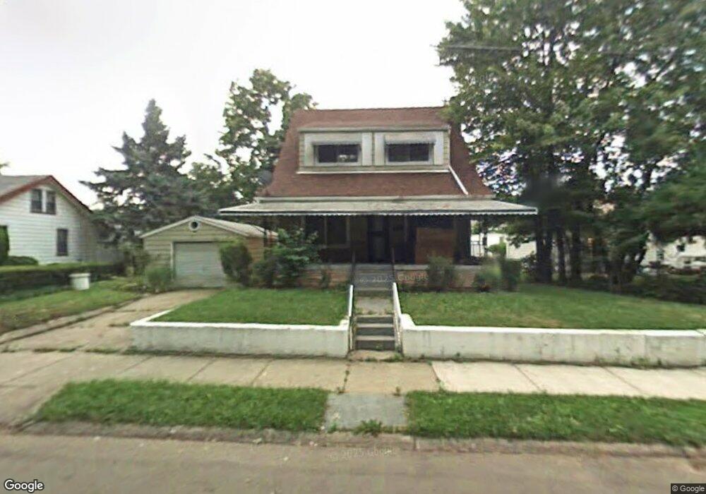
1610 Brookside Dr Flint, MI 48503
Central Park-Fairfield Village NeighborhoodEstimated Value: $95,000 - $115,000
4
Beds
3
Baths
1,638
Sq Ft
$64/Sq Ft
Est. Value
About This Home
This home is located at 1610 Brookside Dr, Flint, MI 48503 and is currently estimated at $104,459, approximately $63 per square foot. 1610 Brookside Dr is a home located in Genesee County with nearby schools including Pierce Elementary School, Flint Southwestern Classical Academy, and Flint Cultural Center Academy.
Ownership History
Date
Name
Owned For
Owner Type
Purchase Details
Closed on
Jun 21, 2024
Sold by
Meier Arthur C
Bought by
Martin Matthew
Current Estimated Value
Purchase Details
Closed on
Jan 29, 2024
Sold by
Meier Arthur C
Bought by
Martin Matthew
Purchase Details
Closed on
Jul 22, 2009
Sold by
Keaton Gail
Bought by
Federal Home Loan Mortgage Corp
Purchase Details
Closed on
May 17, 2006
Sold by
Jackson Alphonso R and Hud
Bought by
Keaton A Gail
Purchase Details
Closed on
Mar 6, 2006
Sold by
Amerihome Mortgage Corp
Bought by
Hud
Purchase Details
Closed on
Jun 23, 2005
Sold by
Powells Dennis and Powells Casaundra A
Bought by
Amerihome Mortgage Corp
Create a Home Valuation Report for This Property
The Home Valuation Report is an in-depth analysis detailing your home's value as well as a comparison with similar homes in the area
Home Values in the Area
Average Home Value in this Area
Purchase History
| Date | Buyer | Sale Price | Title Company |
|---|---|---|---|
| Martin Matthew | $89,999 | None Listed On Document | |
| Martin Matthew | -- | Garrow Title | |
| Federal Home Loan Mortgage Corp | $66,846 | None Available | |
| Keaton A Gail | $13,492 | Wolverton Title Research Co | |
| Hud | -- | Greco Title | |
| Amerihome Mortgage Corp | $46,996 | -- |
Source: Public Records
Tax History
| Year | Tax Paid | Tax Assessment Tax Assessment Total Assessment is a certain percentage of the fair market value that is determined by local assessors to be the total taxable value of land and additions on the property. | Land | Improvement |
|---|---|---|---|---|
| 2025 | $750 | $35,100 | $0 | $0 |
| 2024 | $687 | $25,300 | $0 | $0 |
| 2023 | $838 | $20,100 | $0 | $0 |
| 2022 | $0 | $17,000 | $0 | $0 |
| 2021 | $846 | $13,400 | $0 | $0 |
| 2020 | $784 | $13,000 | $0 | $0 |
| 2019 | $771 | $12,200 | $0 | $0 |
| 2018 | $749 | $13,000 | $0 | $0 |
| 2017 | $731 | $0 | $0 | $0 |
| 2016 | $1,137 | $0 | $0 | $0 |
| 2015 | -- | $0 | $0 | $0 |
| 2014 | -- | $0 | $0 | $0 |
| 2012 | -- | $18,200 | $0 | $0 |
Source: Public Records
Map
Nearby Homes
- 1701 Park St
- 915 E 8th St
- 1720 Park St
- 1210 Blanchard Ave
- 1510 S Franklin Ave
- 2010 Crocker Ave
- 420 Pingree Ave
- 915 E Court #206 St Unit 206
- 915 E Court St
- 2050 Ferris Ave
- 2029 Winans Ave
- 1851 Seymour Ave
- 710 Pierson St
- 2013 E Court St
- 410 E 4th St
- A Avenue
- 621 Pierson St
- 2224 Crocker Ave
- 314 E 4th St
- 2033 Seymour Ave
- 1616 Brookside Dr
- 1626 Brookside Dr
- 912 Kennelworth Ave
- 916 Kennelworth Ave
- 908 Kennelworth Ave
- 1611 Avon St
- 1710 Woodlawn Park Dr
- 920 Kennelworth Ave
- 904 Kennelworth Ave
- 900 Kennelworth Ave
- 921 Kennelworth Ave
- 1626 Avon St
- 1614 Woodlawn Park Dr
- 826 Kennelworth Ave
- 913 Kennelworth Ave
- 905 Kennelworth Ave
- 909 Kennelworth Ave
- 1659 Woodlawn Park Dr
- 901 Kennelworth Ave
- 1651 Woodlawn Park Dr
Your Personal Tour Guide
Ask me questions while you tour the home.