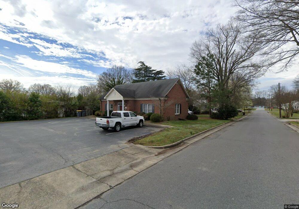
1610 Dale Earnhardt Blvd Kannapolis, NC 28083
Estimated Value: $450,779
--
Bed
1
Bath
1,384
Sq Ft
$326/Sq Ft
Est. Value
About This Home
This home is located at 1610 Dale Earnhardt Blvd, Kannapolis, NC 28083 and is currently priced at $450,779, approximately $325 per square foot. 1610 Dale Earnhardt Blvd is a home located in Cabarrus County with nearby schools including Forest Park Elementary School, Kannapolis Middle, and A.L. Brown High School.
Ownership History
Date
Name
Owned For
Owner Type
Purchase Details
Closed on
Apr 23, 2004
Sold by
Hollowell Charles J and Shofi Hollowell Sylvia A
Bought by
Philips John B and Philips Tina F
Current Estimated Value
Home Financials for this Owner
Home Financials are based on the most recent Mortgage that was taken out on this home.
Original Mortgage
$160,000
Outstanding Balance
$73,662
Interest Rate
5.35%
Mortgage Type
Commercial
Purchase Details
Closed on
Dec 4, 1998
Sold by
Query Robert L and Query Cindy T
Bought by
Hollowell Charles J and Shofi Hollowell Sylvia A
Home Financials for this Owner
Home Financials are based on the most recent Mortgage that was taken out on this home.
Original Mortgage
$108,000
Interest Rate
6.77%
Mortgage Type
Commercial
Purchase Details
Closed on
May 1, 1992
Create a Home Valuation Report for This Property
The Home Valuation Report is an in-depth analysis detailing your home's value as well as a comparison with similar homes in the area
Home Values in the Area
Average Home Value in this Area
Purchase History
| Date | Buyer | Sale Price | Title Company |
|---|---|---|---|
| Philips John B | $180,000 | -- | |
| Hollowell Charles J | $135,000 | -- | |
| -- | $25,200 | -- |
Source: Public Records
Mortgage History
| Date | Status | Borrower | Loan Amount |
|---|---|---|---|
| Open | Philips John B | $160,000 | |
| Previous Owner | Hollowell Charles J | $108,000 |
Source: Public Records
Tax History Compared to Growth
Tax History
| Year | Tax Paid | Tax Assessment Tax Assessment Total Assessment is a certain percentage of the fair market value that is determined by local assessors to be the total taxable value of land and additions on the property. | Land | Improvement |
|---|---|---|---|---|
| 2025 | $3,085 | $271,650 | $82,500 | $189,150 |
| 2024 | $3,085 | $271,650 | $82,500 | $189,150 |
| 2023 | $3,302 | $241,010 | $66,000 | $175,010 |
| 2022 | $3,302 | $241,010 | $66,000 | $175,010 |
| 2021 | $3,302 | $241,010 | $66,000 | $175,010 |
| 2020 | $3,302 | $241,010 | $66,000 | $175,010 |
| 2019 | $2,956 | $215,740 | $53,630 | $162,110 |
| 2018 | $2,912 | $215,740 | $53,630 | $162,110 |
| 2017 | $2,869 | $215,740 | $53,630 | $162,110 |
| 2016 | -- | $196,830 | $53,630 | $143,200 |
| 2015 | $2,480 | $196,830 | $53,630 | $143,200 |
| 2014 | $2,480 | $196,830 | $53,630 | $143,200 |
Source: Public Records
Map
Nearby Homes
- 608 Fairview St
- 1008 Packard Ave
- 615 Fairview St
- 617 Fairview St
- 613 Hillside St
- 500 Plymouth St
- 803 Irene Ave
- 506 Ford St
- 505 Rogers Lake Rd E
- 910 Fairview St
- 402 Ford St
- 621 Norland Ave
- 803 Desoto Ave
- 209 James St
- 1050 Mclain Rd
- 1052 Mclain Rd
- 704 Gem St Unit 17
- 1004 S Ridge Ave
- 1022 Lakeview St
- 704 S Harding Ave
- 1620 Dale Earnhardt Blvd
- 604 Charles St
- 1630 Dale Earnhardt Blvd
- 607 Peach St
- 1587 Dale Earnhardt Blvd
- 1644 Dale Earnhardt Blvd
- 1640 Dale Earnhardt Blvd
- 603 Charles St
- 602 Charles St
- 605 Peach St
- 1583 Dale Earnhardt Blvd
- 603 Peach St
- 1579 Dale Earnhardt Blvd
- 600 Charles St
- 601 Charles St
- 1575 Earnhardt Rd
- 1660 Dale Earnhardt Blvd
- 703 Chapel St
- 1575 Dale Earnhardt Blvd
- 601 Peach St