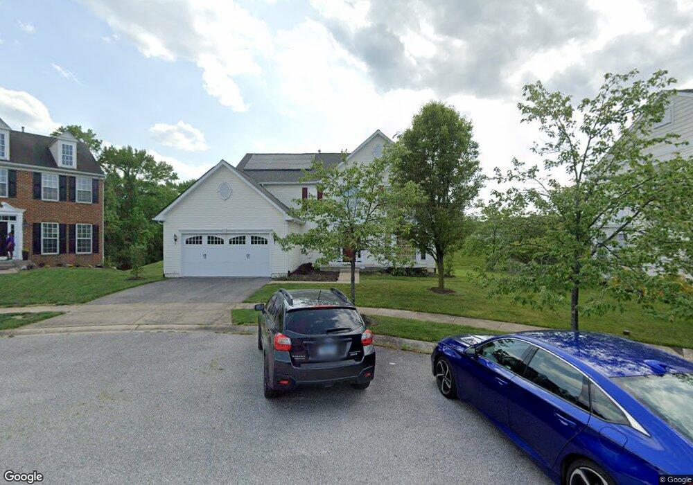
1610 Durham Way Hanover, MD 21076
Estimated Value: $728,070 - $826,000
--
Bed
4
Baths
3,162
Sq Ft
$247/Sq Ft
Est. Value
About This Home
This home is located at 1610 Durham Way, Hanover, MD 21076 and is currently estimated at $779,768, approximately $246 per square foot. 1610 Durham Way is a home located in Anne Arundel County with nearby schools including Hebron-Harman Elementary School, MacArthur Middle School, and Meade High School.
Ownership History
Date
Name
Owned For
Owner Type
Purchase Details
Closed on
Sep 13, 2016
Bought by
Burall Kyle
Current Estimated Value
Home Financials for this Owner
Home Financials are based on the most recent Mortgage that was taken out on this home.
Original Mortgage
$475,200
Outstanding Balance
$379,693
Interest Rate
3.44%
Estimated Equity
$400,075
Purchase Details
Closed on
Feb 27, 2008
Sold by
Cc&Dorchester Llc
Bought by
Burall Kyle B and Burall Laurel S
Home Financials for this Owner
Home Financials are based on the most recent Mortgage that was taken out on this home.
Original Mortgage
$126,600
Interest Rate
6.2%
Mortgage Type
Purchase Money Mortgage
Purchase Details
Closed on
Jan 25, 2008
Sold by
Cc&Dorchester Llc
Bought by
Burall Kyle B and Burall Laurel S
Home Financials for this Owner
Home Financials are based on the most recent Mortgage that was taken out on this home.
Original Mortgage
$126,600
Interest Rate
6.2%
Mortgage Type
Purchase Money Mortgage
Create a Home Valuation Report for This Property
The Home Valuation Report is an in-depth analysis detailing your home's value as well as a comparison with similar homes in the area
Home Values in the Area
Average Home Value in this Area
Purchase History
| Date | Buyer | Sale Price | Title Company |
|---|---|---|---|
| Burall Kyle | -- | -- | |
| Burall Kyle B | $605,260 | -- | |
| Burall Kyle B | $605,260 | -- |
Source: Public Records
Mortgage History
| Date | Status | Borrower | Loan Amount |
|---|---|---|---|
| Open | Burall Kyle | $475,200 | |
| Closed | Burall Kyle | -- | |
| Previous Owner | Burall Kyle B | $126,600 | |
| Previous Owner | Burall Kyle B | $417,000 | |
| Previous Owner | Burall Kyle B | $417,000 |
Source: Public Records
Tax History Compared to Growth
Tax History
| Year | Tax Paid | Tax Assessment Tax Assessment Total Assessment is a certain percentage of the fair market value that is determined by local assessors to be the total taxable value of land and additions on the property. | Land | Improvement |
|---|---|---|---|---|
| 2025 | $8,187 | $616,600 | $120,700 | $495,900 |
| 2024 | $8,187 | $583,267 | $0 | $0 |
| 2023 | $8,097 | $549,933 | $0 | $0 |
| 2022 | $5,398 | $516,600 | $125,700 | $390,900 |
| 2021 | $15,080 | $499,267 | $0 | $0 |
| 2020 | $7,290 | $481,933 | $0 | $0 |
| 2019 | $14,088 | $464,600 | $104,100 | $360,500 |
| 2018 | $4,711 | $464,600 | $104,100 | $360,500 |
| 2017 | $5,886 | $464,600 | $0 | $0 |
| 2016 | -- | $475,200 | $0 | $0 |
| 2015 | -- | $469,067 | $0 | $0 |
| 2014 | -- | $462,933 | $0 | $0 |
Source: Public Records
Map
Nearby Homes
- 1712 Sunningdale Ln
- 1750 Theale Way
- 7591 Taunton Ct
- 1761 Winsford Ct
- 1544 Rutland Way
- 7296 Dorchester Woods Ln
- 7147 Wedmore Ct
- 7266 Dorchester Woods Ln
- 7490 Race Rd
- 7719 Rotherham Dr
- 7777 Rotherham Dr
- 2114 Split Creek Ln
- 7310 Wisteria Point Dr
- 1387 Hawthorn Dr
- 7151 Wright Rd
- 7143 Wright Rd
- Parcel 325 Wright Rd
- Parcel 271 Wright Rd
- Parcel 265 Wright Rd
- 7111 River Birch Dr
- 1612 Durham Way
- 1608 Durham Way
- 1606 Durham Way
- 1604 Durham Way
- 1602 Durham Way
- 1607 Durham Way
- 1600 Durham Way
- 1613 Durham Way
- 1611 Durham Way
- 1609 Durham Way
- 1603 Durham Way
- 1601 Durham Way
- 7501 Langport Ct
- 1728 Theale Way
- 7505 Langport Ct
- 7507 Langport Ct
- 7551 Dorchester Blvd
- 1702 Sunningdale Ln
- 1730 Theale Way
- 1725 Theale Way