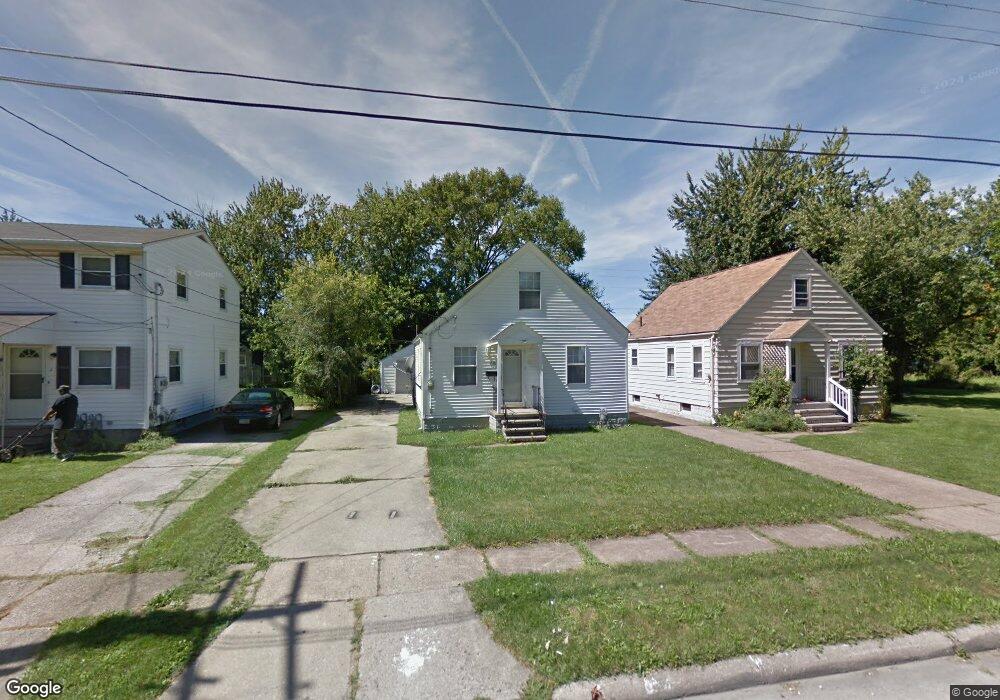
1610 Maine Ave Lorain, OH 44052
Estimated Value: $112,950 - $143,000
3
Beds
1
Bath
1,066
Sq Ft
$121/Sq Ft
Est. Value
About This Home
This home is located at 1610 Maine Ave, Lorain, OH 44052 and is currently estimated at $128,988, approximately $121 per square foot. 1610 Maine Ave is a home located in Lorain County with nearby schools including Larkmoor Elementary School, Longfellow Middle School, and Lorain High School.
Ownership History
Date
Name
Owned For
Owner Type
Purchase Details
Closed on
Apr 21, 2022
Sold by
Raymond C Ditro Trust and Angela S Dutro Trust
Bought by
Sfr3 070 Llc
Current Estimated Value
Purchase Details
Closed on
Jan 7, 2004
Sold by
Hud
Bought by
Dutro Raymond C and Dutro Angela S
Purchase Details
Closed on
Mar 24, 2003
Sold by
Brown Robert L
Bought by
Hud
Purchase Details
Closed on
Mar 24, 1998
Sold by
Ross Anthony Harold
Bought by
Brown Robert L and Brown Lorena
Home Financials for this Owner
Home Financials are based on the most recent Mortgage that was taken out on this home.
Original Mortgage
$74,900
Interest Rate
7.15%
Mortgage Type
FHA
Create a Home Valuation Report for This Property
The Home Valuation Report is an in-depth analysis detailing your home's value as well as a comparison with similar homes in the area
Home Values in the Area
Average Home Value in this Area
Purchase History
| Date | Buyer | Sale Price | Title Company |
|---|---|---|---|
| Sfr3 070 Llc | -- | Petropouleas Jim | |
| Dutro Raymond C | $39,656 | Lakeside Title & Escrow Agen | |
| Hud | $40,000 | -- | |
| Brown Robert L | $75,000 | Midland Title |
Source: Public Records
Mortgage History
| Date | Status | Borrower | Loan Amount |
|---|---|---|---|
| Previous Owner | Brown Robert L | $74,900 |
Source: Public Records
Tax History
| Year | Tax Paid | Tax Assessment Tax Assessment Total Assessment is a certain percentage of the fair market value that is determined by local assessors to be the total taxable value of land and additions on the property. | Land | Improvement |
|---|---|---|---|---|
| 2024 | $1,351 | $31,966 | $2,048 | $29,918 |
| 2023 | $1,048 | $19,845 | $3,654 | $16,191 |
| 2022 | $1,039 | $19,845 | $3,654 | $16,191 |
| 2021 | $1,039 | $19,845 | $3,654 | $16,191 |
| 2020 | $993 | $16,460 | $3,030 | $13,430 |
| 2019 | $987 | $16,460 | $3,030 | $13,430 |
| 2018 | $1,065 | $16,460 | $3,030 | $13,430 |
| 2017 | $1,142 | $17,950 | $4,110 | $13,840 |
| 2016 | $1,133 | $17,950 | $4,110 | $13,840 |
| 2015 | $1,071 | $17,950 | $4,110 | $13,840 |
| 2014 | $1,017 | $17,090 | $3,910 | $13,180 |
| 2013 | $1,009 | $17,090 | $3,910 | $13,180 |
Source: Public Records
Map
Nearby Homes
- 1397 Colorado Ave
- 1528 Maine Ave
- 1545 Fillmore Ave
- V/L Maryland Ave
- 1122 F St
- 2149 Hancock St
- 2201 Eastlawn St
- 2235 Crehore St
- 811 F St
- 326 Indiana Ave
- 2240 Jackson St
- 317 Illinois Ave
- 303 Indiana Ave
- 465 California Ave
- 2456 Jackson St
- 906 E Erie Ave
- 289 W Marina Pkwy
- 0 Eastlawn St Unit 5106705
- 339 Colorado Ave
- 1622 New Jersey Ave
- 1612 Maine Ave
- 1606 Maine Ave
- 1607 Lehigh Ave
- 1615 Lehigh Ave
- 1620 Maine Ave
- 1619 Lehigh Ave
- 1609 Maine Ave
- 1607 Maine Ave
- 1626 Maine Ave
- 1615 Maine Ave
- 1605 Maine Ave
- 1619 Maine Ave
- 1601 Maine Ave
- 1548 Maine Ave
- 1549 Lehigh Ave
- 1608 Maryland Ave
- 1612 Maryland Ave
- 1551 Maine Ave
- 1618 Maryland Ave
- 1608 Lehigh Ave
Your Personal Tour Guide
Ask me questions while you tour the home.