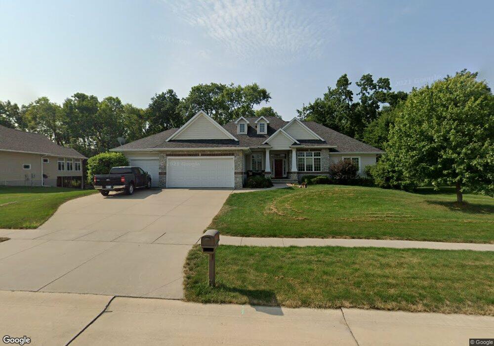
1610 Maple St Robins, IA 52328
Estimated Value: $630,843 - $680,000
About This Home
This home is located at 1610 Maple St, Robins, IA 52328 and is currently estimated at $658,961, approximately $279 per square foot. 1610 Maple St is a home located in Linn County with nearby schools including Nixon Elementary School, Harding Middle School, and John F. Kennedy High School.
Ownership History
We collect this data history from publicly available records. To have your information removed, we recommend requesting removal directly through your county’s website.
Purchase Details
Home Financials for this Owner
Home Financials are based on the most recent Mortgage that was taken out on this home.Purchase Details
Home Financials for this Owner
Home Financials are based on the most recent Mortgage that was taken out on this home.Purchase Details
Home Values in the Area
Average Home Value in this Area
Purchase History
We collect this data history from publicly available records. To have your information removed, we recommend requesting removal directly through your county’s website.
| Date | Buyer | Sale Price | Title Company |
|---|---|---|---|
| $490,000 | None Available | ||
| $510,000 | None Available | ||
| $67,500 | None Available |
Mortgage History
We collect this data history from publicly available records. To have your information removed, we recommend requesting removal directly through your county’s website.
| Date | Status | Borrower | Loan Amount |
|---|---|---|---|
| Open | $98,000 | ||
| Previous Owner | $408,386 |
Tax History
We collect this data history from publicly available records. To have your information removed, we recommend requesting removal directly through your county’s website.
| Year | Tax Paid | Tax Assessment Tax Assessment Total Assessment is a certain percentage of the fair market value that is determined by local assessors to be the total taxable value of land and additions on the property. | Land | Improvement |
|---|---|---|---|---|
| 2025 | $7,916 | $591,800 | $98,800 | $493,000 |
| 2024 | $6,864 | $605,600 | $98,800 | $506,800 |
| 2023 | $6,864 | $605,600 | $98,800 | $506,800 |
| 2022 | $7,306 | $462,600 | $98,800 | $363,800 |
| 2021 | $8,574 | $462,600 | $98,800 | $363,800 |
| 2020 | $8,574 | $502,000 | $98,800 | $403,200 |
| 2019 | $8,186 | $488,400 | $98,800 | $389,600 |
| 2018 | $8,050 | $488,400 | $98,800 | $389,600 |
| 2017 | $8,362 | $490,200 | $98,800 | $391,400 |
| 2016 | $8,436 | $490,200 | $98,800 | $391,400 |
| 2015 | $8,460 | $490,200 | $98,800 | $391,400 |
| 2014 | $8,460 | $490,200 | $98,800 | $391,400 |
| 2013 | $8,276 | $490,200 | $98,800 | $391,400 |
Map
- 435 Phaeton Dr
- 1105 Maple St
- 1145 Vogt Rd
- 9014 Grand Oaks Dr NE
- 8932 Norway Dr NE
- 70.78 Acres M L Quass Rd
- 425 Northhaven Dr
- 718 Palmyra Dr NE
- 8506 Federalist Rd
- 39.69 Acres M L Center Point Rd
- 8.98 Acres M L N Center Point Rd
- 28.72 Acres N Center Point Rd
- 8714 Yeager Ln NE
- 420 Dutch Dr
- 495 Dutch Dr
- 395 S Troy Rd
- 425 Dutch Dr
- 325 Dutch Dr
- 305 Dutch Dr
- 923 Messina Dr NE
- 470 Brougham Rd
- 480 Brougham Rd
- 460 Brougham Rd
- 1590 Maple St
- 490 Brougham Rd
- 445 Brougham Rd
- 450 Brougham Rd
- 1650 Maple St
- 1570 Maple St
- 500 Brougham Rd
- 440 Brougham Rd
- 495 Brougham Rd
- 440 Sycamore Ct
- 435 Brougham Rd
- 1670 Maple St
- 505 Brougham Rd
- 430 Brougham Rd
- 510 Brougham Rd
- 445 Sycamore Ct
- 1550 Maple St
Ask me questions while you tour the home.