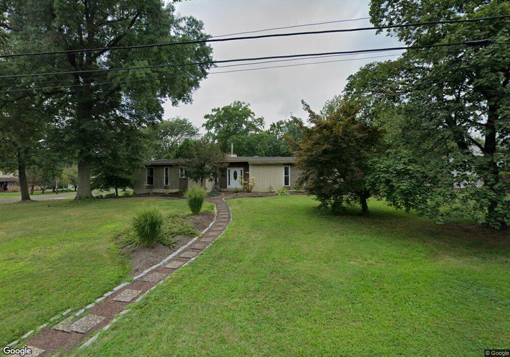
1610 Quarry Rd Lansdale, PA 19446
Estimated Value: $575,005 - $595,000
3
Beds
2
Baths
2,175
Sq Ft
$270/Sq Ft
Est. Value
About This Home
This home is located at 1610 Quarry Rd, Lansdale, PA 19446 and is currently estimated at $586,251, approximately $269 per square foot. 1610 Quarry Rd is a home located in Montgomery County with nearby schools including Walton Farm El School, Pennfield Middle School, and North Penn Senior High School.
Ownership History
Date
Name
Owned For
Owner Type
Purchase Details
Closed on
Jan 31, 2011
Sold by
Amin Ketan and Mcandrews Denise
Bought by
Dressler Jesse F and Dressler Jennifer
Current Estimated Value
Home Financials for this Owner
Home Financials are based on the most recent Mortgage that was taken out on this home.
Original Mortgage
$150,000
Outstanding Balance
$103,127
Interest Rate
4.88%
Estimated Equity
$483,124
Create a Home Valuation Report for This Property
The Home Valuation Report is an in-depth analysis detailing your home's value as well as a comparison with similar homes in the area
Home Values in the Area
Average Home Value in this Area
Purchase History
| Date | Buyer | Sale Price | Title Company |
|---|---|---|---|
| Dressler Jesse F | $300,000 | None Available |
Source: Public Records
Mortgage History
| Date | Status | Borrower | Loan Amount |
|---|---|---|---|
| Open | Dressler Jesse F | $150,000 |
Source: Public Records
Tax History Compared to Growth
Tax History
| Year | Tax Paid | Tax Assessment Tax Assessment Total Assessment is a certain percentage of the fair market value that is determined by local assessors to be the total taxable value of land and additions on the property. | Land | Improvement |
|---|---|---|---|---|
| 2025 | $7,847 | $193,730 | $58,720 | $135,010 |
| 2024 | $7,847 | $193,730 | $58,720 | $135,010 |
| 2023 | $7,515 | $193,730 | $58,720 | $135,010 |
| 2022 | $7,053 | $193,730 | $58,720 | $135,010 |
| 2021 | $6,849 | $193,730 | $58,720 | $135,010 |
| 2020 | $6,539 | $193,730 | $58,720 | $135,010 |
| 2019 | $6,425 | $193,730 | $58,720 | $135,010 |
| 2018 | $1,312 | $193,730 | $58,720 | $135,010 |
| 2017 | $6,170 | $193,730 | $58,720 | $135,010 |
| 2016 | $6,094 | $193,730 | $58,720 | $135,010 |
| 2015 | $5,840 | $193,730 | $58,720 | $135,010 |
| 2014 | $5,840 | $193,730 | $58,720 | $135,010 |
Source: Public Records
Map
Nearby Homes
- 907A Stockton Ct
- 502 Clarella Ct
- 1207B Crosshill Ct
- 113 Clemens Ct
- 114 Clemens Ct
- 1511 Susan Dr
- 25 Chestnut Ct E
- 2 Newbury Way
- 11 Elder Ct
- 1512 Tennis Cir
- 405 Militia Dr
- 413 Militia Dr
- 109 Durham Ct
- 103 Newport Ct
- 2007 Pleasant Valley Dr
- 111 Newport Ct
- 633 Conestoga Ln
- 102 Ridgewood Way
- 1131 Walnut Ln
- 705 Continental Dr
- 1150 Reiff Rd
- 1170 Reiff Rd
- 1155 Reiff Rd
- 1630 Quarry Rd
- 1590 Quarry Rd
- 1165 Reiff Rd
- 713 Springhouse Ct
- 714 Springhouse Ct
- 712 Springhouse Ct
- 711 Springhouse Ct
- 710 Springhouse Ct
- 1640 Quarry Rd
- 1190 Reiff Rd
- 909 Stockton Ct Unit A
- 909 Stockton Ct Unit B
- 910A Stockton Ct
- 909B Stockton Ct Unit B
- 909B Stockton Ct
- 911A Stockton Ct
- 708 Springhouse Ct