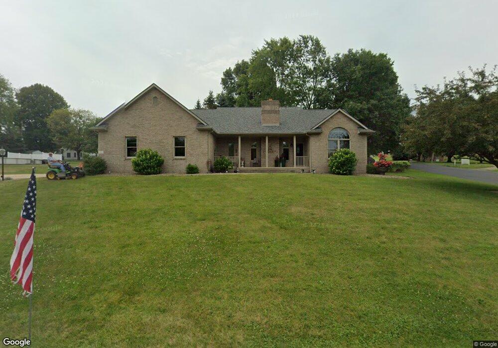
1610 Yoder St Louisville, OH 44641
Estimated Value: $332,000 - $375,000
3
Beds
3
Baths
2,060
Sq Ft
$168/Sq Ft
Est. Value
About This Home
This home is located at 1610 Yoder St, Louisville, OH 44641 and is currently estimated at $346,799, approximately $168 per square foot. 1610 Yoder St is a home located in Stark County with nearby schools including Louisville High School and St. Thomas Aquinas High School & Middle School.
Ownership History
Date
Name
Owned For
Owner Type
Purchase Details
Closed on
Apr 16, 1998
Sold by
Bast Christopher J
Bought by
Miller Donald C and Miller Ann E
Current Estimated Value
Create a Home Valuation Report for This Property
The Home Valuation Report is an in-depth analysis detailing your home's value as well as a comparison with similar homes in the area
Home Values in the Area
Average Home Value in this Area
Purchase History
| Date | Buyer | Sale Price | Title Company |
|---|---|---|---|
| Miller Donald C | $15,000 | -- |
Source: Public Records
Tax History Compared to Growth
Tax History
| Year | Tax Paid | Tax Assessment Tax Assessment Total Assessment is a certain percentage of the fair market value that is determined by local assessors to be the total taxable value of land and additions on the property. | Land | Improvement |
|---|---|---|---|---|
| 2025 | -- | $122,680 | $24,570 | $98,110 |
| 2024 | -- | $122,680 | $24,570 | $98,110 |
| 2023 | $3,555 | $91,920 | $18,590 | $73,330 |
| 2022 | $3,580 | $91,920 | $18,590 | $73,330 |
| 2021 | $3,590 | $91,920 | $18,590 | $73,330 |
| 2020 | $2,834 | $80,050 | $16,730 | $63,320 |
| 2019 | $2,839 | $66,750 | $3,430 | $63,320 |
| 2018 | $2,307 | $66,750 | $3,430 | $63,320 |
| 2017 | $2,163 | $61,220 | $2,770 | $58,450 |
| 2016 | $2,207 | $61,220 | $2,770 | $58,450 |
| 2015 | $2,214 | $61,220 | $2,770 | $58,450 |
| 2014 | $186 | $56,920 | $2,560 | $54,360 |
| 2013 | $1,097 | $56,920 | $2,560 | $54,360 |
Source: Public Records
Map
Nearby Homes
- 0 Michigan Blvd
- 2015 E Main St
- 1170 Winding Ridge Ave
- 910 Crosswyck Cir
- 308 Superior St
- 1812 E Broad St
- 1715 High St
- 325 Lincoln Ave
- 641 S Nickelplate St
- 520 S Silver St
- 728 E Broad St
- 316 E Reno Dr
- 428 Honeycrisp Dr NE
- 3047 Mcintosh Dr NE
- 432 Honeycrisp Dr NE
- 2962 Mcintosh Dr NE
- 2963 Mcintosh Dr NE
- 430 Honeycrisp Dr NE
- 2957 Mcintosh Dr NE
- 204 E Broad St
- 940 N Marion Ave
- 1603 Airpark Dr
- 1617 Airpark Dr
- 901 N Marion Ave
- 1625 Airpark Dr
- 1633 Airpark Dr
- 1640 Yoder St
- 1705 Airpark Dr
- 701 N Marion Ave
- 600 N Marion Ave
- 1630 Airpark Dr
- 1713 Airpark Dr
- 650 Weeburn Way
- 1704 Airpark Dr
- 651 Weeburn Way
- 500 N Marion Ave
- 1723 Airpark Dr
- 402 N Marion Ave
- 644 Weeburn Way
- 645 Weeburn Way