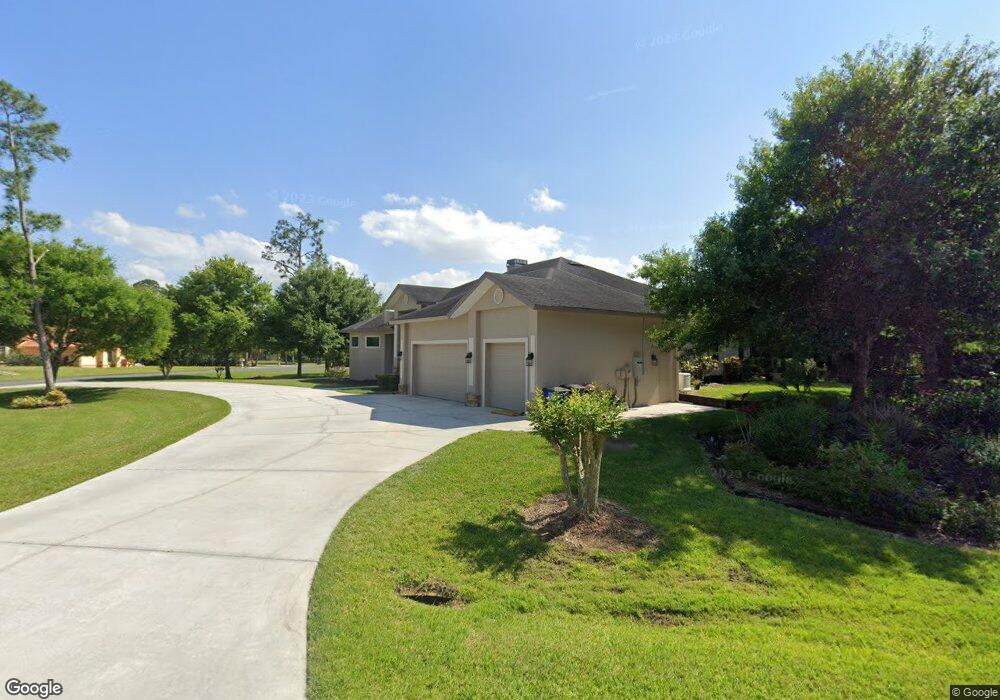
16101 Flagg Pond Ln North Fort Myers, FL 33917
Estimated Value: $508,000 - $622,877
4
Beds
2
Baths
4,333
Sq Ft
$134/Sq Ft
Est. Value
About This Home
This home is located at 16101 Flagg Pond Ln, North Fort Myers, FL 33917 and is currently estimated at $580,719, approximately $134 per square foot. 16101 Flagg Pond Ln is a home located in Lee County with nearby schools including Bayshore Elementary School, Orange River Elementary School, and Tice Elementary School.
Ownership History
Date
Name
Owned For
Owner Type
Purchase Details
Closed on
Nov 18, 2014
Sold by
Plunkett Donald E and Plunkett Denise
Bought by
The Donald E Plunkett Jr Living Trust
Current Estimated Value
Purchase Details
Closed on
May 21, 2002
Sold by
Mcintyre R Hart and Mcintyre Anna Kathleen
Bought by
Plunkett Donald E and Plunkett Denise
Purchase Details
Closed on
Sep 10, 1997
Sold by
Mcintyre R Hart
Bought by
Mcintyre R Hart
Purchase Details
Closed on
May 22, 1997
Sold by
Mcintyre R Hart
Bought by
Mcintyre R Hart
Create a Home Valuation Report for This Property
The Home Valuation Report is an in-depth analysis detailing your home's value as well as a comparison with similar homes in the area
Home Values in the Area
Average Home Value in this Area
Purchase History
| Date | Buyer | Sale Price | Title Company |
|---|---|---|---|
| The Donald E Plunkett Jr Living Trust | -- | Attorney | |
| Plunkett Donald E | $40,000 | -- | |
| Mcintyre R Hart | -- | -- | |
| Mcintyre R Hart | -- | -- |
Source: Public Records
Tax History Compared to Growth
Tax History
| Year | Tax Paid | Tax Assessment Tax Assessment Total Assessment is a certain percentage of the fair market value that is determined by local assessors to be the total taxable value of land and additions on the property. | Land | Improvement |
|---|---|---|---|---|
| 2025 | $4,111 | $296,119 | -- | -- |
| 2024 | $3,999 | $287,774 | -- | -- |
| 2023 | $3,999 | $279,392 | $0 | $0 |
| 2022 | $4,075 | $271,254 | $0 | $0 |
| 2021 | $3,971 | $399,914 | $58,497 | $341,417 |
| 2020 | $3,989 | $259,717 | $0 | $0 |
| 2019 | $3,940 | $253,878 | $0 | $0 |
| 2018 | $3,930 | $249,144 | $0 | $0 |
| 2017 | $3,939 | $244,020 | $0 | $0 |
| 2016 | $3,668 | $296,662 | $22,367 | $274,295 |
| 2015 | $3,708 | $278,701 | $22,367 | $256,334 |
| 2014 | $3,684 | $272,504 | $20,818 | $251,686 |
| 2013 | -- | $247,405 | $19,958 | $227,447 |
Source: Public Records
Map
Nearby Homes
- 7831 Deni Dr
- 7821 Deni Dr
- 16880 Church Dr
- 16890 Church Dr
- 59 Jim Bowie St
- 61 Sam Houston Dr
- 66 Sam Houston Dr
- 16571 Marc Allen Dr
- 1753 Club House Rd
- 17200 S Pioneer St Unit G-13
- 17200 S Pioneer St Unit E4-10
- 17200 S Pioneer St Unit RV-66
- 38 S Pioneer St
- 7974 Samville Rd Unit E5-24
- 2475 Bridge Rd
- 1712 Club House Rd
- 32 S Pioneer St
- 2466 N Westwood Dr
- 8411 Wagon Wheel Cir
- 7970 Samville Rd
- 7980 Deni Dr
- 16105 Flagg Pond Ln
- 16102 Flagg Pond Ln
- 7961 Deni Dr
- 7971 Deni Dr
- 16106 Flagg Pond Ln
- 7951 Deni Dr
- 7981 Deni Dr
- 7991 Deni Dr
- 16110 Flagg Pond Ln
- 7990 Deni Dr
- 16113 Flagg Pond Ln
- 7941 Deni Dr
- 7900 Deni Dr
- 7890 Deni Dr
- 16114 Flagg Pond Ln
- 7880 Deni Dr
- 7931 Deni Dr
- 7870 Deni Dr
- 16115 Flagg Pond Ln