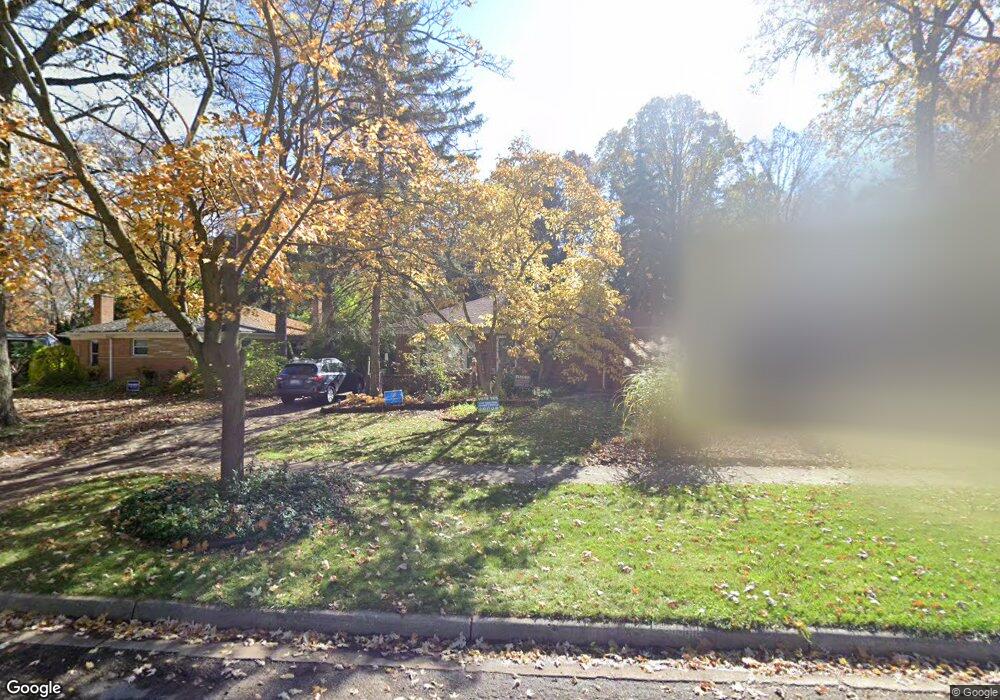
16107 Birwood Ave Beverly Hills, MI 48025
Estimated Value: $438,000 - $482,000
3
Beds
2
Baths
1,439
Sq Ft
$314/Sq Ft
Est. Value
About This Home
This home is located at 16107 Birwood Ave, Beverly Hills, MI 48025 and is currently estimated at $452,054, approximately $314 per square foot. 16107 Birwood Ave is a home located in Oakland County with nearby schools including Wylie E. Groves High School, Greenfield Elementary School, and Berkshire Middle School.
Ownership History
Date
Name
Owned For
Owner Type
Purchase Details
Closed on
Sep 5, 2025
Sold by
Biggs Laura Ann and Biggs Sean
Bought by
Biggs Sean and Ebbeling Laura White
Current Estimated Value
Purchase Details
Closed on
Apr 3, 2000
Sold by
Darge Carl A
Bought by
Biggs Sean
Home Financials for this Owner
Home Financials are based on the most recent Mortgage that was taken out on this home.
Original Mortgage
$150,550
Interest Rate
8.24%
Create a Home Valuation Report for This Property
The Home Valuation Report is an in-depth analysis detailing your home's value as well as a comparison with similar homes in the area
Home Values in the Area
Average Home Value in this Area
Purchase History
| Date | Buyer | Sale Price | Title Company |
|---|---|---|---|
| Biggs Sean | -- | None Listed On Document | |
| Biggs Sean | $188,200 | -- |
Source: Public Records
Mortgage History
| Date | Status | Borrower | Loan Amount |
|---|---|---|---|
| Previous Owner | Biggs Sean | $150,550 |
Source: Public Records
Tax History Compared to Growth
Tax History
| Year | Tax Paid | Tax Assessment Tax Assessment Total Assessment is a certain percentage of the fair market value that is determined by local assessors to be the total taxable value of land and additions on the property. | Land | Improvement |
|---|---|---|---|---|
| 2024 | $4,023 | $180,050 | $0 | $0 |
| 2023 | $3,860 | $166,830 | $0 | $0 |
| 2022 | $4,187 | $158,430 | $0 | $0 |
| 2021 | $4,221 | $151,130 | $0 | $0 |
| 2020 | $3,536 | $146,050 | $0 | $0 |
| 2019 | $2,794 | $139,700 | $0 | $0 |
| 2018 | $4,074 | $131,760 | $0 | $0 |
| 2017 | $4,052 | $131,760 | $0 | $0 |
| 2016 | $4,063 | $122,510 | $0 | $0 |
| 2015 | -- | $117,330 | $0 | $0 |
| 2014 | -- | $104,030 | $0 | $0 |
| 2011 | -- | $89,640 | $0 | $0 |
Source: Public Records
Map
Nearby Homes
- 16217 Birwood Ave
- 1886 Henrietta St
- 32463 Sheridan Dr
- 32210 Sheridan Dr
- 1828 Henrietta St
- 986 Smith Ave
- 870 Davis Ave
- 410 Catalpa Dr
- 350 Catalpa Dr
- 1109 Bird Ave
- 16927 Beverly Rd
- 1859 Stanley Blvd
- 1748 Stanley Blvd
- 1268 Davis Ave
- 17455 Kinross Ave
- 1451 E 14 Mile Rd
- 1723 Birmingham Blvd
- 4218 Normandy Rd
- 31607 Auburn Dr
- 1323 Bennaville Ave
- 16089 Birwood Ave
- 16100 Buckingham Ave
- 16151 Birwood Ave
- 16079 Birwood Ave
- 16116 Buckingham Ave
- 16225 Birwood Ave
- 16106 Birwood Ave
- 16080 Buckingham Ave
- 16086 Birwood Ave
- 16059 Birwood Ave
- 16212 Birwood Ave
- 16060 Buckingham Ave
- 16078 Birwood Ave
- 16212 Buckingham Ave
- 16220 Birwood Ave
- 16049 Birwood Ave
- 16241 Birwood Ave
- 16228 Birwood Ave
- 16058 Birwood Ave
- 16228 Buckingham Ave