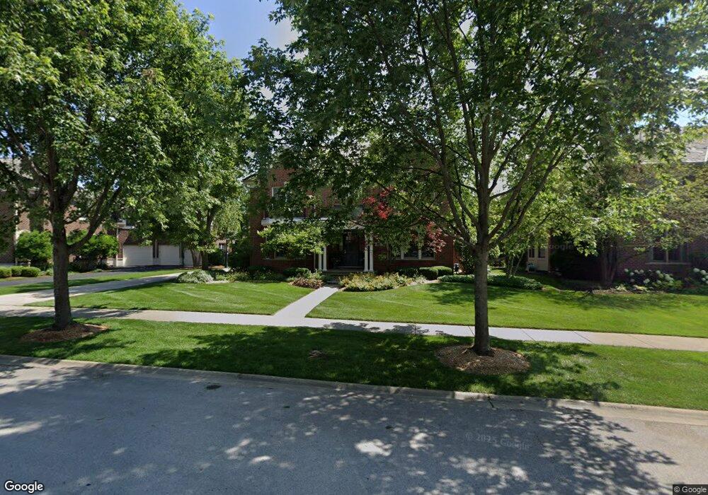
1611 Cabot Ln Glenview, IL 60026
The Glen NeighborhoodEstimated Value: $1,935,000 - $2,011,000
5
Beds
4
Baths
4,565
Sq Ft
$434/Sq Ft
Est. Value
About This Home
This home is located at 1611 Cabot Ln, Glenview, IL 60026 and is currently estimated at $1,979,333, approximately $433 per square foot. 1611 Cabot Ln is a home located in Cook County with nearby schools including Westbrook Elementary School, Glen Grove Elementary School, and Attea Middle School.
Ownership History
Date
Name
Owned For
Owner Type
Purchase Details
Closed on
Sep 16, 2016
Sold by
Schultz Robert A
Bought by
Schultz Christine M and The Christine M Schultz Revcable Trust
Current Estimated Value
Home Financials for this Owner
Home Financials are based on the most recent Mortgage that was taken out on this home.
Original Mortgage
$999,000
Outstanding Balance
$789,916
Interest Rate
3.12%
Mortgage Type
Adjustable Rate Mortgage/ARM
Estimated Equity
$1,189,417
Purchase Details
Closed on
Jun 30, 2004
Sold by
Glenbase Venture
Bought by
Schultz Robert and Schultz Christine
Home Financials for this Owner
Home Financials are based on the most recent Mortgage that was taken out on this home.
Original Mortgage
$806,000
Interest Rate
5.12%
Mortgage Type
Unknown
Create a Home Valuation Report for This Property
The Home Valuation Report is an in-depth analysis detailing your home's value as well as a comparison with similar homes in the area
Home Values in the Area
Average Home Value in this Area
Purchase History
| Date | Buyer | Sale Price | Title Company |
|---|---|---|---|
| Schultz Christine M | -- | Ravenswood Title Company Llc | |
| Schultz Robert | $1,186,000 | Ctic |
Source: Public Records
Mortgage History
| Date | Status | Borrower | Loan Amount |
|---|---|---|---|
| Open | Schultz Christine M | $999,000 | |
| Previous Owner | Schultz Robert | $806,000 | |
| Closed | Schultz Robert | $200,000 |
Source: Public Records
Tax History Compared to Growth
Tax History
| Year | Tax Paid | Tax Assessment Tax Assessment Total Assessment is a certain percentage of the fair market value that is determined by local assessors to be the total taxable value of land and additions on the property. | Land | Improvement |
|---|---|---|---|---|
| 2024 | $25,588 | $118,923 | $26,390 | $92,533 |
| 2023 | $25,936 | $118,923 | $26,390 | $92,533 |
| 2022 | $25,936 | $124,000 | $26,390 | $97,610 |
| 2021 | $24,487 | $101,713 | $12,667 | $89,046 |
| 2020 | $24,253 | $101,713 | $12,667 | $89,046 |
| 2019 | $22,598 | $111,773 | $12,667 | $99,106 |
| 2018 | $23,282 | $104,665 | $11,083 | $93,582 |
| 2017 | $23,836 | $109,851 | $11,083 | $98,768 |
| 2016 | $22,708 | $109,851 | $11,083 | $98,768 |
| 2015 | $21,345 | $92,256 | $8,972 | $83,284 |
| 2014 | $20,967 | $92,256 | $8,972 | $83,284 |
| 2013 | $20,314 | $92,256 | $8,972 | $83,284 |
Source: Public Records
Map
Nearby Homes
- 3081 Saratoga Ln
- 1615 Greenwood Rd
- 3212 Lindenwood Ln
- 1867 Admiral Ct Unit 91
- 1891 Admiral Ct Unit 79
- 2701 Commons Dr Unit 210
- 2750 Langley Cir Unit 203013
- 1704 Executive Ln
- 1045 Crystal Ct
- 2005 Valor Ct Unit 43
- 1735 Patriot Blvd
- 1619 Patriot Blvd
- 3335 Elmdale Rd
- 1088 Shermer Rd Unit DW
- 3537 Maple Leaf Dr
- 705 Glendale Rd
- 2531 Violet St
- 4004 Denice Ct Unit 3
- 1594 Portage Run
- 616 Glendale Rd
- 1601 Cabot Ln
- 1621 Cabot Ln
- 1587 Saratoga Ln
- 1546 Kittyhawk Ln
- 1612 Cabot Ln
- 1627 Saratoga Ln
- 1573 Saratoga Ln
- 1556 Kittyhawk Ln
- 1631 Cabot Ln
- 1536 Kittyhawk Ln
- 1639 Saratoga Ln
- 1624 Cabot Ln
- 1566 Kittyhawk Ln
- 1559 Saratoga Ln
- 1598 Saratoga Ln
- 1586 Saratoga Ln
- 1572 Saratoga Ln
- 1618 Saratoga Ln
- 1576 Kittyhawk Ln
- 1651 Cabot Ln