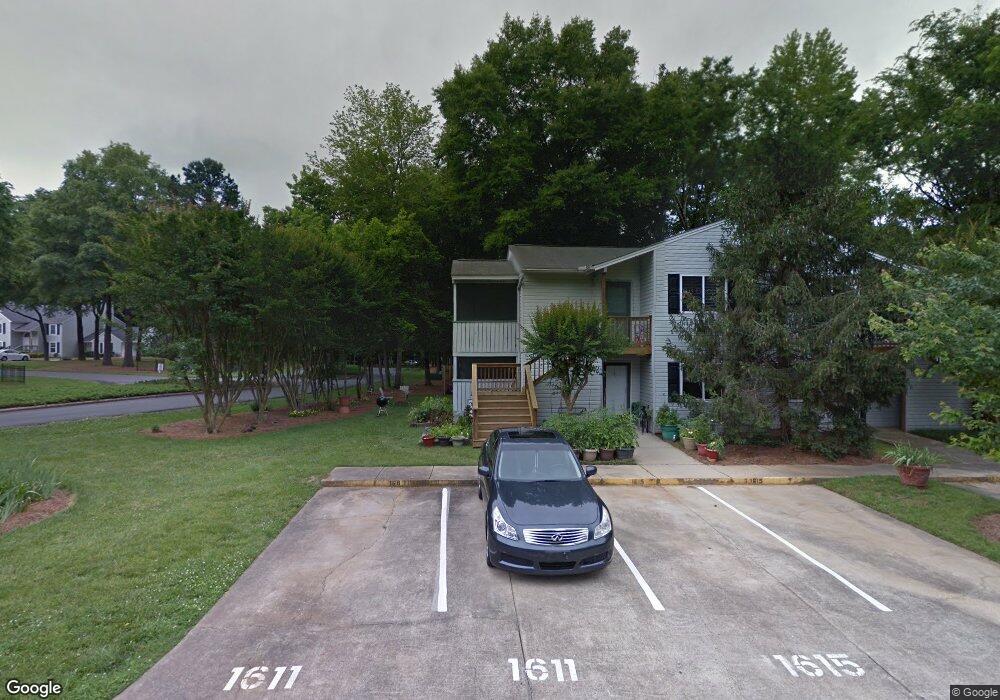
1611 Hunters Trail Rock Hill, SC 29732
Estimated Value: $129,000 - $143,149
--
Bed
--
Bath
884
Sq Ft
$153/Sq Ft
Est. Value
About This Home
This home is located at 1611 Hunters Trail, Rock Hill, SC 29732 and is currently estimated at $135,037, approximately $152 per square foot. 1611 Hunters Trail is a home with nearby schools including W.C. Sullivan Middle School, Rock Hill High School, and St. Anne Catholic School.
Ownership History
Date
Name
Owned For
Owner Type
Purchase Details
Closed on
Oct 1, 2025
Sold by
Guzman Chad Edward and Follmer Kevin Francis
Bought by
Scharf Audrey Leigh and Scharf Brian
Current Estimated Value
Purchase Details
Closed on
May 30, 2025
Sold by
Stom Glenn R and Stom Nadine
Bought by
Howe Thomas D and Howe Sherry J
Purchase Details
Closed on
May 31, 2018
Sold by
Thompson Tristha A and Stom Trisha A
Bought by
Stom Glenn R and Stom Nadine
Purchase Details
Closed on
Sep 28, 2006
Sold by
Truesdale Bruce E
Bought by
Stom Trisha A
Home Financials for this Owner
Home Financials are based on the most recent Mortgage that was taken out on this home.
Original Mortgage
$72,000
Interest Rate
6.36%
Mortgage Type
New Conventional
Create a Home Valuation Report for This Property
The Home Valuation Report is an in-depth analysis detailing your home's value as well as a comparison with similar homes in the area
Home Values in the Area
Average Home Value in this Area
Purchase History
| Date | Buyer | Sale Price | Title Company |
|---|---|---|---|
| Scharf Audrey Leigh | $649,900 | None Listed On Document | |
| Howe Thomas D | $130,000 | None Listed On Document | |
| Howe Thomas D | $130,000 | None Listed On Document | |
| Stom Glenn R | $78,000 | Legal Assistants & Land Titl | |
| Stom Trisha A | $72,000 | None Available |
Source: Public Records
Mortgage History
| Date | Status | Borrower | Loan Amount |
|---|---|---|---|
| Previous Owner | Stom Trisha A | $72,000 |
Source: Public Records
Tax History Compared to Growth
Tax History
| Year | Tax Paid | Tax Assessment Tax Assessment Total Assessment is a certain percentage of the fair market value that is determined by local assessors to be the total taxable value of land and additions on the property. | Land | Improvement |
|---|---|---|---|---|
| 2024 | $2,198 | $4,967 | $0 | $4,967 |
| 2023 | $2,204 | $4,972 | $0 | $4,972 |
| 2022 | $2,100 | $4,972 | $0 | $4,972 |
| 2021 | -- | $4,972 | $0 | $4,972 |
| 2020 | $2,058 | $4,972 | $0 | $0 |
| 2019 | $1,859 | $4,380 | $0 | $0 |
| 2018 | $1,392 | $4,380 | $0 | $0 |
| 2017 | $1,344 | $3,330 | $0 | $0 |
| 2016 | $1,318 | $3,330 | $0 | $0 |
| 2014 | $1,434 | $3,330 | $0 | $3,330 |
| 2013 | $1,434 | $3,780 | $0 | $3,780 |
Source: Public Records
Map
Nearby Homes
- 1565 Hunt Club Ct
- 1542 Hunt Club Ct Unit 1542
- 1541 Hunt Club Ct Unit 1541
- 1533 Hunt Club Ct Unit 1533
- 2350 Brookview Ct
- 1729 Fieldcrest Cir
- 1944 Bristol Pkwy
- 1505 Tuckers Glenn Dr
- 1667 Flintwood Dr
- 2246 Myers St
- 2236 Myers St
- 2016 Celanese Rd
- 1319 Mount Gallant Rd
- 1352 Walnut Hill Dr
- 1776 Rosewell Dr
- 1791 Rosewell Dr Unit 65
- 1542 Maypine Commons Way
- 1581 Maypine Commons Way
- 1620 Tate Rd
- 1684 Tate Rd Unit 273
- 1615 Hunters Trail
- 1617 Hunters Trail
- 1619 Hunters Trail
- 1624 Hunters Trail
- 1622 Hunters Trail
- 1651 Hunters Trail Unit 1651
- 1626 Hunters Trail Unit 1626
- 1653 Hunters Trail Unit 1653
- 1777 Hunters Trail Unit 1777
- 1771 Hunters Trail
- 1775 Hunters Trail
- 1628 Hunters Trail Unit 1628
- 1655 Hunters Trail
- 1657 Hunters Trail
- 1781 Hunters Trail Unit 1781
- 1781 Hunters Trail Unit 1
- 1590 Hunt Club Ct
- 1783 Hunters Trail
- 1632 Hunters Trail Unit 1632
- 1785 Hunters Trail Unit 1785