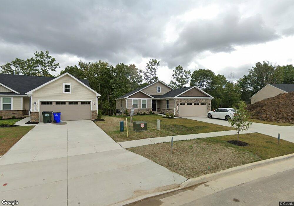
1611 Leslie Dr Streetsboro, OH 44241
Estimated Value: $372,391 - $418,000
3
Beds
2
Baths
1,736
Sq Ft
$224/Sq Ft
Est. Value
About This Home
This home is located at 1611 Leslie Dr, Streetsboro, OH 44241 and is currently estimated at $389,598, approximately $224 per square foot. 1611 Leslie Dr is a home with nearby schools including Streetsboro High School and Crossroads Christian Academy.
Ownership History
Date
Name
Owned For
Owner Type
Purchase Details
Closed on
Apr 29, 2021
Sold by
Ryan Homes and Nvr Inc
Bought by
Glenn Reginald and Houseworth Chandra
Current Estimated Value
Home Financials for this Owner
Home Financials are based on the most recent Mortgage that was taken out on this home.
Original Mortgage
$284,859
Outstanding Balance
$257,750
Interest Rate
3%
Mortgage Type
FHA
Estimated Equity
$131,848
Purchase Details
Closed on
Apr 19, 2021
Sold by
Nvr Inc
Bought by
Glenn Reginald and Houseworth Chandra
Home Financials for this Owner
Home Financials are based on the most recent Mortgage that was taken out on this home.
Original Mortgage
$284,859
Outstanding Balance
$257,750
Interest Rate
3%
Mortgage Type
FHA
Estimated Equity
$131,848
Purchase Details
Closed on
Dec 15, 2020
Sold by
Flg Streetsboro Llc
Bought by
Nvr Inc
Create a Home Valuation Report for This Property
The Home Valuation Report is an in-depth analysis detailing your home's value as well as a comparison with similar homes in the area
Home Values in the Area
Average Home Value in this Area
Purchase History
| Date | Buyer | Sale Price | Title Company |
|---|---|---|---|
| Glenn Reginald | -- | Nvr Title Agency | |
| Glenn Reginald | $294,700 | Nvr Title Agency Llc | |
| Nvr Inc | $59,700 | Nvr Title Agency Llc |
Source: Public Records
Mortgage History
| Date | Status | Borrower | Loan Amount |
|---|---|---|---|
| Open | Glenn Reginald | $284,859 | |
| Closed | Glenn Reginald | $284,859 |
Source: Public Records
Tax History Compared to Growth
Tax History
| Year | Tax Paid | Tax Assessment Tax Assessment Total Assessment is a certain percentage of the fair market value that is determined by local assessors to be the total taxable value of land and additions on the property. | Land | Improvement |
|---|---|---|---|---|
| 2024 | $5,825 | $128,870 | $19,250 | $109,620 |
| 2023 | $5,123 | $91,810 | $18,130 | $73,680 |
| 2022 | $4,641 | $91,810 | $18,130 | $73,680 |
| 2021 | $844 | $16,310 | $16,310 | $0 |
| 2020 | $0 | $0 | $0 | $0 |
Source: Public Records
Map
Nearby Homes
- 1654 Leslie Dr
- 1675 Duncan Way
- 1678 Duncan Way
- 1448 Jude Ave
- 1648 Maple View Ct
- 8807 Kelly Ln
- 1489 Crescent Dr
- V/L State Route 14
- 1932 Summers Ave
- 1446 Trader Dr Unit H5
- 1440 Trader Dr
- 9012 Patriot Dr
- 9018 Patriot Dr
- 2074 Deer Crossing Dr
- 8158 State Route 43
- 9244 Lakeside Dr
- 9315 June Dr
- 8291 State Route 14
- 9431 Briar Dr
- 1490 Evergreen Dr
- 1615 Leslie Dr
- 1603 Leslie Dr
- 1619 Leslie Dr
- 1599 Leslie Dr
- 1623 Leslie Dr
- 1618 Leslie Dr
- 1595 Leslie Dr
- 1627 Leslie Dr
- 1622 Leslie Dr
- 326 S/L Leslie Dr
- 1626 Leslie Dr
- 1631 Leslie Dr
- 1591 Leslie Dr
- 446 S/L Leslie Ave
- 1630 Leslie Dr
- 1635 Leslie Dr
- 1587 Leslie Dr
- 1634 Leslie Dr
- 1583 Leslie Dr
- 1639 Leslie Dr