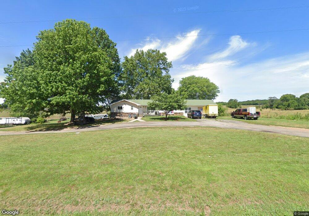
1611 N State Highway 43 Anderson, MO 64831
Estimated Value: $343,000 - $552,831
4
Beds
2
Baths
2,600
Sq Ft
$170/Sq Ft
Est. Value
About This Home
This home is located at 1611 N State Highway 43, Anderson, MO 64831 and is currently estimated at $441,277, approximately $169 per square foot. 1611 N State Highway 43 is a home located in McDonald County with nearby schools including McDonald County High School.
Ownership History
Date
Name
Owned For
Owner Type
Purchase Details
Closed on
Aug 19, 2020
Sold by
Village Capital & Investmerns Llc
Bought by
Crocrtt Tee and Crocrtt Heather
Current Estimated Value
Home Financials for this Owner
Home Financials are based on the most recent Mortgage that was taken out on this home.
Original Mortgage
$210,750
Outstanding Balance
$186,950
Interest Rate
3%
Mortgage Type
New Conventional
Estimated Equity
$254,327
Purchase Details
Closed on
Jun 14, 2019
Sold by
S & W Foreclosure Corporation
Bought by
Village Capital & Investment Llc
Purchase Details
Closed on
Oct 30, 2013
Sold by
Miller Vicky L and Formby Melvin R
Bought by
Braat Randall
Home Financials for this Owner
Home Financials are based on the most recent Mortgage that was taken out on this home.
Original Mortgage
$165,280
Interest Rate
4.21%
Mortgage Type
VA
Create a Home Valuation Report for This Property
The Home Valuation Report is an in-depth analysis detailing your home's value as well as a comparison with similar homes in the area
Home Values in the Area
Average Home Value in this Area
Purchase History
| Date | Buyer | Sale Price | Title Company |
|---|---|---|---|
| Crocrtt Tee | -- | Waco Title Company Pineville | |
| Village Capital & Investment Llc | $146,822 | None Available | |
| Braat Randall | -- | None Available |
Source: Public Records
Mortgage History
| Date | Status | Borrower | Loan Amount |
|---|---|---|---|
| Open | Crocrtt Tee | $210,750 | |
| Previous Owner | Braat Randall | $165,280 |
Source: Public Records
Tax History Compared to Growth
Tax History
| Year | Tax Paid | Tax Assessment Tax Assessment Total Assessment is a certain percentage of the fair market value that is determined by local assessors to be the total taxable value of land and additions on the property. | Land | Improvement |
|---|---|---|---|---|
| 2024 | $1,770 | $44,650 | $0 | $0 |
| 2023 | $1,770 | $44,650 | $0 | $0 |
| 2022 | $1,769 | $44,650 | $0 | $0 |
| 2021 | $2,121 | $53,520 | $0 | $0 |
| 2020 | $811 | $20,390 | $0 | $0 |
| 2019 | $810 | $20,390 | $0 | $0 |
| 2018 | $812 | $20,390 | $0 | $0 |
| 2017 | $812 | $20,390 | $0 | $0 |
| 2016 | $797 | $20,020 | $0 | $0 |
| 2015 | -- | $20,020 | $0 | $0 |
| 2014 | -- | $19,970 | $0 | $0 |
Source: Public Records
Map
Nearby Homes
- 1203 State Highway 43
- 27501 S 705th Rd
- 21501 S 705 Rd
- 70190 E 240 Rd
- 1553 Lone Dove Rd
- 71.8 Klondike Rd
- 24301 S 690 Rd
- 24827 S 680 Rd
- 24870 S 680 Ct
- 69125 E 252 Rd
- Tbd Stogdon Hollow Rd
- 68040 E 250 Loop
- 22351 S 672 Rd
- 24841 S 675 Rd
- 25450 S 676 Rd
- 188 Lonestar Rd
- 25541 S 676 Rd
- 681 & 825 Windwalker Ln
- 66301 E 248 Ln
- 5541 S State Highway 43
- 1611 N State Highway 43
- 1611 Missouri 43
- 1611 Mo-43
- 1776 N State Highway 43
- 1608 N State Highway 43
- 1206 Missouri 43
- 1206 N State Highway 43
- 1880 County Rd
- 299 Boonville Ln
- 408 Boonville Ln
- 83 Brentley Ln
- 22151 S 705 Rd
- 875 Buffalo Creek Rd
- 23051 S 705 Rd
- 70220 E 230 Rd
- 894 Buffalo Creek Rd
- 1191 Buffalo Creek Rd
- 70201 E 230 Rd
- 515 Buffalo Creek Rd
- 23101 S 705 Rd