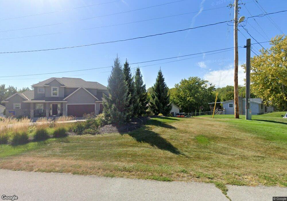
1611 Rock Bluff Rd Plattsmouth, NE 68048
Estimated Value: $448,000 - $549,295
3
Beds
2
Baths
1,668
Sq Ft
$305/Sq Ft
Est. Value
About This Home
This home is located at 1611 Rock Bluff Rd, Plattsmouth, NE 68048 and is currently estimated at $508,324, approximately $304 per square foot. 1611 Rock Bluff Rd is a home located in Cass County with nearby schools including Conestoga Elementary School and Conestoga Junior/Senior High School.
Ownership History
Date
Name
Owned For
Owner Type
Purchase Details
Closed on
Jul 13, 2005
Sold by
Segelberg Roy R and Segelberg Catherine A
Bought by
Haugaard Scott D and Haugaard Treva D
Current Estimated Value
Home Financials for this Owner
Home Financials are based on the most recent Mortgage that was taken out on this home.
Original Mortgage
$253,000
Interest Rate
5.78%
Mortgage Type
Construction
Create a Home Valuation Report for This Property
The Home Valuation Report is an in-depth analysis detailing your home's value as well as a comparison with similar homes in the area
Home Values in the Area
Average Home Value in this Area
Purchase History
| Date | Buyer | Sale Price | Title Company |
|---|---|---|---|
| Haugaard Scott D | $73,000 | -- |
Source: Public Records
Mortgage History
| Date | Status | Borrower | Loan Amount |
|---|---|---|---|
| Closed | Haugaard Scott D | $253,000 |
Source: Public Records
Tax History Compared to Growth
Tax History
| Year | Tax Paid | Tax Assessment Tax Assessment Total Assessment is a certain percentage of the fair market value that is determined by local assessors to be the total taxable value of land and additions on the property. | Land | Improvement |
|---|---|---|---|---|
| 2025 | $5,501 | $459,865 | $209,210 | $250,655 |
| 2024 | $5,501 | $459,865 | $209,210 | $250,655 |
| 2023 | $5,699 | $426,120 | $181,920 | $244,200 |
| 2022 | $5,899 | $410,981 | $191,016 | $219,965 |
| 2021 | $4,600 | $309,325 | $106,120 | $203,205 |
| 2020 | $4,520 | $294,827 | $98,692 | $196,135 |
| 2019 | $4,269 | $262,728 | $76,944 | $185,784 |
| 2018 | $4,199 | $262,728 | $76,944 | $185,784 |
| 2017 | $3,945 | $243,733 | $76,944 | $166,789 |
| 2016 | $3,776 | $243,733 | $76,944 | $166,789 |
| 2015 | $3,761 | $243,733 | $76,944 | $166,789 |
| 2014 | $4,235 | $243,733 | $76,944 | $166,789 |
Source: Public Records
Map
Nearby Homes
- 1524 Trumball Terrace
- 1715 Rock Bluff Rd
- 9518 Sterling Cir
- 1402 Elm Creek Rd
- 914 Beaver Lake Blvd
- 113 Rock Bluff Rd
- 113 Rock Bluff Rd Unit 1
- 9012 Murray Dr
- 9019 Bellvue Dr
- 8883 Verdon Cir
- 0 Forest Ln
- 2206 Beaver Lake Blvd
- 1928 Beaver Lake Blvd
- 1812 Beaver Lake Blvd
- 1710 Beaver Lake Blvd
- 9415 Monroe Rd
- 819 Mead Ct
- LOT 4 620 Rock Bluff Rd
- 9212 Monroe Rd
- 9202 Monroe Rd
- 1609 Rock Bluff Rd
- 9714 Clubhouse Cir
- 1607 Rock Bluff Rd
- 9708 Clubhouse Cir
- 9714 Clubhouse Cr
- 1516 Trumball Terrace
- 9704 Clubhouse Cir
- 1512 Trumball Terrace
- 1520 Trumball Terrace
- 9707 Clubhouse Cir
- 1514 Trumball Terrace
- 9705 Clubhouse Cir
- 9700 Clubhouse Cir
- 1705 Rock Bluff Rd
- 1705 Rock Bluff Plattsmo Rd
- 1508 Cree Ct
- 9618 Clubhouse Cir
- 1515 Trumball Terrace
- 1511 Trumball 1598 C Tr
- 1506 Trumball Terrace