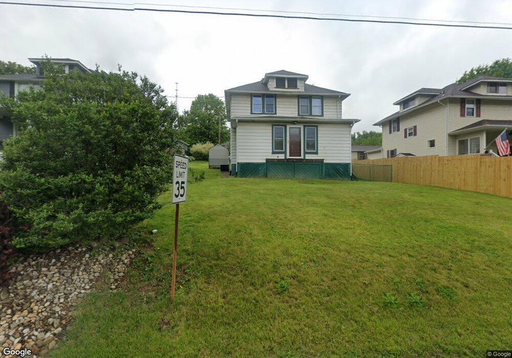
1611 Route 481 Charleroi, PA 15022
Fallowfield Township NeighborhoodEstimated Value: $120,000 - $144,000
3
Beds
2
Baths
1,640
Sq Ft
$82/Sq Ft
Est. Value
About This Home
This home is located at 1611 Route 481, Charleroi, PA 15022 and is currently estimated at $133,860, approximately $81 per square foot. 1611 Route 481 is a home located in Washington County with nearby schools including Charleroi Elementary Center, Charleroi Area Middle School, and Charleroi Area High School.
Ownership History
Date
Name
Owned For
Owner Type
Purchase Details
Closed on
Aug 31, 2005
Sold by
Carson Jack A
Bought by
Toth Jason L
Current Estimated Value
Home Financials for this Owner
Home Financials are based on the most recent Mortgage that was taken out on this home.
Original Mortgage
$60,000
Outstanding Balance
$32,080
Interest Rate
5.84%
Mortgage Type
New Conventional
Estimated Equity
$101,780
Create a Home Valuation Report for This Property
The Home Valuation Report is an in-depth analysis detailing your home's value as well as a comparison with similar homes in the area
Home Values in the Area
Average Home Value in this Area
Purchase History
| Date | Buyer | Sale Price | Title Company |
|---|---|---|---|
| Toth Jason L | $74,900 | -- |
Source: Public Records
Mortgage History
| Date | Status | Borrower | Loan Amount |
|---|---|---|---|
| Open | Toth Jason L | $60,000 |
Source: Public Records
Tax History Compared to Growth
Tax History
| Year | Tax Paid | Tax Assessment Tax Assessment Total Assessment is a certain percentage of the fair market value that is determined by local assessors to be the total taxable value of land and additions on the property. | Land | Improvement |
|---|---|---|---|---|
| 2025 | $1,756 | $74,600 | $16,000 | $58,600 |
| 2024 | $1,696 | $74,600 | $16,000 | $58,600 |
| 2023 | $1,696 | $74,600 | $16,000 | $58,600 |
| 2022 | $1,632 | $74,600 | $16,000 | $58,600 |
| 2021 | $1,632 | $74,600 | $16,000 | $58,600 |
| 2020 | $1,584 | $74,600 | $16,000 | $58,600 |
| 2019 | $1,543 | $74,600 | $16,000 | $58,600 |
| 2018 | $1,502 | $74,600 | $16,000 | $58,600 |
| 2017 | $154 | $74,600 | $16,000 | $58,600 |
| 2016 | $154 | $6,171 | $963 | $5,208 |
| 2015 | -- | $6,171 | $963 | $5,208 |
| 2014 | $154 | $6,171 | $963 | $5,208 |
| 2013 | $154 | $6,171 | $963 | $5,208 |
Source: Public Records
Map
Nearby Homes
- 138 Crossridge Rd
- 9 Coyle Curtain Rd
- 306 & 308 Fallowfield Ave
- Lot 9 Coyle Curtain Rd
- 000 Bentleyville Rd
- 1190 Route 481
- 60 Wisetown Rd
- 959 Bentleyville Rd
- 5 Wesley St
- 30 Evans Rd
- 316 Fox Stop Rd
- 1544 Route 2023
- 536 Conrad Ave
- 432 Conrad Ave
- 531 Conrad Ave
- 123 Sims Ln
- 706 Shady Ave
- 713 Meadow Ave
- 828 Crest Ave
- 705 Meadow Ave
- 6 Memorial Dr
- 1619 Route 481
- 1625 Route 481
- 8 Memorial Dr
- 0 Route 481
- 1627 Route 481
- 1627 Route 481
- 1629 Route 481
- 5 Memorial Dr
- 1601 Route 481
- 342 Redds Mill Rd
- 0 State Rt 481 Unit 992177
- 0 State Rt 481 Unit 992175
- 0 State Rt 481 Unit 992168
- 0 State Rt 481 Unit 884232
- 0 State Rt 481 Unit 937440
- 1599 Route 481
- 336 Redds Mill Rd
- 336 Redds Mill Rd
- 336 Redds Mill Rd