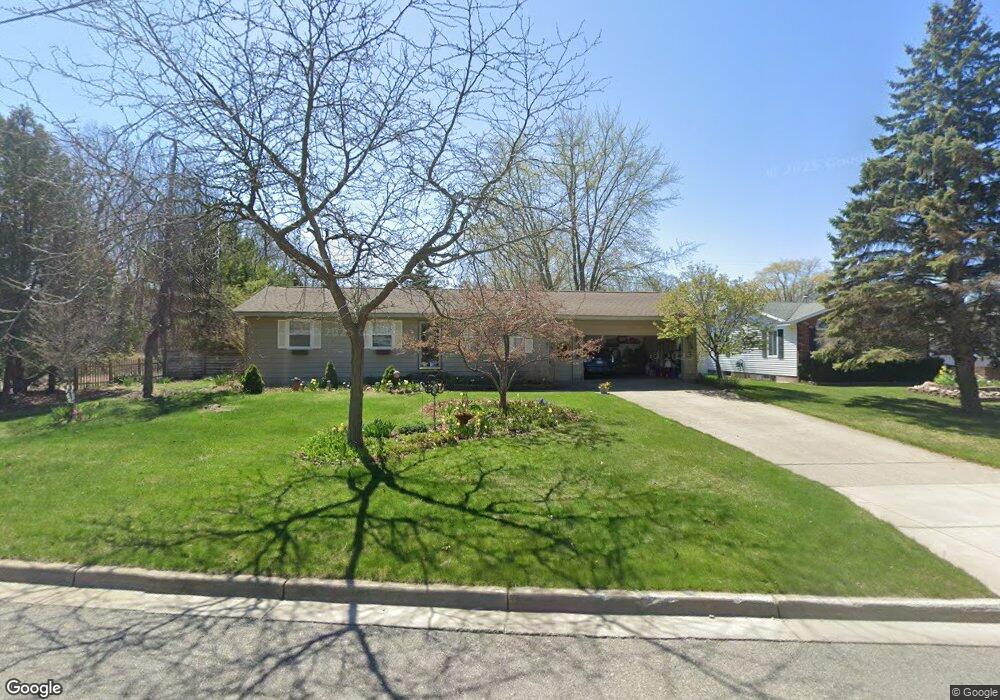
1611 Woodside Rd Norton Shores, MI 49441
Estimated Value: $274,494 - $286,000
4
Beds
2
Baths
1,767
Sq Ft
$158/Sq Ft
Est. Value
About This Home
This home is located at 1611 Woodside Rd, Norton Shores, MI 49441 and is currently estimated at $278,374, approximately $157 per square foot. 1611 Woodside Rd is a home located in Muskegon County with nearby schools including Mona Shores High School, Muskegon Heights Academy, and West Shore Lutheran School.
Ownership History
Date
Name
Owned For
Owner Type
Purchase Details
Closed on
Apr 18, 2007
Sold by
Saling Julia A
Bought by
Saling Julia and The Julia Saling Living Trust
Current Estimated Value
Home Financials for this Owner
Home Financials are based on the most recent Mortgage that was taken out on this home.
Original Mortgage
$92,852
Outstanding Balance
$11,038
Interest Rate
6.28%
Mortgage Type
Purchase Money Mortgage
Estimated Equity
$267,336
Purchase Details
Closed on
Feb 21, 2007
Sold by
Lakos Thomas M and Lakos Rebecca J
Bought by
Saling Julia A
Home Financials for this Owner
Home Financials are based on the most recent Mortgage that was taken out on this home.
Original Mortgage
$92,852
Outstanding Balance
$11,038
Interest Rate
6.28%
Mortgage Type
Purchase Money Mortgage
Estimated Equity
$267,336
Create a Home Valuation Report for This Property
The Home Valuation Report is an in-depth analysis detailing your home's value as well as a comparison with similar homes in the area
Home Values in the Area
Average Home Value in this Area
Purchase History
| Date | Buyer | Sale Price | Title Company |
|---|---|---|---|
| Saling Julia | -- | Rei | |
| Saling Julia A | -- | None Available |
Source: Public Records
Mortgage History
| Date | Status | Borrower | Loan Amount |
|---|---|---|---|
| Open | Saling Julia A | $92,852 |
Source: Public Records
Tax History Compared to Growth
Tax History
| Year | Tax Paid | Tax Assessment Tax Assessment Total Assessment is a certain percentage of the fair market value that is determined by local assessors to be the total taxable value of land and additions on the property. | Land | Improvement |
|---|---|---|---|---|
| 2025 | $2,191 | $117,300 | $0 | $0 |
| 2024 | $1,717 | $108,800 | $0 | $0 |
| 2023 | $1,640 | $96,300 | $0 | $0 |
| 2022 | $1,999 | $84,700 | $0 | $0 |
| 2021 | $1,943 | $75,600 | $0 | $0 |
| 2020 | $1,921 | $67,500 | $0 | $0 |
| 2019 | $1,886 | $60,400 | $0 | $0 |
| 2018 | $1,842 | $55,000 | $0 | $0 |
| 2017 | $1,799 | $53,300 | $0 | $0 |
| 2016 | $1,393 | $48,400 | $0 | $0 |
| 2015 | -- | $46,200 | $0 | $0 |
| 2014 | $1,671 | $46,000 | $0 | $0 |
| 2013 | -- | $43,300 | $0 | $0 |
Source: Public Records
Map
Nearby Homes
- 1582 Haverhill Rd
- 1733 Woodside Rd
- 1480 Marlboro Rd
- 1448 Marlboro Rd
- 1689 Bonneville Dr
- 1744 W Norton Ave
- 3246 Royal Oak Rd
- 1650 Bonneville Dr
- 1752 Bonneville Dr
- 2881 Cornell Ct
- 1936 Lawnel Ave
- 1377 Princeton Rd
- 1521 Cornell Rd
- 3283 Mccracken St
- 3320 Davis Rd
- 3658 Lake Harbor Rd
- 1243 Crandall Ave
- 3684 Harris Dr
- 1045 Le Roux Rd Unit 178
- 1059 W Summit Ave
- 1625 Woodside Rd
- 1606 Woodside Rd
- 1618 Woodside Rd
- 1630 Woodside Rd
- 1637 Woodside Rd
- 1588 Woodside Rd
- 1612 Lawnel Ave
- 1644 Woodside Rd
- 1649 Woodside Rd
- 1578 Woodside Rd
- 1568 Woodside Rd
- 1626 Lawnel Ave
- 1583 Marlboro Rd
- 1658 Woodside Rd
- 1483 Lawnel Ave
- 1638 Lawnel Ave
- 1569 Marlboro Rd
- 1611 Lawnel Ave
- 1650 Lawnel Ave
- 1625 Lawnel Ave