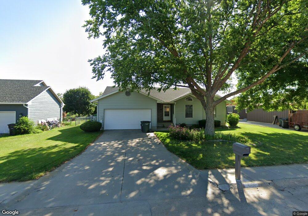
1612 Apache Ave Hastings, NE 68901
Estimated Value: $286,000 - $378,000
3
Beds
3
Baths
1,507
Sq Ft
$211/Sq Ft
Est. Value
About This Home
This home is located at 1612 Apache Ave, Hastings, NE 68901 and is currently estimated at $317,917, approximately $210 per square foot. 1612 Apache Ave is a home located in Adams County with nearby schools including Hastings Senior High School, St. Michael's Preschool & Elementary School, and Zion Lutheran School.
Ownership History
Date
Name
Owned For
Owner Type
Purchase Details
Closed on
Nov 12, 2011
Sold by
Kroeger Kenneth E and Kroeger Charlotte E
Bought by
Kroeger Cameron D and Jones Carolyn L
Current Estimated Value
Purchase Details
Closed on
Jan 2, 2008
Sold by
Frey Derek S
Bought by
Kroeger Kenneth E and Kroeger Charlotte E
Purchase Details
Closed on
Mar 6, 2007
Sold by
Frey Derek S
Bought by
Frey Derek S and Derek S Frey Revocable Trust
Purchase Details
Closed on
Sep 28, 2005
Sold by
Bailey Bradley G and Bailey Lorinda B
Bought by
Frey Derek S
Home Financials for this Owner
Home Financials are based on the most recent Mortgage that was taken out on this home.
Original Mortgage
$134,000
Interest Rate
5.76%
Mortgage Type
New Conventional
Create a Home Valuation Report for This Property
The Home Valuation Report is an in-depth analysis detailing your home's value as well as a comparison with similar homes in the area
Home Values in the Area
Average Home Value in this Area
Purchase History
| Date | Buyer | Sale Price | Title Company |
|---|---|---|---|
| Kroeger Cameron D | -- | -- | |
| Kroeger Kenneth E | $157,000 | None Available | |
| Frey Derek S | -- | None Available | |
| Frey Derek S | $168,000 | None Available |
Source: Public Records
Mortgage History
| Date | Status | Borrower | Loan Amount |
|---|---|---|---|
| Previous Owner | Frey Derek S | $134,000 |
Source: Public Records
Tax History
| Year | Tax Paid | Tax Assessment Tax Assessment Total Assessment is a certain percentage of the fair market value that is determined by local assessors to be the total taxable value of land and additions on the property. | Land | Improvement |
|---|---|---|---|---|
| 2025 | $3,560 | $227,727 | $28,080 | $199,647 |
| 2024 | $3,690 | $227,727 | $28,080 | $199,647 |
| 2023 | $4,081 | $197,781 | $28,080 | $169,701 |
| 2022 | $4,177 | $185,445 | $28,080 | $157,365 |
| 2021 | $4,015 | $183,105 | $25,740 | $157,365 |
| 2020 | $3,948 | $183,105 | $25,740 | $157,365 |
| 2019 | $3,906 | $183,105 | $25,740 | $157,365 |
| 2018 | $3,776 | $176,085 | $18,720 | $157,365 |
| 2017 | $3,707 | $173,000 | $0 | $0 |
| 2016 | $3,494 | $162,905 | $18,720 | $144,185 |
| 2011 | -- | $151,450 | $16,850 | $134,600 |
Source: Public Records
Map
Nearby Homes
- 1720 Apache Ave
- 1406 Sheridan Place
- 1401 Heritage Dr
- 1233 Heritage Dr
- 1253 Westridge Dr
- 1225 Heritage Dr
- 1250 Heritage Place
- 1105 Jefferson Ave
- 1909 W 10th St
- 1934 W 9th St
- 2019 W 9th St
- 910 Jefferson Ave
- 1334 W 12th St
- 2412 W 8th St
- 736 N Barnes Ave
- 1810 W 8th St
- 1701 Boyce St
- 1831 W 8th St
- 2603 Bateman St
- 929 N Briggs Ave
- 1616 Apache Ave
- 1606 Apache Ave
- 1620 Apache Ave
- 1600 Apache Ave
- 1613 Apache Ave
- 2013 Crane Circle Dr
- 1607 Apache Ave
- 1700 Apache Ave
- 1617 Apache Ave
- 1520 Apache Ave
- 1601 Apache Ave
- 1627 Apache Ave
- 2016 Crane Circle Dr
- 2009 Crane Circle Dr
- 1521 Apache Ave
- 1518 Arapahoe Ave
- 1705 Apache Ave
- 1706 Apache Ave
- 1518 Apache Ave
- 1514 Arapahoe Ave
Your Personal Tour Guide
Ask me questions while you tour the home.