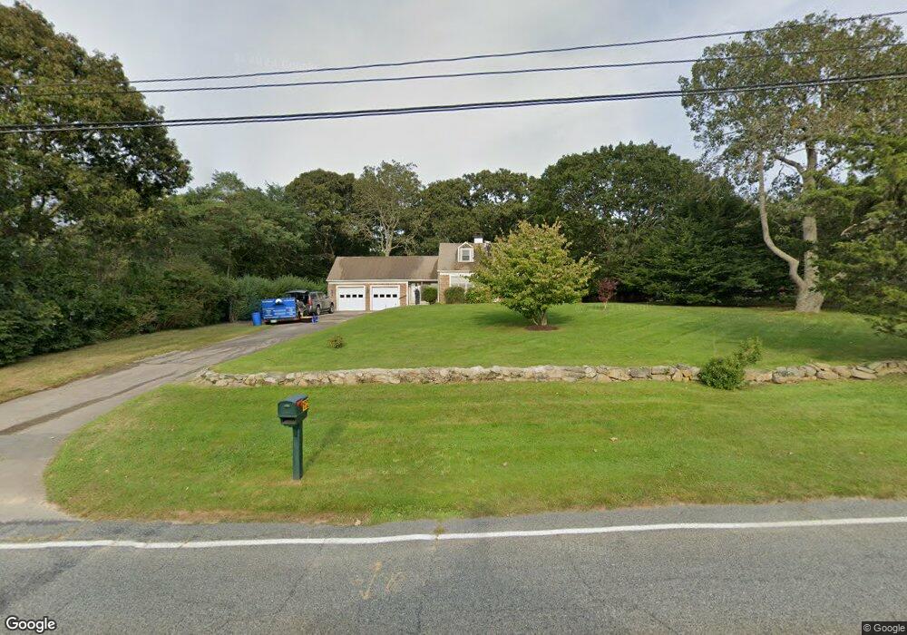
1612 Main Rd Westport, MA 02790
Westport Point NeighborhoodEstimated Value: $742,000 - $972,297
3
Beds
--
Bath
1,608
Sq Ft
$542/Sq Ft
Est. Value
About This Home
This home is located at 1612 Main Rd, Westport, MA 02790 and is currently estimated at $871,324, approximately $541 per square foot. 1612 Main Rd is a home located in Bristol County with nearby schools including Alice A. Macomber Primary School, Westport Elementary School, and Westport Middle-High School.
Ownership History
Date
Name
Owned For
Owner Type
Purchase Details
Closed on
Jul 8, 2019
Sold by
Margot Green Lt
Bought by
Margot Green Lt
Current Estimated Value
Purchase Details
Closed on
Nov 29, 2012
Sold by
Green Margot P
Bought by
Margot Green Lt
Purchase Details
Closed on
Oct 16, 2003
Sold by
Green Margot P
Bought by
Margot Green Lt
Purchase Details
Closed on
Jul 10, 1995
Sold by
Sherman Priscilla H and Sherman Bradford W
Bought by
Green Margot P
Create a Home Valuation Report for This Property
The Home Valuation Report is an in-depth analysis detailing your home's value as well as a comparison with similar homes in the area
Home Values in the Area
Average Home Value in this Area
Purchase History
| Date | Buyer | Sale Price | Title Company |
|---|---|---|---|
| Margot Green Lt | -- | -- | |
| Margot Green Lt | -- | -- | |
| Margot Green Lt | -- | -- | |
| Green Margot P | $193,000 | -- |
Source: Public Records
Tax History Compared to Growth
Tax History
| Year | Tax Paid | Tax Assessment Tax Assessment Total Assessment is a certain percentage of the fair market value that is determined by local assessors to be the total taxable value of land and additions on the property. | Land | Improvement |
|---|---|---|---|---|
| 2025 | $5,297 | $711,000 | $491,200 | $219,800 |
| 2024 | $5,181 | $670,300 | $455,100 | $215,200 |
| 2023 | $3,574 | $438,000 | $235,800 | $202,200 |
| 2022 | $3,469 | $409,100 | $235,800 | $173,300 |
| 2021 | $3,352 | $388,900 | $214,400 | $174,500 |
| 2020 | $3,206 | $380,300 | $205,800 | $174,500 |
| 2019 | $3,107 | $375,700 | $205,800 | $169,900 |
| 2018 | $3,047 | $372,900 | $218,600 | $154,300 |
| 2017 | $3,133 | $393,100 | $236,500 | $156,600 |
| 2016 | $3,219 | $406,900 | $256,800 | $150,100 |
| 2015 | $3,038 | $383,100 | $238,900 | $144,200 |
Source: Public Records
Map
Nearby Homes
- 1580 Main Rd
- 1749 Main Rd
- 1346 Main Rd Unit B
- 1881 Main Rd
- 1702J Drift Rd
- 1702 Drift Rd
- 99 Sylvia Ln
- 19 Seabury Ln
- 225 Hixbridge Rd
- 920 Drift Rd
- 17 Quail Trail
- 101 Adamsville Rd
- 245 John Dyer Rd
- 255 John Dyer Rd
- 837 Main Rd
- 189 Brayton Point Rd
- 8 Village Way
- 7 Village Way
- 15 Village Way
- 304 Brayton Point Rd