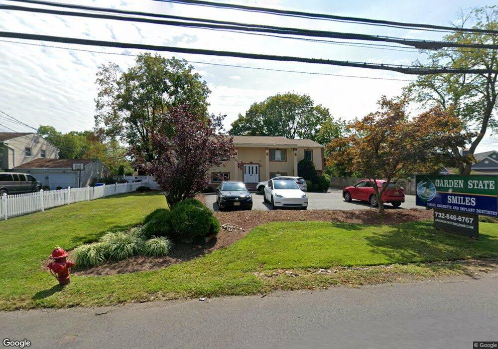
1612 State Route 27 North Brunswick, NJ 08902
Estimated Value: $758,000 - $848,000
--
Bed
--
Bath
2,929
Sq Ft
$274/Sq Ft
Est. Value
About This Home
This home is located at 1612 State Route 27, North Brunswick, NJ 08902 and is currently estimated at $803,611, approximately $274 per square foot. 1612 State Route 27 is a home located in Middlesex County with nearby schools including John Adams Elementary School, Linwood Middle School, and North Brunswick Twp High School.
Ownership History
Date
Name
Owned For
Owner Type
Purchase Details
Closed on
Oct 7, 2013
Sold by
Drd & Sons Llc
Bought by
Detinich Vlad
Current Estimated Value
Home Financials for this Owner
Home Financials are based on the most recent Mortgage that was taken out on this home.
Original Mortgage
$313,200
Outstanding Balance
$81,107
Interest Rate
4.14%
Mortgage Type
New Conventional
Estimated Equity
$722,504
Purchase Details
Closed on
May 6, 2008
Sold by
Detinich Vlad
Bought by
Drd & Sons Llc
Purchase Details
Closed on
Mar 30, 2005
Sold by
Reiter Arlene
Bought by
Detinich Vlad
Home Financials for this Owner
Home Financials are based on the most recent Mortgage that was taken out on this home.
Original Mortgage
$380,000
Interest Rate
1.75%
Mortgage Type
Adjustable Rate Mortgage/ARM
Create a Home Valuation Report for This Property
The Home Valuation Report is an in-depth analysis detailing your home's value as well as a comparison with similar homes in the area
Home Values in the Area
Average Home Value in this Area
Purchase History
| Date | Buyer | Sale Price | Title Company |
|---|---|---|---|
| Detinich Vlad | -- | None Available | |
| Drd & Sons Llc | -- | None Available | |
| Detinich Vlad | $475,000 | -- |
Source: Public Records
Mortgage History
| Date | Status | Borrower | Loan Amount |
|---|---|---|---|
| Open | Detinich Vlad | $313,200 | |
| Previous Owner | Detinich Vlad | $380,000 |
Source: Public Records
Tax History Compared to Growth
Tax History
| Year | Tax Paid | Tax Assessment Tax Assessment Total Assessment is a certain percentage of the fair market value that is determined by local assessors to be the total taxable value of land and additions on the property. | Land | Improvement |
|---|---|---|---|---|
| 2025 | $15,396 | $243,000 | $66,500 | $176,500 |
| 2024 | $15,119 | $243,000 | $66,500 | $176,500 |
| 2023 | $15,119 | $243,000 | $66,500 | $176,500 |
| 2022 | $14,604 | $243,000 | $66,500 | $176,500 |
| 2021 | $10,641 | $243,000 | $66,500 | $176,500 |
| 2020 | $14,060 | $243,000 | $66,500 | $176,500 |
| 2019 | $13,773 | $243,000 | $66,500 | $176,500 |
| 2018 | $13,491 | $243,000 | $66,500 | $176,500 |
| 2017 | $13,253 | $243,000 | $66,500 | $176,500 |
| 2016 | $12,976 | $243,000 | $66,500 | $176,500 |
| 2015 | $12,755 | $243,000 | $66,500 | $176,500 |
| 2014 | $12,612 | $243,000 | $66,500 | $176,500 |
Source: Public Records
Map
Nearby Homes
- 1632 Hudson Ave
- 1365 Sioux Rd
- 1899 Noah Dr
- 1499 La Rose Ave
- 1209 Dakota Rd
- 1464 Columbia Dr
- 1008 Schmidt Ln
- 1027 Schmidt Ln
- 1074 Schmidt Ln
- 1103 Schmidt Ln
- 1 Michael Ct
- 1067 Grove St
- 66 Riverbend Dr
- 174 Nathan Dr
- 1010 N Oaks Blvd
- 210 N Oaks Blvd Unit 210
- 78 Churchill Ave
- 139 Churchill Ave
- 5208 N Oaks Blvd
- 1133 Livingston Ave Unit 11C
- 1612 New Jersey 27
- 1604 State Route 27
- 1494 Pawnee Rd
- 1494 Pawnee Rd
- 1510 Seneca Rd
- 1628 State Route 27
- 1501 N Pawnee Place
- 1484 Pawnee Rd
- 1583 New Jersey 27
- 1481 Pawnee Rd
- 1401 Parillo Ct
- 1474 Pawnee Rd
- 1507 Seneca Rd
- 1553 New Jersey 27
- 1553 New Jersey 27 Unit 1600
- 1553 New Jersey 27 Unit 1200
- 1553 New Jersey 27 Unit 111
- 1499 Seneca Rd
- 1527 New Jersey 27 Unit 2100
- 1527 New Jersey 27