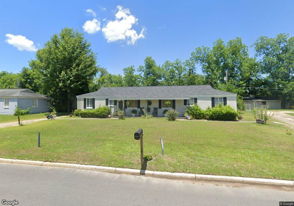
1613 Malone Dr Albany, GA 31705
Estimated Value: $48,000 - $63,225
4
Beds
2
Baths
1,632
Sq Ft
$35/Sq Ft
Est. Value
About This Home
This home is located at 1613 Malone Dr, Albany, GA 31705 and is currently estimated at $56,806, approximately $34 per square foot. 1613 Malone Dr is a home located in Dougherty County with nearby schools including Robert H. Harvey Elementary School, Albany Middle School, and Dougherty Comprehensive High School.
Ownership History
Date
Name
Owned For
Owner Type
Purchase Details
Closed on
Aug 22, 2014
Sold by
Harris Bernice
Bought by
Harris Mary Dean
Current Estimated Value
Purchase Details
Closed on
Aug 27, 2010
Sold by
Harris B J
Bought by
Harris Bernice
Purchase Details
Closed on
Oct 21, 1994
Sold by
Chitty Charles A
Bought by
Harris B J
Purchase Details
Closed on
May 24, 1994
Sold by
Desrosiers Donna
Bought by
Chitty Charles A
Purchase Details
Closed on
Jun 9, 1978
Sold by
Pratt Mollie M
Bought by
Des Rosier Donna
Create a Home Valuation Report for This Property
The Home Valuation Report is an in-depth analysis detailing your home's value as well as a comparison with similar homes in the area
Home Values in the Area
Average Home Value in this Area
Purchase History
| Date | Buyer | Sale Price | Title Company |
|---|---|---|---|
| Harris Mary Dean | -- | -- | |
| Harris Bernice | -- | -- | |
| Harris B J | -- | -- | |
| Chitty Charles A | $1,500 | -- | |
| Des Rosier Donna | -- | -- |
Source: Public Records
Tax History Compared to Growth
Tax History
| Year | Tax Paid | Tax Assessment Tax Assessment Total Assessment is a certain percentage of the fair market value that is determined by local assessors to be the total taxable value of land and additions on the property. | Land | Improvement |
|---|---|---|---|---|
| 2024 | $404 | $14,720 | $1,800 | $12,920 |
| 2023 | $0 | $14,720 | $1,800 | $12,920 |
| 2022 | $393 | $14,720 | $1,800 | $12,920 |
| 2021 | $356 | $14,720 | $1,800 | $12,920 |
| 2020 | $357 | $14,720 | $1,800 | $12,920 |
| 2019 | $358 | $14,720 | $1,800 | $12,920 |
| 2018 | $645 | $14,720 | $1,800 | $12,920 |
| 2017 | $601 | $14,720 | $1,800 | $12,920 |
| 2016 | $601 | $14,720 | $1,800 | $12,920 |
| 2015 | $603 | $14,720 | $1,800 | $12,920 |
| 2014 | $322 | $14,720 | $1,800 | $12,920 |
Source: Public Records
Map
Nearby Homes
- 1901 S Flintlock Dr
- 1978 S Riverview Cir
- 1980 S Riverview Cir
- 1982 S Riverview Cir
- 1604, 1606, 1607 Cromartie Beach Dr
- 2034 N Riverview Cir
- 1616 Cromartie Beach Dr
- 1618 Beverly Ave
- 1500 Evelyn Ave
- 1412 Westcliff Ct
- 1405 Westcliff Ct
- 1524 Grand Cypress Ln
- 1522 Grand Cypress Ln
- 1308 Congressional Ct
- 1302 Congressional Ct
- 1200 River Pointe Dr
- 1312 River Pointe Dr
- 1408 River Pointe Dr
- 1812 River Pointe Dr
- 1901 River Pointe Dr
- 1611 Malone Dr
- 1615 Malone Dr
- 1940 S Riverview Cir
- 1942 S Riverview Cir
- 1938 S Riverview Cir
- 1944 S Riverview Cir
- 1609 Malone Dr
- 1617 Malone Dr
- 1946 S Riverview Cir
- 1612 Malone Dr
- 1610 Malone Dr
- 1934 S Riverview Cir
- 1614 Malone Dr
- 1608 Malone Dr
- 1603 Worrell Ct
- 1948 S Riverview Cir
- 1939 S Riverview Cir
- 1937 S Riverview Cir
- 1941 S Riverview Cir
- 1932 S Riverview Cir