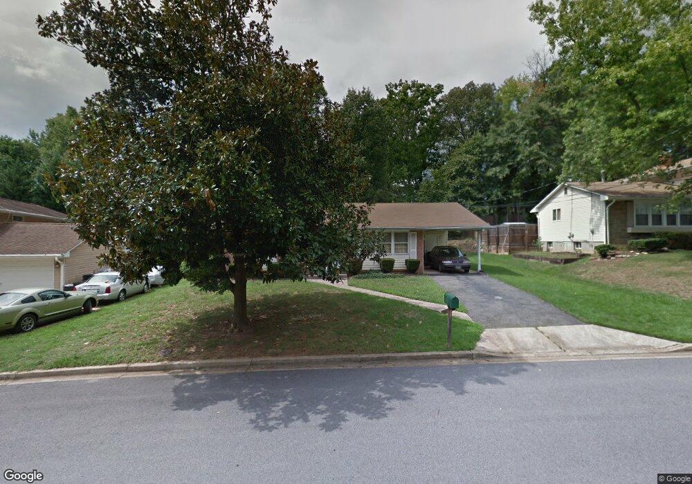
1613 Taylor Ave Fort Washington, MD 20744
Estimated Value: $351,173 - $463,000
--
Bed
2
Baths
1,287
Sq Ft
$323/Sq Ft
Est. Value
About This Home
This home is located at 1613 Taylor Ave, Fort Washington, MD 20744 and is currently estimated at $416,043, approximately $323 per square foot. 1613 Taylor Ave is a home located in Prince George's County with nearby schools including Fort Washington Forest Elementary School, Accokeek Academy, and Friendly High School.
Ownership History
Date
Name
Owned For
Owner Type
Purchase Details
Closed on
May 18, 2025
Sold by
White Theresa
Bought by
White Theresa and Francis Reginald
Current Estimated Value
Purchase Details
Closed on
Apr 30, 2025
Sold by
White-Mccall Wonder W and White Theresa
Bought by
White Theresa
Purchase Details
Closed on
Jun 11, 1998
Sold by
White Wonder W
Bought by
Mccall Wilton Etal
Purchase Details
Closed on
Feb 7, 1986
Sold by
Limstrong Edwin G
Bought by
White Wonder W
Create a Home Valuation Report for This Property
The Home Valuation Report is an in-depth analysis detailing your home's value as well as a comparison with similar homes in the area
Home Values in the Area
Average Home Value in this Area
Purchase History
| Date | Buyer | Sale Price | Title Company |
|---|---|---|---|
| White Theresa | -- | None Listed On Document | |
| White Theresa | -- | None Listed On Document | |
| White Theresa | -- | None Listed On Document | |
| White Theresa | -- | None Listed On Document | |
| Mccall Wilton Etal | -- | -- | |
| White Wonder W | $80,500 | -- |
Source: Public Records
Tax History Compared to Growth
Tax History
| Year | Tax Paid | Tax Assessment Tax Assessment Total Assessment is a certain percentage of the fair market value that is determined by local assessors to be the total taxable value of land and additions on the property. | Land | Improvement |
|---|---|---|---|---|
| 2025 | $3,971 | $323,667 | -- | -- |
| 2024 | $3,971 | $309,600 | $101,700 | $207,900 |
| 2023 | $3,814 | $289,833 | $0 | $0 |
| 2022 | $3,622 | $270,067 | $0 | $0 |
| 2021 | $3,435 | $250,300 | $100,800 | $149,500 |
| 2020 | $3,396 | $246,067 | $0 | $0 |
| 2019 | $3,341 | $241,833 | $0 | $0 |
| 2018 | $3,268 | $237,600 | $75,800 | $161,800 |
| 2017 | $3,154 | $221,067 | $0 | $0 |
| 2016 | -- | $204,533 | $0 | $0 |
| 2015 | $2,938 | $188,000 | $0 | $0 |
| 2014 | $2,938 | $188,000 | $0 | $0 |
Source: Public Records
Map
Nearby Homes
- 1410 Fillmore Rd
- 13503 Harrison Ave
- 1916 Taylor Ave
- 13318 Chalfont Ave
- 12806 Monroe Ave
- 14005 Livingston Rd
- 12904 Chalfont Ave
- 804 Cascade Dr
- 802 Cornish St
- 13303 Pendleton St
- 13403 Pendleton St
- 2421 Baileys Pond Rd
- 0 Joseph Dr
- 13024 Old Fort Rd
- 14311 Livingston Rd
- 2001 Medinah Ridge Rd
- 0 Holly Rd Unit MDPG2160552
- 13102 Gerry Rd
- 12309 Livingston Rd
- 13030 Old Fort Rd
- 1611 Taylor Ave
- 1615 Taylor Ave
- 13302 Cleveland Ln
- 1609 Taylor Ave
- 13304 Cleveland Ln
- 1617 Taylor Ave
- 1616 Taylor Ave
- 1614 Taylor Ave
- 13206 Cleveland Ln
- 13306 Cleveland Ln
- 1607 Taylor Ave
- 13204 Cleveland Ln
- 1619 Taylor Ave
- 1608 Taylor Ave
- 1618 Taylor Ave
- 13308 Cleveland Ln
- 13202 Cleveland Ln
- 1606 Taylor Ave
- 1605 Taylor Ave
- 1612 Taylor Ave