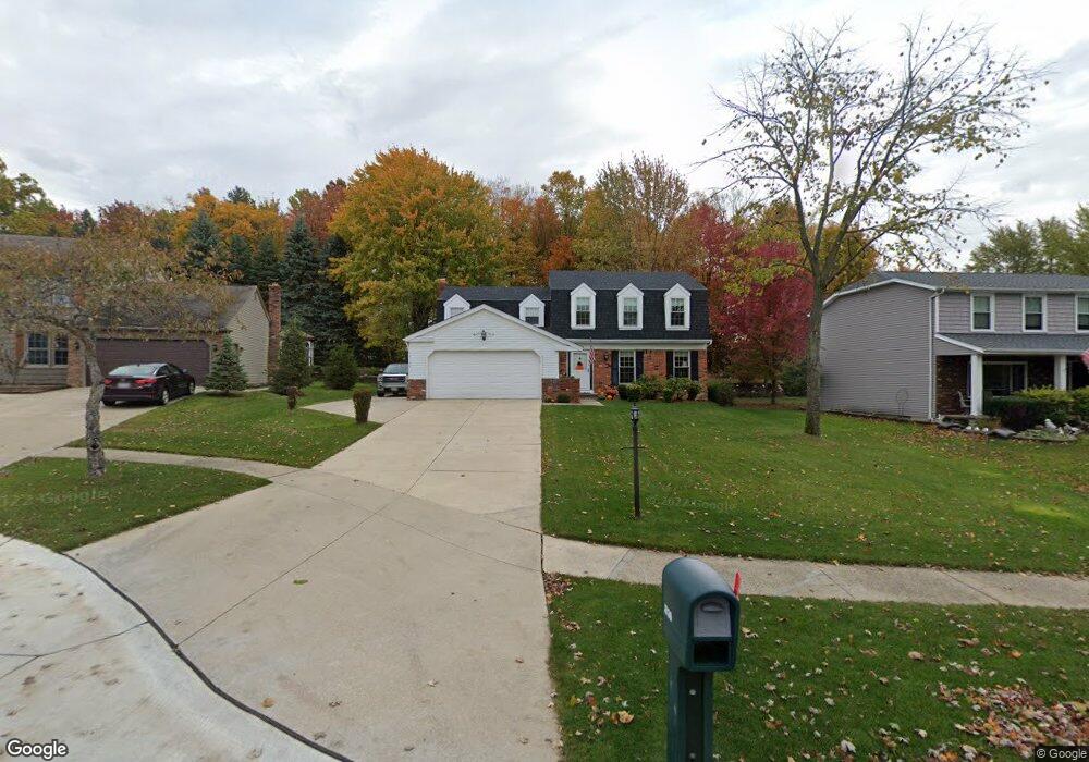
16130 Lakeforest Dr Strongsville, OH 44136
Estimated Value: $349,000 - $388,000
4
Beds
3
Baths
2,115
Sq Ft
$174/Sq Ft
Est. Value
About This Home
This home is located at 16130 Lakeforest Dr, Strongsville, OH 44136 and is currently estimated at $368,296, approximately $174 per square foot. 16130 Lakeforest Dr is a home located in Cuyahoga County with nearby schools including Strongsville High School, Sts Joseph & John Interparochial School, and The Academy of St. Bartholomew.
Ownership History
Date
Name
Owned For
Owner Type
Purchase Details
Closed on
Oct 3, 1986
Sold by
Fisher Charles M and Fisher Jamie M
Bought by
Fisher Jamie M
Current Estimated Value
Purchase Details
Closed on
May 28, 1982
Bought by
Fisher Charles M and Fisher Jamie M
Purchase Details
Closed on
Apr 12, 1982
Bought by
Continental Fedl S & L Asso
Purchase Details
Closed on
Dec 21, 1981
Bought by
Mays A R - Trustee
Purchase Details
Closed on
May 10, 1979
Bought by
New Concord Homes Inc
Purchase Details
Closed on
Jan 1, 1979
Bought by
Whitney Land Dev Co
Create a Home Valuation Report for This Property
The Home Valuation Report is an in-depth analysis detailing your home's value as well as a comparison with similar homes in the area
Home Values in the Area
Average Home Value in this Area
Purchase History
| Date | Buyer | Sale Price | Title Company |
|---|---|---|---|
| Fisher Jamie M | -- | -- | |
| Fisher Charles M | $85,000 | -- | |
| Continental Fedl S & L Asso | -- | -- | |
| Mays A R - Trustee | -- | -- | |
| New Concord Homes Inc | -- | -- | |
| Whitney Land Dev Co | -- | -- |
Source: Public Records
Tax History Compared to Growth
Tax History
| Year | Tax Paid | Tax Assessment Tax Assessment Total Assessment is a certain percentage of the fair market value that is determined by local assessors to be the total taxable value of land and additions on the property. | Land | Improvement |
|---|---|---|---|---|
| 2024 | $5,048 | $107,520 | $24,710 | $82,810 |
| 2023 | $4,817 | $76,930 | $21,770 | $55,160 |
| 2022 | $4,782 | $76,930 | $21,770 | $55,160 |
| 2021 | $4,744 | $76,930 | $21,770 | $55,160 |
| 2020 | $4,624 | $66,330 | $18,760 | $47,570 |
| 2019 | $4,488 | $189,500 | $53,600 | $135,900 |
| 2018 | $3,834 | $66,330 | $18,760 | $47,570 |
| 2017 | $3,662 | $55,200 | $14,280 | $40,920 |
| 2016 | $3,632 | $55,200 | $14,280 | $40,920 |
| 2015 | $3,576 | $55,200 | $14,280 | $40,920 |
| 2014 | $3,576 | $53,590 | $13,860 | $39,730 |
Source: Public Records
Map
Nearby Homes
- 9129 Tahoe Cir
- 9945 Twelve Oaks Cir
- 10369 Council Bluff
- 9890 Webster Rd
- 10010 Chevy Chase
- 15485 Albion Rd
- 16519 Albion Rd
- 9531 Nicole Cir
- 0 Webster Rd
- 18203 Broxton Dr
- 18433 Whitney Rd
- 14069 Basswood Cir
- Buchanan Plan at The Enclave at Pine Lakes Crossing
- Belleville Plan at The Enclave at Pine Lakes Crossing
- 7685 Saratoga Rd
- 18737 Evergreen Dr
- 14015 Byron Blvd
- 13976 W Sprague Rd
- 11650 River Moss Rd
- 12101 The Bluffs
- 16108 Lakeforest Dr
- 16152 Lakeforest Dr
- 16086 Lakeforest Dr
- 16174 Lakeforest Dr
- 16193 Lakeforest Dr
- 16216 Lakeforest Dr
- 9608 N Bexley Dr
- 16097 Lakeforest Dr
- 9580 N Bexley Dr
- 16225 Lakeforest Dr
- 9329 Ellis Way
- 9333 Ellis Way
- 16085 Lakeforest Dr
- 16238 Lakeforest Dr
- 9558 N Bexley Dr
- 9326 Ellis Way
- 16063 Lakeforest Dr
- 16257 Lakeforest Dr
- 16270 Lakeforest Dr
- 9337 Ellis Way