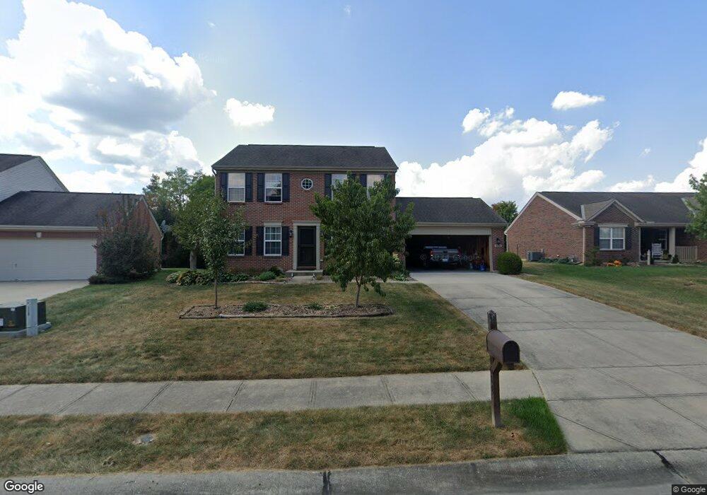
1614 Battery Cir Unit 107NP Hebron, KY 41048
Estimated Value: $346,000 - $361,000
3
Beds
3
Baths
1,760
Sq Ft
$200/Sq Ft
Est. Value
About This Home
This home is located at 1614 Battery Cir Unit 107NP, Hebron, KY 41048 and is currently estimated at $352,401, approximately $200 per square foot. 1614 Battery Cir Unit 107NP is a home located in Boone County with nearby schools including North Pointe Elementary School, Conner Middle School, and Conner High School.
Ownership History
Date
Name
Owned For
Owner Type
Purchase Details
Closed on
Aug 9, 2021
Sold by
Meilicke Melicke and Meilicke Hayley Brooks
Bought by
Ahousaleh Saleh
Current Estimated Value
Purchase Details
Closed on
Jul 15, 2016
Sold by
Slavey Bruce W
Bought by
Meilicke Warren A
Home Financials for this Owner
Home Financials are based on the most recent Mortgage that was taken out on this home.
Original Mortgage
$149,600
Interest Rate
3.66%
Mortgage Type
New Conventional
Purchase Details
Closed on
Jul 13, 2006
Sold by
Arlinghaus Builders Llc
Bought by
Slavey Bruce W
Home Financials for this Owner
Home Financials are based on the most recent Mortgage that was taken out on this home.
Original Mortgage
$127,000
Interest Rate
6.68%
Mortgage Type
New Conventional
Create a Home Valuation Report for This Property
The Home Valuation Report is an in-depth analysis detailing your home's value as well as a comparison with similar homes in the area
Home Values in the Area
Average Home Value in this Area
Purchase History
| Date | Buyer | Sale Price | Title Company |
|---|---|---|---|
| Ahousaleh Saleh | $280,000 | 360 American Title Svcs Llc | |
| Meilicke Warren A | $187,000 | Stewart Title Co | |
| Slavey Bruce W | $197,000 | None Available |
Source: Public Records
Mortgage History
| Date | Status | Borrower | Loan Amount |
|---|---|---|---|
| Previous Owner | Meilicke Warren A | $149,600 | |
| Previous Owner | Slavey Bruce W | $127,000 |
Source: Public Records
Tax History Compared to Growth
Tax History
| Year | Tax Paid | Tax Assessment Tax Assessment Total Assessment is a certain percentage of the fair market value that is determined by local assessors to be the total taxable value of land and additions on the property. | Land | Improvement |
|---|---|---|---|---|
| 2024 | $2,501 | $280,000 | $30,000 | $250,000 |
| 2023 | $2,495 | $280,000 | $30,000 | $250,000 |
| 2022 | $2,569 | $280,000 | $30,000 | $250,000 |
| 2021 | $2,078 | $187,000 | $30,000 | $157,000 |
| 2020 | $2,040 | $187,000 | $30,000 | $157,000 |
| 2019 | $2,056 | $187,000 | $30,000 | $157,000 |
| 2018 | $2,098 | $187,000 | $30,000 | $157,000 |
| 2017 | $2,038 | $187,000 | $30,000 | $157,000 |
| 2015 | $2,132 | $197,000 | $30,000 | $167,000 |
| 2013 | -- | $197,000 | $30,000 | $167,000 |
Source: Public Records
Map
Nearby Homes
- 1843 Emory Ct
- 1195 Breckenridge Ln
- 1218 Breckenridge Ln
- 1215 Breckenridge Ln
- 803 N Bend Rd Unit 6
- 1963 Greyfield Trail
- 803 Lot 6 N Bend Rd Unit 6
- 1353 Dominion Trail
- 765 N Bend Rd
- 2320 Summerwoods Dr
- 1977 Coachtrail Dr
- 1516 Bloomin Spring Ct
- 1437 Windyoak Ln
- The Jefferson Plan at North Pointe
- The Bristol Plan at North Pointe
- The Austin Plan at North Pointe
- The Rosewood Plan at North Pointe
- The Ella Marie Plan at North Pointe
- The Lancaster Plan at North Pointe
- The Morgan Plan at North Pointe
- 1614 Battery Cir
- 1618 Battery Cir
- 1618 Battery Cir Unit 108NP
- 1610 Battery Cir
- 1622 Battery Cir
- 1603 Battery Cir
- 1603 Battery Cir Unit 118NP
- 1602 Battery Cir
- 1595 Battery Cir
- 1607 Battery Cir
- 1626 Battery Cir
- 1626 Battery Cir Unit 110NP
- 1698 Bingham Cir
- 1702 Bingham Cir
- 1611 Battery Cir
- 1611 Battery Cir Unit 116NP
- 1598 Battery Cir
- 1706 Bingham Cir
- 1619 Battery Cir
- 1694 Bingham Cir