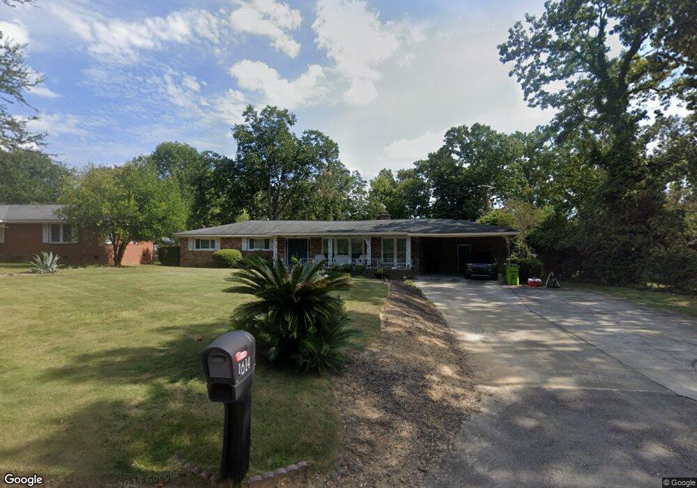
1614 Sandra Dr Columbia, SC 29209
Southeast Columbia NeighborhoodEstimated Value: $224,000 - $258,000
3
Beds
2
Baths
2,013
Sq Ft
$120/Sq Ft
Est. Value
About This Home
This home is located at 1614 Sandra Dr, Columbia, SC 29209 and is currently estimated at $242,333, approximately $120 per square foot. 1614 Sandra Dr is a home located in Richland County with nearby schools including Annie Burnside Elementary School, Crayton Middle School, and A. C. Flora High School.
Ownership History
Date
Name
Owned For
Owner Type
Purchase Details
Closed on
Oct 12, 2023
Sold by
Lane Jerry L
Bought by
Lane Crystal N
Current Estimated Value
Home Financials for this Owner
Home Financials are based on the most recent Mortgage that was taken out on this home.
Original Mortgage
$244,000
Outstanding Balance
$240,084
Interest Rate
7.12%
Mortgage Type
VA
Estimated Equity
$2,249
Purchase Details
Closed on
May 26, 2000
Sold by
Lane Jerry L
Bought by
Lane Evelyn
Home Financials for this Owner
Home Financials are based on the most recent Mortgage that was taken out on this home.
Original Mortgage
$124,930
Interest Rate
8.11%
Mortgage Type
Unknown
Create a Home Valuation Report for This Property
The Home Valuation Report is an in-depth analysis detailing your home's value as well as a comparison with similar homes in the area
Home Values in the Area
Average Home Value in this Area
Purchase History
| Date | Buyer | Sale Price | Title Company |
|---|---|---|---|
| Lane Crystal N | $244,000 | None Listed On Document | |
| Lane Evelyn | -- | -- |
Source: Public Records
Mortgage History
| Date | Status | Borrower | Loan Amount |
|---|---|---|---|
| Open | Lane Crystal N | $244,000 | |
| Previous Owner | Lane Jerry L | $121,150 | |
| Previous Owner | Lane Jerry L | $116,000 | |
| Previous Owner | Lane Jerry L | $124,930 | |
| Previous Owner | Lane Jerry L | $19,500 |
Source: Public Records
Tax History Compared to Growth
Tax History
| Year | Tax Paid | Tax Assessment Tax Assessment Total Assessment is a certain percentage of the fair market value that is determined by local assessors to be the total taxable value of land and additions on the property. | Land | Improvement |
|---|---|---|---|---|
| 2024 | $1,924 | $244,000 | $26,100 | $217,900 |
| 2023 | $1,924 | $0 | $0 | $0 |
| 2021 | $324 | $4,436 | $684 | $3,752 |
| 2020 | $324 | $0 | $0 | $0 |
| 2019 | $286 | $0 | $0 | $0 |
| 2018 | $249 | $0 | $0 | $0 |
| 2017 | $249 | $0 | $0 | $0 |
| 2016 | $249 | $0 | $0 | $0 |
| 2015 | $249 | $0 | $0 | $0 |
| 2014 | $249 | $0 | $0 | $0 |
| 2013 | -- | $0 | $0 | $0 |
Source: Public Records
Map
Nearby Homes
- 2 Routhland Ct
- 349 Eastfair Dr
- 525 Eastfair Dr
- 7428 Fairmont Rd
- 7245 Venus Rd
- 7229 Holloway Rd
- 1527 Burnside Ave
- 155 Colonial Commons Ln
- 267 Blue Savannah St
- 7024 Hilo St
- 7600 Leitner Rd
- 263 Blue Savannah St
- 1925 Beckley Dr
- 115 Colonial Commons Ln
- 168 Ashewood Commons Dr
- 106 Colonial Commons Ln
- 7021 Gray St
- 7712 Burdell Dr
- 101 Colonial Commons Ln
- 175 Nestle Ct
- 1624 Sandra Dr
- 7414 Patricia Dr
- 1632 Sandra Dr
- 7424 Patricia Dr
- 1615 Sandra Dr
- 1623 Sandra Dr
- 1625 Alba Dr
- 7432 Patricia Dr
- 1605 Sandra Dr
- 1631 Sandra Dr
- 1635 Alba Dr
- 1640 Sandra Dr
- 1605 Alba Dr
- 1639 Sandra Dr
- 7411 Patricia Dr
- 7403 Patricia Dr
- 1614 Woodford Rd
- 1624 Woodford Rd
- 7442 Patricia Dr
- 7419 Patricia Dr