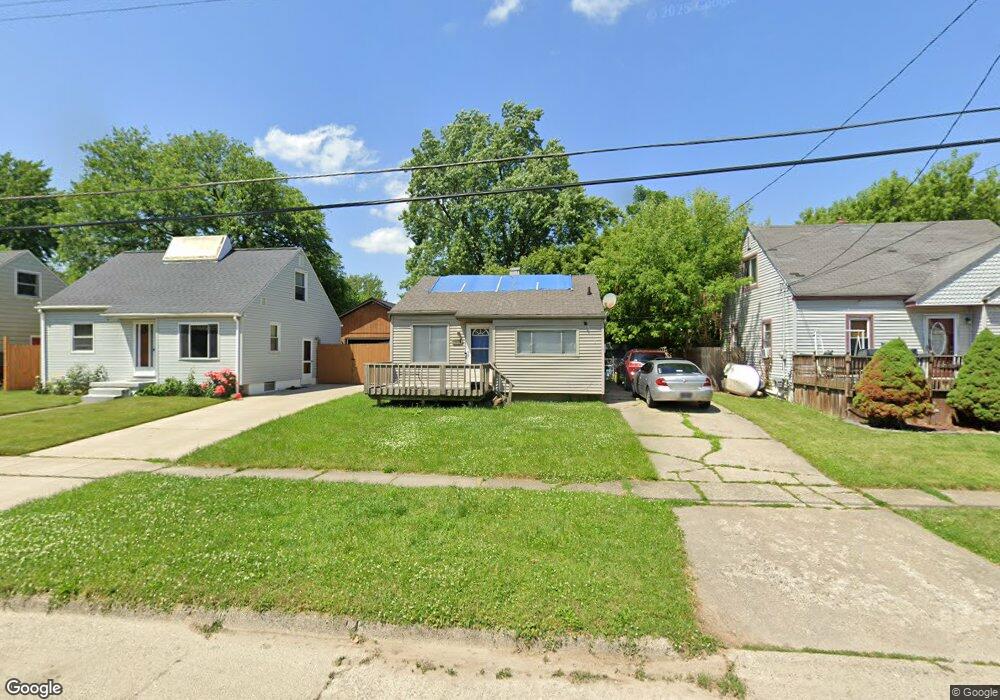
1614 Waldman Ave Flint, MI 48507
South Side NeighborhoodEstimated Value: $42,000 - $81,000
2
Beds
1
Bath
720
Sq Ft
$75/Sq Ft
Est. Value
About This Home
This home is located at 1614 Waldman Ave, Flint, MI 48507 and is currently estimated at $53,987, approximately $74 per square foot. 1614 Waldman Ave is a home located in Genesee County with nearby schools including Neithercut Elementary School, Flint Southwestern Classical Academy, and International Academy of Flint (K-12).
Ownership History
Date
Name
Owned For
Owner Type
Purchase Details
Closed on
Jan 16, 2019
Sold by
Thorne Veronica K and Thorne Family Revocable Trust
Bought by
Curry Tywan
Current Estimated Value
Purchase Details
Closed on
Dec 17, 2013
Sold by
Thorne Veronica Kay and Veronica Kay Thorne Living Tru
Bought by
Thorne Family Revocable Trust
Purchase Details
Closed on
Nov 1, 2012
Sold by
Thorne Veronica K
Bought by
Curry Deshawnna V
Home Financials for this Owner
Home Financials are based on the most recent Mortgage that was taken out on this home.
Original Mortgage
$11,000
Interest Rate
3.51%
Mortgage Type
Seller Take Back
Create a Home Valuation Report for This Property
The Home Valuation Report is an in-depth analysis detailing your home's value as well as a comparison with similar homes in the area
Home Values in the Area
Average Home Value in this Area
Purchase History
| Date | Buyer | Sale Price | Title Company |
|---|---|---|---|
| Curry Tywan | $11,550 | Cislo Title Co | |
| Thorne Family Revocable Trust | -- | None Available | |
| Curry Deshawnna V | $11,550 | None Available |
Source: Public Records
Mortgage History
| Date | Status | Borrower | Loan Amount |
|---|---|---|---|
| Previous Owner | Curry Deshawnna V | $11,000 |
Source: Public Records
Tax History
| Year | Tax Paid | Tax Assessment Tax Assessment Total Assessment is a certain percentage of the fair market value that is determined by local assessors to be the total taxable value of land and additions on the property. | Land | Improvement |
|---|---|---|---|---|
| 2025 | $702 | $13,200 | $0 | $0 |
| 2024 | $645 | $13,200 | $0 | $0 |
| 2023 | $782 | $12,000 | $0 | $0 |
| 2022 | $0 | $9,500 | $0 | $0 |
| 2021 | $789 | $8,600 | $0 | $0 |
| 2020 | $733 | $7,100 | $0 | $0 |
| 2019 | $768 | $7,700 | $0 | $0 |
| 2018 | $829 | $8,700 | $0 | $0 |
| 2017 | $823 | $0 | $0 | $0 |
| 2016 | $818 | $0 | $0 | $0 |
| 2015 | -- | $0 | $0 | $0 |
| 2014 | -- | $0 | $0 | $0 |
| 2012 | -- | $11,700 | $0 | $0 |
Source: Public Records
Map
Nearby Homes
- 1514 W Atherton Rd
- 3713 Briarwood Dr
- 1506 Pettibone Ave
- 1413 Lincoln Ave
- 1741 Carmanbrook Pkwy
- 1410 Berrywood Ln
- 1814 Carmanbrook Pkwy
- 1727 Briarwood Dr
- 1130 W Atherton Rd
- 1310 Alvord Ave
- 1826 Greenbrook Ln
- 4101 Greenbrook Ln
- 1310 Huron St
- 1836 Willowbrook Cir
- 1234 Huron St
- 1028 Campbell St
- 1318 Ingleside Ave
- 4502 Huckleberry Ln
- 1627 Blackberry Ln
- 1210 Pinehurst Ave
- 1610 Waldman Ave
- 1618 Waldman Ave
- 1606 Waldman Ave
- 1622 Waldman Ave
- 1611 Pettibone Ave
- 1615 Pettibone Ave
- 1609 Pettibone Ave
- 1619 Pettibone Ave
- 1602 Waldman Ave
- 1626 Waldman Ave
- 1601 Pettibone Ave
- 1623 Pettibone Ave
- 1609 Waldman Ave
- 1617 Waldman Ave
- 1605 Waldman Ave
- 1630 Waldman Ave
- 1621 Waldman Ave
- 1627 Pettibone Ave
- 1536 Waldman Ave
- 1601 Waldman Ave
Your Personal Tour Guide
Ask me questions while you tour the home.