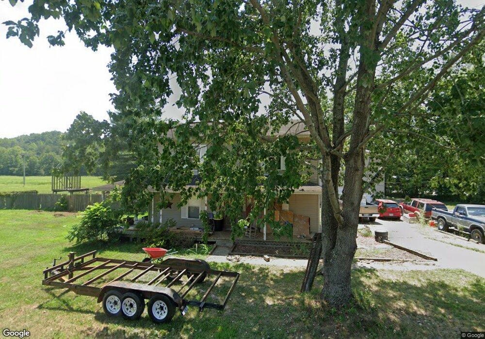
16143 State Route 775 Willow Wood, OH 45696
Estimated Value: $175,000 - $331,000
4
Beds
3
Baths
2,840
Sq Ft
$88/Sq Ft
Est. Value
About This Home
This home is located at 16143 State Route 775, Willow Wood, OH 45696 and is currently estimated at $249,778, approximately $87 per square foot. 16143 State Route 775 is a home located in Lawrence County with nearby schools including Symmes Valley Elementary School and Symmes Valley High School.
Ownership History
Date
Name
Owned For
Owner Type
Purchase Details
Closed on
Nov 20, 2015
Sold by
Smith Margaret S
Bought by
Smith Michael H
Current Estimated Value
Purchase Details
Closed on
May 14, 2010
Sold by
Pyles Billie J
Bought by
Smith Michael H and Smith Margaret S
Home Financials for this Owner
Home Financials are based on the most recent Mortgage that was taken out on this home.
Original Mortgage
$143,000
Outstanding Balance
$97,013
Interest Rate
5.3%
Mortgage Type
New Conventional
Estimated Equity
$152,765
Purchase Details
Closed on
Aug 6, 2004
Sold by
Miller Terry A and Miller Becky
Bought by
Pyles Billie J Michael
Purchase Details
Closed on
Jul 17, 1996
Sold by
Miller Allen K and Miller Carol J
Bought by
Miller Terry A and Miller Becky
Purchase Details
Closed on
Feb 26, 1996
Sold by
Jones Mary Beth
Bought by
Miller Allen K and Miller Carol J
Purchase Details
Closed on
Oct 20, 1994
Sold by
Jones Dorothy P and Jones Mary
Bought by
Jones Mary Beth
Create a Home Valuation Report for This Property
The Home Valuation Report is an in-depth analysis detailing your home's value as well as a comparison with similar homes in the area
Home Values in the Area
Average Home Value in this Area
Purchase History
| Date | Buyer | Sale Price | Title Company |
|---|---|---|---|
| Smith Michael H | -- | Bestitle | |
| Smith Michael H | -- | None Available | |
| Pyles Billie J Michael | $170,000 | -- | |
| Miller Terry A | -- | -- | |
| Miller Allen K | $30,000 | -- | |
| Jones Mary Beth | -- | -- |
Source: Public Records
Mortgage History
| Date | Status | Borrower | Loan Amount |
|---|---|---|---|
| Open | Smith Michael H | $143,000 |
Source: Public Records
Tax History Compared to Growth
Tax History
| Year | Tax Paid | Tax Assessment Tax Assessment Total Assessment is a certain percentage of the fair market value that is determined by local assessors to be the total taxable value of land and additions on the property. | Land | Improvement |
|---|---|---|---|---|
| 2024 | -- | $80,230 | $1,140 | $79,090 |
| 2023 | $2,204 | $80,230 | $1,140 | $79,090 |
| 2022 | $2,202 | $80,230 | $1,140 | $79,090 |
| 2021 | $1,526 | $54,710 | $990 | $53,720 |
| 2020 | $1,540 | $54,710 | $990 | $53,720 |
| 2019 | $1,623 | $54,710 | $990 | $53,720 |
| 2018 | $1,868 | $62,680 | $990 | $61,690 |
| 2017 | $1,869 | $62,680 | $990 | $61,690 |
| 2016 | $1,734 | $62,680 | $990 | $61,690 |
| 2015 | $1,572 | $56,470 | $990 | $55,480 |
| 2014 | $1,571 | $56,470 | $990 | $55,480 |
| 2013 | $1,570 | $56,470 | $990 | $55,480 |
Source: Public Records
Map
Nearby Homes
- 18325 State Route 141
- 0 Ohio 775
- 1102 County Road 8
- 321 Township Road 75 S
- 266 Twp Rd 209
- 0 Ohio 141
- 174 Township Road 74
- 7381 County Road 16
- 168 Township Road 122 W
- 13498 County Road 2
- 0 Venisonham-Camp Branch Rd Unit Tract 2
- 0 Venisonham-Camp Branch Rd Unit Tract 1
- 0 Venisonham-Camp Branch Rd
- 0 Venisonham-Camp Branch Rd Unit 25766693
- 0 Venisonham-Camp Branch Rd Unit 3
- 479 Township Road 122
- 0 County Road 213
- 784 Township Road 209
- 810 Township Road 141
- 1790 Hull Rd
- 17012 State Route 141
- 16755 State Route 141
- 17009 State Route 141
- 17009 State Route 141
- 16909 State Route 141
- 15981 State Route 775
- 15903 State Route 775
- 15908 State Route 775
- 0 Twp Rd 177
- 00000 Twp Rd 177
- 17285 State Route 141
- 15848 State Route 775
- 35 Township Road 177
- 15821 State Route 775
- Rr 2
- Rr 2
- Rr 2
- Rr 2
- Rr 2
- Rr 2