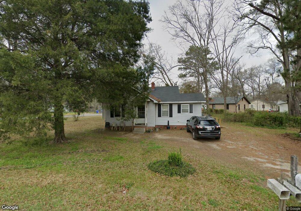
1615 Forestside Dr Columbus, GA 31907
East Columbus NeighborhoodEstimated Value: $75,000 - $92,333
2
Beds
2
Baths
786
Sq Ft
$107/Sq Ft
Est. Value
About This Home
This home is located at 1615 Forestside Dr, Columbus, GA 31907 and is currently estimated at $84,083, approximately $106 per square foot. 1615 Forestside Dr is a home located in Muscogee County with nearby schools including Rigdon Road Elementary School, Richards Middle School, and Hardaway High School.
Ownership History
Date
Name
Owned For
Owner Type
Purchase Details
Closed on
Feb 24, 2014
Sold by
Liberty Stone Properties L
Bought by
Menefee Warren
Current Estimated Value
Home Financials for this Owner
Home Financials are based on the most recent Mortgage that was taken out on this home.
Original Mortgage
$34,267
Outstanding Balance
$25,884
Interest Rate
4.25%
Mortgage Type
FHA
Estimated Equity
$58,199
Purchase Details
Closed on
Mar 1, 2012
Sold by
Branch Banking & Trust C
Bought by
Liberty Stone Properties Llc
Purchase Details
Closed on
Nov 18, 2010
Sold by
Branch Banking & Trust Company
Bought by
Bb
Purchase Details
Closed on
Aug 3, 2010
Sold by
Hatley Gary Steven
Bought by
Branch Banking & Trust Company
Create a Home Valuation Report for This Property
The Home Valuation Report is an in-depth analysis detailing your home's value as well as a comparison with similar homes in the area
Home Values in the Area
Average Home Value in this Area
Purchase History
| Date | Buyer | Sale Price | Title Company |
|---|---|---|---|
| Menefee Warren | $34,900 | -- | |
| Liberty Stone Properties Llc | $22,500 | -- | |
| Bb | $39,592 | None Available | |
| Branch Banking & Trust Company | $39,592 | None Available |
Source: Public Records
Mortgage History
| Date | Status | Borrower | Loan Amount |
|---|---|---|---|
| Open | Menefee Warren | $34,267 |
Source: Public Records
Tax History
| Year | Tax Paid | Tax Assessment Tax Assessment Total Assessment is a certain percentage of the fair market value that is determined by local assessors to be the total taxable value of land and additions on the property. | Land | Improvement |
|---|---|---|---|---|
| 2025 | $30 | $25,024 | $7,108 | $17,916 |
| 2024 | $29 | $25,024 | $7,108 | $17,916 |
| 2023 | $12 | $25,024 | $7,108 | $17,916 |
| 2022 | $30 | $19,260 | $5,332 | $13,928 |
| 2021 | $23 | $18,480 | $5,332 | $13,148 |
| 2020 | $23 | $18,480 | $5,332 | $13,148 |
| 2019 | $25 | $18,480 | $5,332 | $13,148 |
| 2018 | $25 | $18,480 | $5,332 | $13,148 |
| 2017 | $27 | $18,480 | $5,332 | $13,148 |
| 2016 | $28 | $13,960 | $2,072 | $11,888 |
| 2015 | $29 | $13,960 | $2,072 | $11,888 |
| 2014 | $662 | $16,000 | $2,072 | $13,928 |
| 2013 | -- | $16,000 | $2,072 | $13,928 |
Source: Public Records
Map
Nearby Homes
- 1618 Forestside Dr
- 1650 Berkley Ave
- 3946 Forestside Dr
- 4 Clausen Dr
- 1433 Kevin Ct
- 5 Clausen Dr
- 3857 Woodland Dr
- 1544 Celia Dr
- 3836 Mulberry Dr
- 4229 Barr St
- 4418 Gardiner Dr
- 4135 Forrest Rd
- 911 Lamore St
- 4201 Forrest Rd
- 1813 Celia Dr
- 10 Kingswood Ct
- 2218 Avalon Rd
- 2213 Welch Dr
- 1243 Aspen Ave
- 4705 Langdon St
- 1618 Berkley Ave
- 1625 Forestside Dr
- 1611 Berkley Ave
- 1612 Forestside Dr
- 1617 Berkley Ave
- 1605 Berkley Ave
- 1604 Forestside Dr
- 1626 Berkley Ave
- 1633 Forestside Dr
- 1623 Berkley Ave
- 1624 Forestside Dr
- 1601 Berkley Ave
- 1600 Forestside Dr
- 1629 Berkley Ave
- 1630 Forestside Dr
- 1632 Berkley Ave
- 1637 Forestside Dr
- 1556 Forestside Dr
- 1635 Berkley Ave
- 1636 Forestside Dr
Your Personal Tour Guide
Ask me questions while you tour the home.