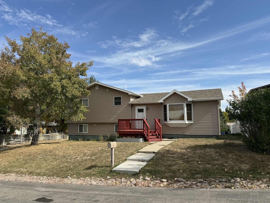
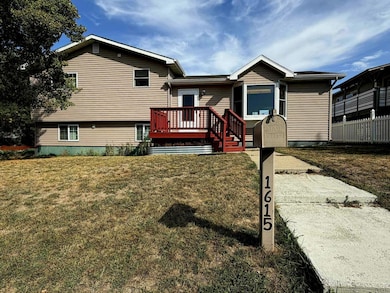
1615 Holmes Ave Sheridan, WY 82801
Estimated payment $2,468/month
Total Views
7,207
3
Beds
2
Baths
1,598
Sq Ft
$275
Price per Sq Ft
Highlights
- Wood Burning Stove
- Cooling System Mounted In Outer Wall Opening
- Baseboard Heating
- Sheridan High School Rated A-
About This Home
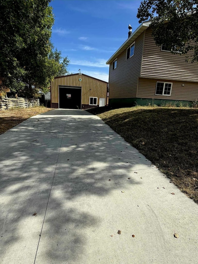
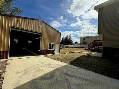
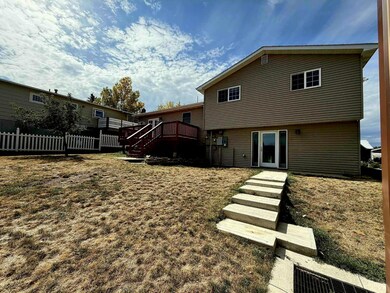
Don't miss this must-see property! Featuring 3 spacious bedrooms, 2 bathrooms, and a large 1,500 sq ft shop in the back—complete with in-floor heating rough-ins and an included (but not yet installed) heating unit. You'll also find a separate garage with convenient alley access. As a bonus, the seller is offering a $5,000 credit toward flooring and/or repairs—giving you the perfect opportunity to add your personal touch.

Home Details
Home Type
- Single Family
Est. Annual Taxes
- $1,848
Year Built
- Built in 1977
Parking
- 2 Car Garage
- Driveway
Home Design
- Asphalt Roof
- Metal Siding
Interior Spaces
- 1,598 Sq Ft Home
- Wood Burning Stove
- Wood Burning Fireplace
Bedrooms and Bathrooms
- 3 Bedrooms
- 2 Bathrooms
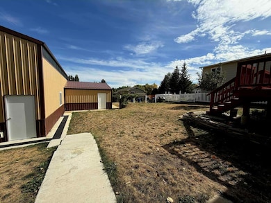
Outdoor Features
- Shop
Utilities
- Cooling System Mounted In Outer Wall Opening
- Baseboard Heating
Community Details
- Downer Subdivision
Map
Create a Home Valuation Report for This Property
The Home Valuation Report is an in-depth analysis detailing your home's value as well as a comparison with similar homes in the area
Home Values in the Area
Average Home Value in this Area
Tax History
| Year | Tax Paid | Tax Assessment Tax Assessment Total Assessment is a certain percentage of the fair market value that is determined by local assessors to be the total taxable value of land and additions on the property. | Land | Improvement |
|---|---|---|---|---|
| 2025 | $2,340 | $25,844 | $7,617 | $18,227 |
| 2024 | $2,340 | $32,727 | $10,155 | $22,572 |
| 2023 | $2,242 | $31,361 | $8,938 | $22,423 |
| 2022 | $1,925 | $26,916 | $8,457 | $18,459 |
| 2021 | $1,657 | $23,177 | $6,815 | $16,362 |
| 2020 | $1,583 | $22,145 | $6,374 | $15,771 |
| 2019 | $1,247 | $17,445 | $5,078 | $12,367 |
| 2018 | $1,170 | $16,365 | $4,902 | $11,463 |
| 2017 | $1,159 | $16,207 | $4,902 | $11,305 |
| 2015 | $1,092 | $15,276 | $4,062 | $11,214 |
| 2014 | $1,027 | $14,366 | $3,397 | $10,969 |
| 2013 | -- | $13,118 | $3,410 | $9,708 |
Source: Public Records
Property History
| Date | Event | Price | List to Sale | Price per Sq Ft |
|---|---|---|---|---|
| 09/30/2025 09/30/25 | For Sale | $440,000 | -- | $275 / Sq Ft |
Source: Sheridan County Board of REALTORS®
Purchase History
| Date | Type | Sale Price | Title Company |
|---|---|---|---|
| Special Warranty Deed | -- | None Available | |
| Sheriffs Deed | $214,894 | None Available |
Source: Public Records
Source: Sheridan County Board of REALTORS®
MLS Number: 25-1013
APN: 03-5684-22-2-65-002-25
Nearby Homes
- 1725 Highland Ave
- 1613 Taylor Ave
- 1629 Taylor Ave
- 1792 Yonkee Ave
- 1134 W 15th St
- 1335 Highland Ave
- 1606 Omarr Ave
- 1745 N Heights Cir
- 1430 Omarr Ave
- 1753 N North Heights Dr
- 1507 Omarr Ave
- 1441 Dana Ave
- 1851 Birch Ave
- 1970 Maple Ave
- 1349 Dana Ave
- 430 W 11th St
- 426 W 11th St
- 1405 Ridgeway Ave
- 1701 Sagebrush Dr
- 859 W 5th St