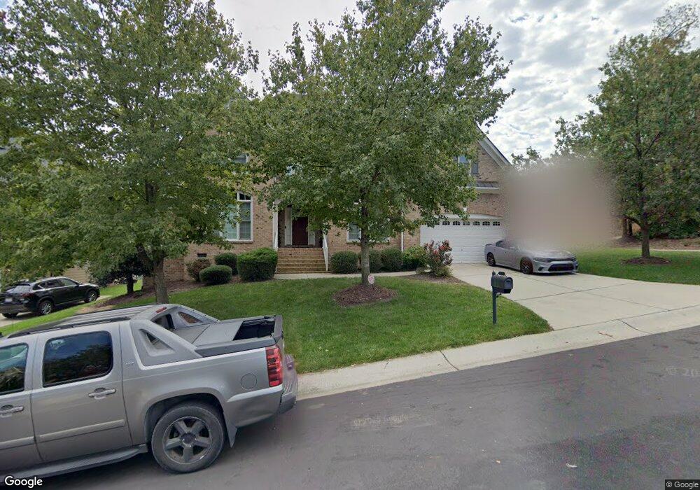
1615 Pattersons Mill Rd Durham, NC 27703
Eastern Durham NeighborhoodEstimated Value: $654,820 - $734,000
4
Beds
4
Baths
3,813
Sq Ft
$185/Sq Ft
Est. Value
About This Home
This home is located at 1615 Pattersons Mill Rd, Durham, NC 27703 and is currently estimated at $705,205, approximately $184 per square foot. 1615 Pattersons Mill Rd is a home located in Durham County with nearby schools including Spring Valley Elementary School, John W Neal Middle School, and Southern School of Energy & Sustainability.
Ownership History
Date
Name
Owned For
Owner Type
Purchase Details
Closed on
Apr 30, 2007
Sold by
St Lawrence Homes Inc
Bought by
Wall Todd M and Wall Anika A
Current Estimated Value
Home Financials for this Owner
Home Financials are based on the most recent Mortgage that was taken out on this home.
Original Mortgage
$366,929
Outstanding Balance
$222,338
Interest Rate
6.1%
Mortgage Type
Purchase Money Mortgage
Estimated Equity
$482,867
Create a Home Valuation Report for This Property
The Home Valuation Report is an in-depth analysis detailing your home's value as well as a comparison with similar homes in the area
Home Values in the Area
Average Home Value in this Area
Purchase History
| Date | Buyer | Sale Price | Title Company |
|---|---|---|---|
| Wall Todd M | $459,000 | None Available |
Source: Public Records
Mortgage History
| Date | Status | Borrower | Loan Amount |
|---|---|---|---|
| Open | Wall Todd M | $366,929 | |
| Closed | Wall Todd M | $68,799 |
Source: Public Records
Tax History Compared to Growth
Tax History
| Year | Tax Paid | Tax Assessment Tax Assessment Total Assessment is a certain percentage of the fair market value that is determined by local assessors to be the total taxable value of land and additions on the property. | Land | Improvement |
|---|---|---|---|---|
| 2025 | $5,698 | $715,548 | $111,125 | $604,423 |
| 2024 | $5,698 | $408,484 | $63,250 | $345,234 |
| 2023 | $5,351 | $408,484 | $63,250 | $345,234 |
| 2022 | $5,228 | $408,484 | $63,250 | $345,234 |
| 2021 | $5,204 | $408,484 | $63,250 | $345,234 |
| 2020 | $5,081 | $408,484 | $63,250 | $345,234 |
| 2019 | $5,081 | $408,484 | $63,250 | $345,234 |
| 2018 | $5,727 | $422,207 | $63,250 | $358,957 |
| 2017 | $5,685 | $422,207 | $63,250 | $358,957 |
| 2016 | $5,493 | $422,207 | $63,250 | $358,957 |
| 2015 | $5,813 | $419,953 | $78,722 | $341,231 |
| 2014 | $5,813 | $419,953 | $78,722 | $341,231 |
Source: Public Records
Map
Nearby Homes
- 1613 Waddell Ct
- 200 Callandale Ln
- 1821 S Mineral Springs Rd
- 533 Kings Lake Way
- 4 Seawell Ct
- 543 Callandale Ln
- 1607 Willowcrest Rd
- 1602 Eagle Lodge Ln
- 140 Token House Rd
- Winstead III Plan at Mica Ridge - Sterling Collection
- Nelson Plan at Mica Ridge - Sterling Collection
- Somerset III Plan at Mica Ridge - Sterling Collection
- 144 Daneborg Rd
- 110 Elmsford St
- 104 Elmsford St
- 148 Daneborg Rd
- 1711 S Miami Blvd
- 3105 Ranger Dr
- 3465 Delmar Dr
- 3463 Delmar Dr
- 1613 Pattersons Mill Rd
- 2006 Hawkins St
- 2001 Golden Belt Pkwy
- 2003 Golden Belt Pkwy
- 1722 Waddell Ct
- 1614 Pattersons Mill Rd
- 2008 Hawkins St
- 1612 Pattersons Mill Rd
- 2007 Hawkins St
- 2005 Hawkins St
- 2005 Golden Belt Pkwy
- 2010 Hawkins St
- 1610 Pattersons Mill Rd
- 2009 Hawkins St
- 1709 Waddell Ct
- 2011 Hawkins St
- 2002 Golden Belt Pkwy
- 1608 Pattersons Mill Rd
- 2004 Golden Belt Pkwy
- 2012 Hawkins St