D
Seller's Agent in 2012
Donna Munson-
Area One Realtors LLC

Estimated Value: $188,000 - $247,000
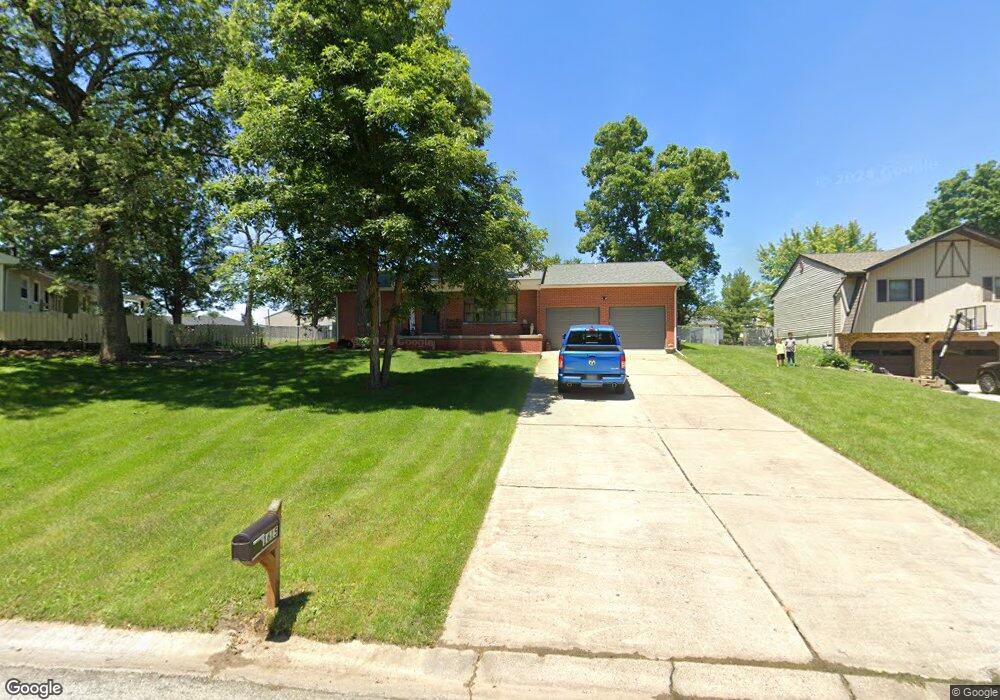
Sharp ranch with large family room w/ hardwood floors and open to the kitchen. Formal living and dining with new carpet and just painted. Several rooms just painted and new carpet in 1 bedroom. Privacy fenced backyard wilth numerous perennials. 1 car attached and 1 car detached garage. Gas fireplace with attractive brick and built-ins. All appliances stay- Microwave 6 months old, stove 3 yrs, dishwasher 5 yrs. Small office area off kitchen. Great home. New bathroom with jetted tub, walk in shower and huge closet.
Last Agent to Sell the Property
Donna Munson-
Area One Realtors LLC Listed on: 03/26/2012
| Date | Buyer | Sale Price | Title Company |
|---|---|---|---|
| Moore Kimberley | -- | None Listed On Document | |
| Bailey Richard L | $143,000 | None Available | |
| -- | $122,900 | -- |
| Date | Status | Borrower | Loan Amount |
|---|---|---|---|
| Previous Owner | Bailey Richard L | $140,200 |
| Date | Event | Price | List to Sale | Price per Sq Ft |
|---|---|---|---|---|
| 07/17/2012 07/17/12 | Sold | $142,900 | -7.7% | $73 / Sq Ft |
| 06/02/2012 06/02/12 | Pending | -- | -- | -- |
| 03/26/2012 03/26/12 | For Sale | $154,900 | -- | $79 / Sq Ft |
| Year | Tax Paid | Tax Assessment Tax Assessment Total Assessment is a certain percentage of the fair market value that is determined by local assessors to be the total taxable value of land and additions on the property. | Land | Improvement |
|---|---|---|---|---|
| 2024 | $3,884 | $68,643 | $6,050 | $62,593 |
| 2023 | $4,124 | $63,842 | $5,627 | $58,215 |
| 2022 | $4,435 | $53,594 | $5,338 | $48,256 |
| 2021 | $3,814 | $50,208 | $5,000 | $45,208 |
| 2020 | $0 | $53,113 | $5,976 | $47,137 |
| 2019 | $3,409 | $53,113 | $5,976 | $47,137 |
| 2018 | $0 | $51,757 | $5,823 | $45,934 |
| 2017 | $3,409 | $50,762 | $5,711 | $45,051 |
| 2016 | $3,364 | $49,879 | $5,612 | $44,267 |
| 2015 | $3,248 | $49,385 | $5,556 | $43,829 |
| 2014 | $3,335 | $49,385 | $5,556 | $43,829 |
| 2013 | $3,374 | $49,385 | $5,556 | $43,829 |
D
Seller's Agent in 2012
Donna Munson-
Area One Realtors LLC

Buyer's Agent in 2012
Kristie Tindall
KELLER WILLIAMS-TREC
(217) 855-1085
3 in this area
25 Total Sales
Source: Central Illinois Board of REALTORS®
MLS Number: 5188723
APN: 12-17-04-103-013
Ask me questions while you tour the home.